Overview: The Pass That Captured a Viceroy’s Heart
In 1905, the most powerful man in India stood on a ridge in the Garhwal Himalayas and looked at the mountains. Lord George Curzon, then Viceroy of India, could have gone anywhere. He had an empire at his disposal. And when he decided he wanted to see the high Himalayas, this is the route he chose. The trail he followed is now known as the famous Lord Curzon Trail, and the pass he crossed has been called Kuari Pass ever since.
One hundred and twenty years later, people walk the same ridge for the same reason. Because the view from Kuari Pass is, without qualification, one of the finest mountain panoramas accessible to a trekker without technical climbing experience anywhere in India.
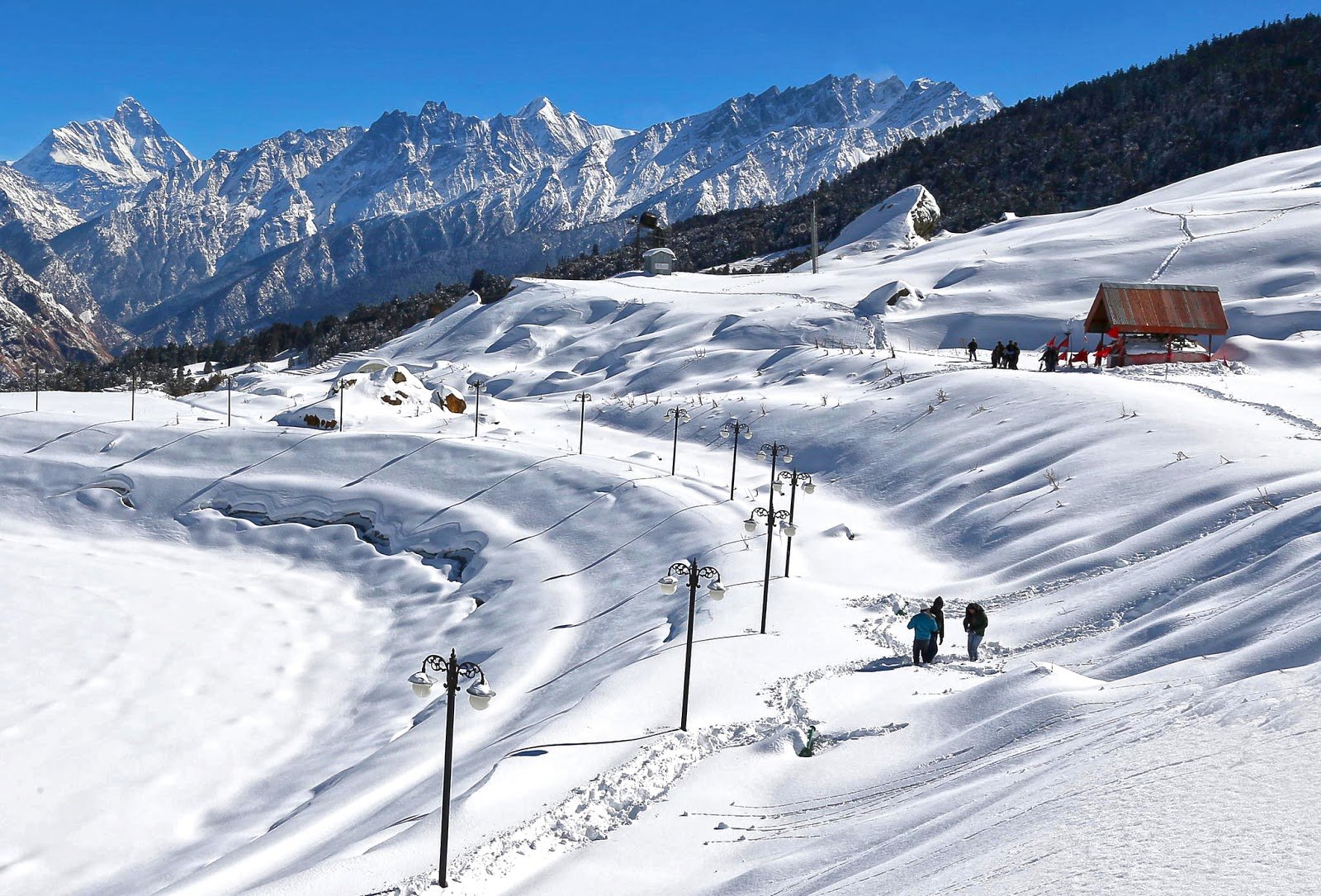
Nestled in the Chamoli district of Uttarakhand, Kuari Pass stands at approximately 12,516 feet (3,815 metres) and offers a 360-degree panorama of some of India’s most iconic peaks — Nanda Devi (7,816 m), Dronagiri, Kamet, Chaukhamba, Trishul, Hathi Ghoda, and Neelkanth — all visible simultaneously from the ridge.
What makes Kuari Pass truly special is its accessibility. The gradual altitude gain, well-defined trail, and relatively short duration make it an excellent entry point into high-altitude trekking. One of the rare Himalayan trails that stays open for almost nine months of the year, Kuari Pass offers a different experience in every season — from lush green meadows in summer to a snow-blanketed winter wonderland.
Whether you are a first-time trekker seeking a manageable Himalayan adventure, a photography enthusiast chasing the perfect shot of Nanda Devi, or an experienced trekker looking for a classic route, the Kuari Pass Trek promises an experience that stays with you forever.
Key Information at a Glance
History of Kuari Pass: The Birth of the Lord Curzon Trail
The Legendary 1905 Expedition
The history of the Kuari Pass trek is one of the most documented colonial trekking stories in India. In 1905, Lord Curzon, the Viceroy of India from 1899 to 1905, trekked from Ghat to Kuari Pass. At that time, this pass had no name. Curzon, an avid trekker, was so struck by the views that the trail has carried his name ever since.
According to local lore, when Curzon asked the villagers what the area was called, they replied, “We don’t know what it’s called, Sahab. No one goes there!”. Intrigued by the unexplored nature of the region, Curzon asked for the Hindi word for “virgin” or “doorway.” When told it was “Kuari,” he named the pass Kuari Pass — meaning “Doorway”.
The Golden Age of Himalayan Exploration
The trail was specially improved so that Lord Curzon could trek. Since then, it has been known as the Lord Curzon Trail or Curzon’s Trail. Extremely popular among British and American trekkers, the Kuari Pass trek offers majestic sights of the twin peaks of Nanda Devi and Nanda Devi East, Kamet, Dronagiri, Hathi Parbat, and Ghori Parbat.
After independence, the trail was briefly renamed the Nehru Trail, though the name never stuck as firmly as the Lord Curzon Trail. Today, it remains a classic Himalayan route, continuing to attract explorers from India and abroad.
Geography of Kuari Pass
Location and Topography
Kuari Pass is located in the Garhwal region of Uttarakhand, in the Chamoli district. The nearest town that serves as a base is Joshimath, which is connected to Rishikesh, Haridwar, and Dehradun by road.
The Trail and Terrain
The Kuari Pass trek covers approximately 28–33 kilometres round trip. A common route begins at Dhak village, which is a short drive from Joshimath. Another approach is through Auli, the well-known ski destination, from where the trail leads to Gorson Bugyal.
Key Campsites:
| Campsite | Altitude | Highlights |
|---|---|---|
| Joshimath | 6,150 ft (1,875 m) | Base camp, transit point |
| Dhak / Tugasi | 6,000–7,000 ft | Start point of the trek |
| Gulling | ~9,400 ft (2,864 m) | First campsite, dense forest |
| Tali | ~10,000 ft | Forest campsite beside a stream |
| Khullara | ~11,000 ft (3,352 m) | Alpine meadows, Dronagiri & Nanda Devi views |
| Kuari Pass | 12,516 ft (3,815 m) | Summit, 360° panorama |
The Summit Panorama
From the summit, trekkers are rewarded with a 360-degree panorama of some of the most iconic Himalayan peaks:
Flora and Fauna of Kuari Pass
Flora — A Botanical Paradise
The Kuari Pass trek passes through pristine forests and alpine meadows, offering a rich diversity of plant life.
Dominant Tree Species:
- Oak — dense forests in the lower reaches
- Rhododendron — vibrant red blooms in spring
- Deodar — towering Himalayan cedars
- Birch — found in the higher reaches
- Maple and Chestnut — adding to the biodiversity
Alpine Meadows (Bugyals):
- Gorson Bugyal — one of the most spectacular meadows
- Khullara Meadows — high-altitude bugyal at 11,000 ft with unobstructed views of Dronagiri and Nanda Devi
- Chitrakantha — rolling alpine meadows
The trail passes through protected Garhwali forests that bloom spectacularly in spring. The transformation in the scenery with each climb is extraordinarily stunning in any season.
Fauna — Wildlife in the Wilderness
The Kuari Pass region is rich in biodiversity and is an excellent area for wildlife spotting.
Mammals:
- Himalayan Black Bear — occasionally spotted
- Leopard — pugmarks are sometimes found on the trail
- Musk Deer — shy and rare
- Bharal (Blue Sheep) — found in higher altitudes
- Snow Leopard — elusive apex predator
- Himalayan Tahr — a mountain goat-antelope
Birds:
- Himalayan Monal — the colourful state bird of Uttarakhand
- Various pheasant species
- Golden Eagle — soaring above the peaks
Religious Beliefs and Cultural Significance
A Route of Spiritual Significance
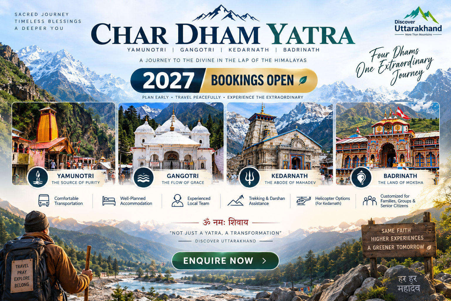
The Kuari Pass has been a route to the Kedarnath Yatra, regarded as an auspicious religious journey. The region is characterised by a multitude of ancient temples which bear the signs of a harmonious blend of Hindu and Tibetan Buddhist traditions.
The nearby Nanda Devi peak is worshipped as a goddess and holds great cultural and religious significance among locals. The trail passes through the heart of Garhwal, where the mountain is seen as the “courtyard of the Goddess”.
Dronagiri and the Ramayana Connection
Dronagiri Peak is known for its closeness to India’s most revered epic — the Ramayana. According to the epic, Lord Hanuman carried a part of Mount Dronagiri while searching for the Sanjeevani booti to revive Lakshmana.
Ancient Trade Route
The tract of the road is an old trade route that joins the regions of Uttarakhand and Tibet, promoting cultural exchange for years. Indigenous communities like the Bhotiya and the Indo-Tibetan populations are important because of the distinctive identity of their cultures and traditions.
How to Reach Kuari Pass
Step 1: Reach Joshimath (The Base Camp)
The base camp for the Kuari Pass trek is Joshimath, approximately 500 kilometres from Delhi.
By Air — Nearest Airports
| Airport | Distance | Details |
|---|---|---|
| Jolly Grant Airport, Dehradun | ~25 km from Dehradun city | Connected to Delhi with daily flights |
| Indira Gandhi International Airport, Delhi | ~500 km to Joshimath | Major international hub |
From Dehradun Airport:
- Hire a taxi to Joshimath (approx. 10–11 hours)
By Train — Nearest Railway Stations
| Station | Distance | Details |
|---|---|---|
| Haridwar Railway Station | ~320 km to Joshimath | Well-connected to Delhi (4–5 hours) |
| Dehradun Railway Station | ~270 km to Joshimath | Connected via overnight trains from Delhi |
Popular Trains from Delhi:
- Nanda Devi Express (12205) — Departure 11:50 PM; Arrival 5:40 AM
- Dehradun Express (12687) — Overnight train
From Haridwar/Dehradun:
- Hire a taxi or take a bus to Joshimath (approx. 10–11 hours)
By Road (Most Popular)
| Route | Distance | Travel Time |
|---|---|---|
| Delhi → Joshimath | ~500 km | 12–14 hours |
| Haridwar → Joshimath | ~320 km | 10–11 hours |
| Dehradun → Joshimath | ~270 km | 9–10 hours |
| Rishikesh → Joshimath | ~260 km | 9–10 hours |
Route:
Delhi → Haridwar → Rishikesh → Devprayag → Rudraprayag → Karnaprayag → Nandprayag → Chamoli → Joshimath
Transport Options:
- Private Taxi: Most convenient and flexible
- State Transport Buses: Available from Haridwar and Rishikesh
- Shared Jeep: Available from Dehradun
Step 2: Reach the Trailhead
From Joshimath, the trek begins from nearby villages such as Dhak or Tugasi, which is a short drive of about 12 km.
| Route | Distance | Travel Time |
|---|---|---|
| Joshimath → Dhak | ~12 km | 30–40 minutes |
| Joshimath → Auli | ~14 km | 45 minutes |
| Joshimath → Tugasi | ~6 km from Dhak | 30 minutes |
Distance from Major Cities
| City | Distance to Joshimath | Travel Time |
|---|---|---|
| Delhi | ~500 km | 12–14 hours |
| Haridwar | ~320 km | 10–11 hours |
| Dehradun | ~270 km | 9–10 hours |
| Rishikesh | ~260 km | 9–10 hours |
| Chandigarh | ~500 km | 12–14 hours |
Weather and Best Time to Visit
Climate Overview
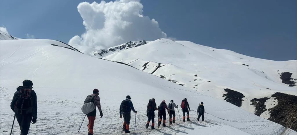
Kuari Pass is one of those rare Himalayan trails that stays open for almost nine months of the year. Except during the monsoon season — July, August, and early September — you can plan this trek in any other season. What’s really exciting is how different the trail looks in each of these seasons.
Seasonal Breakdown
| Season | Months | Temperature | Conditions | Suitability |
|---|---|---|---|---|
| Winter (Peak Snow) | Mid-Dec–Mid-Mar | Day: -2°C to 10°C; Night: -10°C to -5°C | Heavy snowfall, winter wonderland | ⭐ Best (Snow Lovers) |
| Spring | Mid-Mar–End Apr | Day: 8°C to 18°C; Night: 0°C to 5°C | Snow melting, early blooms | ⭐ Best (Transition) |
| Summer (Peak) | May–Mid-Jun | Day: 8°C to 24°C; Night: 3°C to 8°C | Lush greenery, clear skies | ⭐ Best (Comfort) |
| Monsoon | Jul–Early Sep | Variable | Heavy rainfall, leeches | ❌ Avoid |
| Autumn | Mid-Sep–Nov | Day: 8°C to 20°C; Night: 0°C to 5°C | Crystal clear skies, golden meadows | ⭐ Best (Photography) |
Best Time to Visit by Season
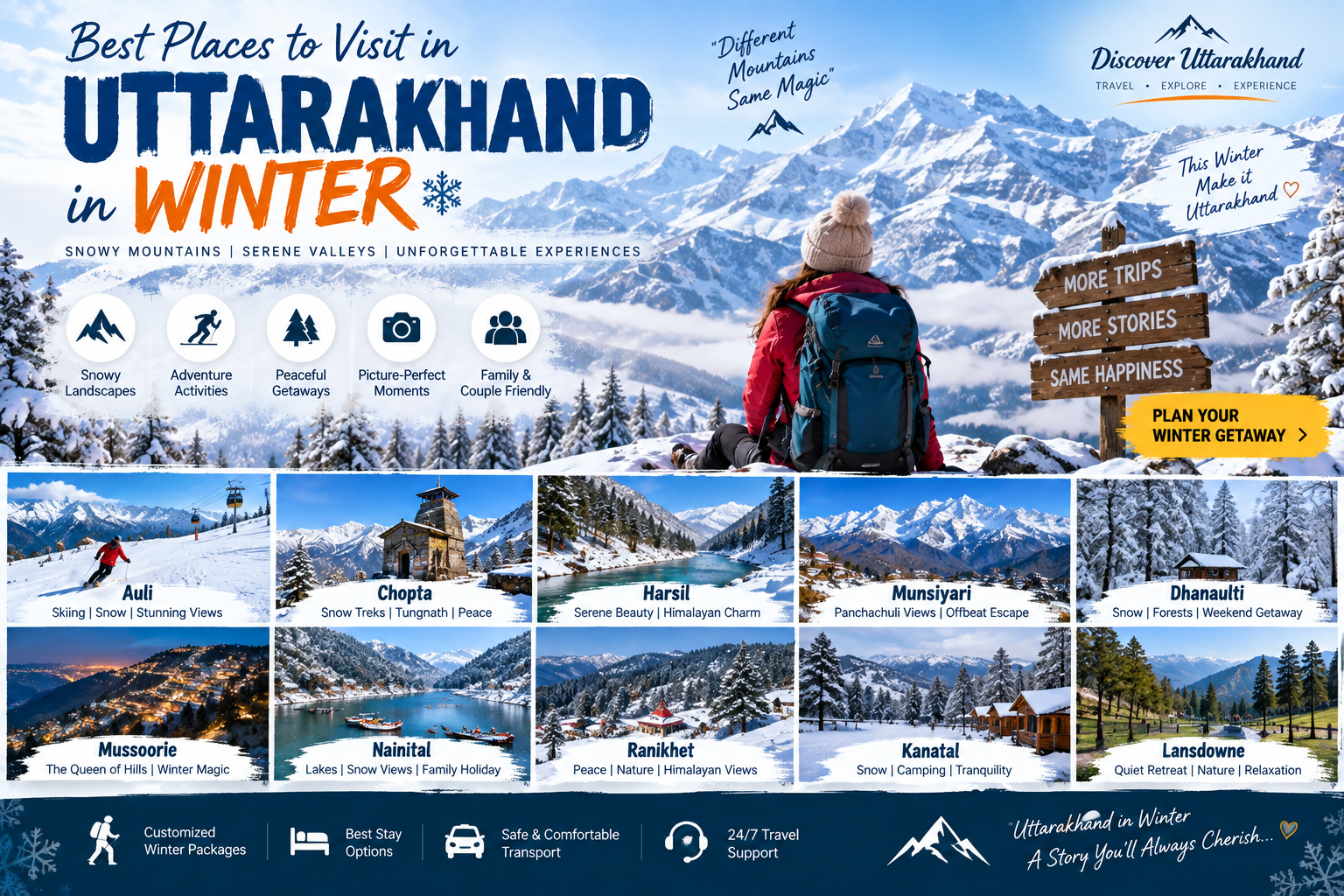
Why Visit in Winter (December–March)
- The trail gets a generous layer of snow, turning into a winter wonderland
- It’s one of those treks where every turn gives you a frame worth capturing
- Kuari Pass is one of the few treks where you can experience snow drama at such a manageable difficulty
- Some of the best winter photos from the Indian Himalayas have come from this trail
Why Visit in Summer (May–June)
- Lush meadows at Khulara and Gorson Bugyal are full of colour
- Pleasant temperatures and easy trekking conditions
- Great time for birdwatching
- Clear skies with the best views of the Himalayan peaks
Why Visit in Autumn (September–November)
- Crystal clear skies with excellent visibility
- Wildflowers dot the slopes
- Comfortable trekking conditions
- Ideal for photographers and first-time trekkers
Packing Guide
The Kuari Pass Trek: A Step-by-Step Guide
Trek Overview
| Detail | Information |
|---|---|
| Total Distance | 28–33 km round trip |
| Duration | 5–6 days |
| Difficulty | Easy to Moderate |
| Walking Hours | 4–6 hours per day (Summit day: 7–8 hours) |
Day-by-Day Itinerary (6 Days / 5 Nights)
Day 1: Drive from Haridwar/Rishikesh to Joshimath
- Distance: 260–320 km
- Travel Time: 10–11 hours
- Highlights: Scenic drive through Devprayag, Rudraprayag, and Karnaprayag
- Overnight: Guesthouse or hotel in Joshimath
Day 2: Joshimath to Dhak (Drive) & Trek to Gulling
- Drive (Joshimath → Dhak): 12 km / 30–40 minutes
- Trek (Dhak → Gulling): 4.5–5 km / 4–5 hours
- Altitude: 6,150 ft to 9,400 ft
- Highlights: Dense oak and rhododendron forests, first glimpses of the Himalayas
- Overnight: Camp at Gulling
Day 3: Gulling to Khullara
- Trek Distance: 5–6 km / 5–6 hours
- Altitude: 9,400 ft to 11,000 ft
- Highlights: Alpine meadows, first clear views of Dronagiri and Nanda Devi
- Overnight: Camp at Khullara
Day 4: Khullara to Kuari Pass & Return to Tali
- Trek Distance: 8–10 km / 7–8 hours
- Altitude Gain: 11,000 ft to 12,516 ft
- Highlights: Summit of Kuari Pass, 360° panoramic views
- Overnight: Camp at Tali
Day 5: Tali to Tugasi & Drive to Joshimath
- Trek Distance: 6–7 km / 4–5 hours
- Highlights: Descend through forests and meadows
- Drive: Joshimath
- Overnight: Guesthouse or hotel in Joshimath
Day 6: Joshimath to Haridwar/Rishikesh
- Distance: 260–320 km
- Travel Time: 10–11 hours
- End of Trek: Return to Haridwar
Summit Day: The Climb to Kuari Pass
The summit climb is the highlight of the trek. Trekkers typically start early in the morning to catch the sunrise from the top. The final ascent is steep but rewarding, and the view from the summit is unparalleled.
What You See from the Top:
- Nanda Devi — India’s second-highest peak, massive and close
- Dronagiri — associated with the Ramayana
- Kamet — third-highest peak in India
- Chaukhamba — prominent Garhwal peak
- Trishul — recognisable by its three peaks
- Hathi Ghoda and Neelkanth — visible from the ridge
Nearby Places to Visit
| Destination | Distance | Highlights |
|---|---|---|
| Joshimath | Base camp | Narsingh Temple, Kalpavriksha tree |
| Auli | ~14 km from Joshimath | India’s premier skiing destination, cable car |
| Gorson Bugyal | On the trek | Stunning alpine meadow |
| Tali Lake | On the trek | High-altitude lake with mountain reflections |
| Devprayag | En route | Sacred confluence of Alaknanda and Bhagirathi |
| Rudraprayag | En route | Confluence of Alaknanda and Mandakini |
| Karnaprayag | En route | Confluence of Alaknanda and Pindar |
| Nandprayag | En route | Confluence of Alaknanda and Nandakini |
Things to Do on the Kuari Pass Trek
1. Walk the Historic Lord Curzon Trail
The primary activity is walking the same ridge route explored by the Viceroy of India in 1905. One of the few Himalayan trekking routes with a documented colonial history.
2. Witness the 360° Panorama
Stand at Kuari Pass and see Nanda Devi, Dronagiri, Kamet, Chaukhamba, Trishul, Hathi Ghoda, and Neelkanth — all at once. The view is, without qualification, one of the finest mountain panoramas accessible to a trekker without technical climbing experience anywhere in India.
3. Camp at Khullara Meadows
Experience the high-altitude bugyal at 11,000 ft with unobstructed views of Dronagiri and Nanda Devi. This is where the mountains first come fully into view.
4. Explore the Rhododendron and Oak Forests
The lower trail from Tugasi to Guling passes through protected Garhwali forests that bloom spectacularly in spring.
5. Winter Snow Trekking
From December through February, the entire route from Guling onward is blanketed in snow, transforming the forest trails and meadows into a winter landscape.
6. Photography
From the golden autumn meadows to the snow-covered winter landscapes, Kuari Pass offers endless photography opportunities.
7. Visit Garhwali Villages
The trail passes through Tugasi and Guling, traditional mountain communities where the pace of life and the architecture are unchanged from decades ago.
8. Enjoy the View of Nanda Devi
This is the closest most people without technical climbing experience will ever get to India’s second-highest mountain, visible from Khullara Meadows and dominant from Kuari Pass.
Accommodation Options
| Type | Location | Features | Price Range |
|---|---|---|---|
| Guesthouses/Hotels | Joshimath | Basic amenities, comfortable stay | ₹1,500 – ₹4,000 |
| Camps | On the trail | Tents with basic facilities | Included in trek package |
| Homestays | Tugasi, Guling | Authentic local experience | ₹800 – ₹2,000 |
| Forest Rest Houses | Govind Wildlife Sanctuary | Basic accommodation | ₹500 – ₹1,500 |
Travel Tip: Most trek packages include accommodation in tents during the trek and guesthouse stays in Joshimath. Book accommodation well in advance, especially during peak season (May–June and September–October).
Local Cuisine — A Taste of Garhwal
The food on the Kuari Pass trek is simple, nutritious, and mostly vegetarian.
What to Expect
| Meal | Description |
|---|---|
| Breakfast | Porridge, eggs, bread, tea/coffee |
| Lunch | Packed lunch (sandwiches, fruits, snacks) |
| Dinner | Dal, rice, roti, sabzi, soup |
| Snacks | Maggi, biscuits, energy bars |
Where to Eat:
- Trek Packages: Most packages include all meals during the trek
- Joshimath: Simple meals at local eateries
- Local Favourites: Try authentic Garhwali dishes like Kafuli and Phanu
Frequently Asked Questions (FAQs)
General Questions
Q1: Why is it called Kuari Pass?
A: The name “Kuari” means “virgin” or “doorway” in Hindi. In 1905, when Lord Curzon asked the locals what the area was called, they replied that it had no name. He named it “Kuari” Pass to signify its unexplored nature.
Q2: Why is it called the Lord Curzon Trail?
A: In 1905, Lord Curzon, the Viceroy of India, trekked this route. The trail has carried his name ever since.
Q3: What is the altitude of Kuari Pass?
A: Kuari Pass stands at approximately 12,516 feet (3,815 metres) above sea level.
Q4: What is the difficulty level of the Kuari Pass trek?
A: The trek is rated easy to moderate. It is suitable for first-time trekkers and those with prior experience.
Q5: What is the best time to visit Kuari Pass?
A: The best time depends on your preference:
- For snow: December to March
- For clear views and lush greenery: May to June and September to November
- Avoid: July to August (monsoon)
Q6: How long is the Kuari Pass trek?
A: The total trek distance is approximately 28–33 kilometres round trip. The trek typically takes 5 to 6 days to complete.
Q7: What peaks can I see from the Kuari Pass summit?
A: From the summit, you can see a 360-degree panorama of peaks including Nanda Devi (7,816 m), Dronagiri, Kamet, Chaukhamba, Trishul, Hathi Ghoda, and Neelkanth.
Q8: Is Kuari Pass open all year?
A: Yes, the trek is open for almost nine months of the year. Except during the monsoon season — July, August, and early September — you can plan this trek in any other season.
Q9: Do I need a permit for the Kuari Pass trek?
A: Permits may be required for entering the Govind Wildlife Sanctuary or Nanda Devi Biosphere Reserve. Most trek operators arrange this on your behalf.
Q10: Is there mobile connectivity on the trek?
A: Mobile connectivity is limited on the trek. BSNL tends to have the best coverage in the region. There is no connectivity at higher camps.
Q11: Are there ATMs near the trek?
A: The last ATM is in Joshimath. It is advisable to carry sufficient cash for the entire trip.
Q12: What is the local language spoken in the region?
A: The official language is Hindi. The regional language is Garhwali. English is understood in tourist areas.
Travel Logistics
Q13: How can I reach Kuari Pass from Delhi?
A: You can reach Kuari Pass by:
- Road: Drive from Delhi to Joshimath (~500 km, 12–14 hours)
- Train: Take a train to Haridwar or Dehradun, then a taxi/bus to Joshimath
- Air: Fly to Jolly Grant Airport, Dehradun, then a taxi/bus to Joshimath (10–11 hours)
Q14: What is the distance between Delhi and Kuari Pass?
A: The distance from Delhi to Joshimath (the base camp) is approximately 500 km.
Q15: What is the nearest railway station to Kuari Pass?
A: The nearest railway stations are Haridwar and Dehradun.
Q16: What is the nearest airport to Kuari Pass?
A: The nearest airport is Jolly Grant Airport, Dehradun.
Q17: How can I book a Kuari Pass trek?
A: Trek packages can be booked through:
- Local tour operators in Rishikesh, Haridwar, and Joshimath
- Trekking agencies specialising in Himalayan treks
- Discover Uttarakhand for customised trekking packages
Practical Information
Q18: What should I pack for the Kuari Pass trek?
A: Pack thermal wear, a fleece jacket, an insulated jacket, waterproof trekking shoes, warm socks, gloves, a woollen cap, sunscreen, sunglasses, a headlamp, a sleeping bag, and personal medication.
Q19: What is the food like on the trek?
A: The food is simple, vegetarian, and nutritious, including dal, rice, roti, sabzi, soup, and snacks. Most trek packages include all meals.
Q20: Is camping allowed on the trek?
A: Yes, camping is allowed at designated campsites like Gulling, Khullara, and Tali. Most trek packages include tented accommodation.
Q21: Can I do the Kuari Pass trek solo?
A: While it is possible to trek solo, it is recommended to join a group or hire a local guide for safety, as the terrain is remote and weather can change rapidly.
Q22: What is the water availability on the trek?
A: Water sources are available along the trail, but it is advisable to carry a water bottle and a water purifier. In winter, streams may be frozen.
Plan Your Kuari Pass Adventure with Discover Uttarakhand
At Discover Uttarakhand, we’ve been organising unforgettable Himalayan journeys since 1997. As a trusted local operator with deep knowledge of the Garhwal region and its iconic treks, we offer:
✅ Customized Kuari Pass trek packages (5 to 7 days)
✅ Combined itineraries with Auli, Valley of Flowers, and Pangarchulla
✅ Experienced local guides and porters
✅ Comfortable transport with experienced hill drivers
✅ All necessary permits and arrangements
✅ Quality camping equipment and nutritious meals
✅ 24/7 customer support throughout your journey
Recommended Kuari Pass Packages
| Package | Duration | Starting Point | Highlights |
|---|---|---|---|
| Kuari Pass Trek | 5 Nights / 6 Days | Haridwar | Lord Curzon Trail, Nanda Devi views, Khullara Meadows |
| Kuari Pass & Auli Explorer | 6 Nights / 7 Days | Haridwar | Kuari Pass summit, Auli skiing, cable car |
| Garhwal Himalayan Circuit | 8 Nights / 9 Days | Delhi | Kuari Pass, Valley of Flowers, Hemkund Sahib |
📞 Call / WhatsApp: +91-9997187178, 9760222178, 8171977178
📍 Visit Our Office: Himalayan Colony, opposite DSVV, Haripur Kalan, Haridwar, Motichur Range, Uttarakhand 249411
🌐 Website: www.discover-uttarakhand.com
📧 Email: info@discover-uttarakhand.com
Discover Uttarakhand – Your Local Partner for Unforgettable Himalayan Journeys Since 1997 🏔️