Overview: The Glacier of the Himalayas
Tucked away in the remote reaches of the Garhwal Himalayas, Bagini Glacier—also known as Bagni Glacier or Bangni Glacier—is not just a destination; it is a journey into the soul of the mountains.
Part of the Nanda Devi National Park in the Chamoli District of Uttarakhand, Bagini Glacier is one of the most beautiful glaciers in the region. Situated at an altitude of approximately 4,515 metres (14,816 feet) above sea level, this magnificent glacier is a paradise for nature lovers and trekkers alike.
What makes Bagini Glacier truly special is its pristine, uncrowded nature. Unlike more commercialised treks, Bagini offers the experience of being at Everest Base Camp without the rush and bustle of crowds and commercialisation. It serves as an Advance Camp for mountaineering expeditions to high-altitude peaks such as Changbang and Kalanka, making it a vital hub for Himalayan exploration.
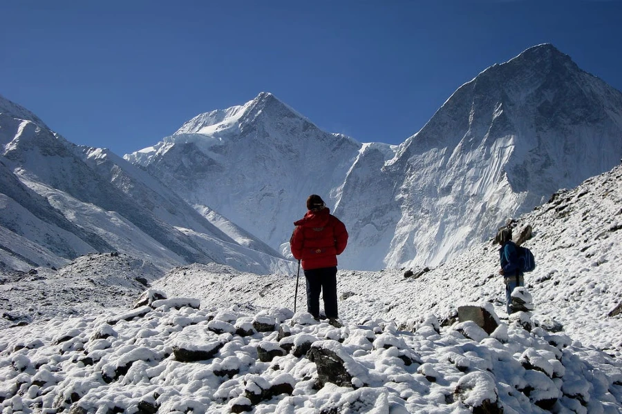
The trek to Bagini Glacier, which begins from the remote village of Jumma near Joshimath, is a challenging yet rewarding journey through dense forests, blooming alpine meadows, and rugged terrain. It offers close-up views of some of the tallest Himalayan peaks, including Nanda Devi, Dunagiri, Changbang, and Kalanka.
Key Information at a Glance
History of Bagini Glacier
Scientific Documentation
Bagini Glacier has been the subject of extensive scientific study, making it one of the most well-documented glaciers in the Central Himalaya. The glacier is also referred to as Bangni Glacier in scientific literature.
Holocene Glaciations: Research has identified three major glacial stages in the Dunagiri valley:
- Bangni Glacial Stage-I (BGS-I): Dated between 12 and 9 ka (thousand years ago)—the oldest and most extensive glaciation
- Bangni Glacial Stage-II (BGS-II): Dated between 7.5 and 4.5 ka
- Bangni Glacial Stage-III (BGS-III): Dated at ~1 ka
Glacial Retreat
Like many Himalayan glaciers, Bagni has been experiencing significant retreat:
- The glacier retreated 2,080 ± 162 metres between 1962 and 2013
- The average retreat rate was 41 ± 3.2 metres per year during this period
- The Equilibrium Line Altitude (ELA) shifted 64 ± 30 metres upward during the study period
Mountaineering History
The Nanda Devi region has a rich mountaineering history:
- 1937: The first ascent of Nanda Devi was achieved by legendary climbers H.W. Tilman and Noel Odell
- The quest for exploration in this region dates back to the 1930s, with numerous expeditions failing to reach even the base due to the impenetrable mountain range surrounding the sanctuary
- British expeditions led by Eric Shipton and Tilman eventually discovered a route through the Rishi Gorge into the Nanda Devi Sanctuary
Geography of Bagini Glacier
Location and Topography
Bagini Glacier is located in the Chamoli District of Uttarakhand, within the Nanda Devi National Park of the Garhwal Himalayas.
| Feature | Details |
|---|---|
| Coordinates | Garhwal Himalayas, Nanda Devi National Park |
| Elevation | 4,515 m (14,816 ft) |
| Terrain | Compound valley glacier with moraines, ice, and alpine meadows |
| Key Peaks | Dunagiri (7,066 m), Changbang (6,864 m), Kalanka (6,931 m) |
| River System | Dhauliganga River (via Bagini Nala / Bagini River) |
The Glacier Structure
Bagini Glacier is a compound valley glacier formed by four tributaries originating on the north and northwestern slopes of the surrounding massifs. It is the largest glacier in the Dunagiri valley, covering an area of approximately 24 km² with a length of about 11.5 km.
The Shankalpa Divide Connection
Bagini Glacier is part of a complex glacial system. Scientific studies have documented its retreat alongside the adjacent Dunagiri Glacier, which retreated 484 ± 38 metres at an average rate of 9 ± 0.6 metres per year between 1962 and 2013.
Surrounding Peaks
The Bagini Glacier region offers spectacular views of some of the most iconic Himalayan peaks:
| Peak | Elevation |
|---|---|
| Nanda Devi | 7,817 m |
| Dunagiri | 7,066 m |
| Hardeol | 7,151 m |
| Trishul | 7,120 m |
| Kalanka | 6,931 m |
| Changbang | 6,864 m |
| Rishi Pahar | 6,992 m |
| Hathi Parvat | 6,727 m |
| Ghodi Parvat | 6,708 m |
Hydrological Significance
The glacier feeds the Bagini River (locally called Bagini Nala), which flows along the trek. The Bagini River originates from the Trishul peaks and Changbang (northwards) and joins the waters of the Dunagiri Glacier (westwards). The combined stream is joined by the Lampak stream before flowing into the Dhauli Ganga River.
Flora and Fauna
Flora
The region surrounding Bagini Glacier is blessed with rich alpine biodiversity.
Lower Elevations:
Higher Elevations (Alpine Meadows):
- Vibrant seasonal wildflowers in captivating colours
- Rare alpine flowers that bloom during the summer months
- The meadows are ornamented with wildflowers, creating a colourful tapestry against the snow-capped peaks
Fauna
The Nanda Devi National Park is home to a variety of rare and endangered Himalayan wildlife. Trekkers on the Bagini route may be fortunate enough to spot:
Conservation Status
The Bagini Glacier is located within the Nanda Devi National Park, which is part of the Nanda Devi Biosphere Reserve. The entire park lies at an elevation of more than 3,500 metres (11,500 feet) above sea level. The area is ecologically sensitive and protected, requiring trekkers to follow Leave No Trace principles.
Religious Beliefs and Significance
The Nanda Devi Connection
The Bagini Glacier trek holds deep mythological significance as it is located in the Nanda Devi region, which is deeply revered in Hindu mythology.
Nanda Devi, the second-highest peak in India, is considered the sacred abode of the goddess Nanda Devi, an incarnation of Parvati. According to legend:
- The goddess Nanda Devi fled to this mountain to escape from an evil demon
- The area is still regarded as her sanctuary
- Trekkers and mountaineers often find themselves immersed in these rich mythological stories, adding a spiritual dimension to the challenging journey
The Legend of Sanjeevani Booti
The Dronagiri Valley has a fascinating connection to the Ramayana:
- According to mythology, Lord Hanuman found the Sanjeevani Booti (a mythical medicinal herb) in this valley to cure Laxman during the great war
- Interestingly, locals in the Dronagiri valley are said to be angry at Lord Hanuman for taking the Sanjeevani Booti from the valley without asking, and blame him for committing theft
- This folklore adds a unique cultural dimension to the trek
The Sacred Peaks
For centuries, the Garhwal Himalayas have been revered as the abode of gods. The peaks surrounding Bagini Glacier—Nanda Devi, Trishul, Dunagiri, and others—are considered sacred, and the region is often referred to as “Devbhoomi” (Land of the Gods). The presence of remote villages like Dronagiri (named after the mythical mountain) loudly recounts the stories of this region’s rich cultural and religious past.
How to Reach Bagini Glacier
The journey to Bagini Glacier is a multi-day trek and requires significant physical fitness.
By Air
The nearest airport is Jolly Grant Airport in Dehradun, located approximately 20 km from the city centre. From there, you can hire a taxi or take a bus to reach Joshimath (approx. 8–9 hours).
By Train
The nearest railway stations are Haridwar and Rishikesh, which are well-connected to Delhi and other major cities. From the station, you can take a taxi or bus to Joshimath.
By Road
| Route | Distance | Travel Time |
|---|---|---|
| Delhi → Haridwar/Rishikesh | ~220 km | 5–6 hours |
| Haridwar/Rishikesh → Joshimath | ~250–280 km | 9–11 hours |
| Joshimath → Jumma | ~44 km | ~2 hours (by jeep) |
The road journey from Rishikesh to Joshimath passes through scenic towns like Devprayag, Rudraprayag, and Karnaprayag, along the Ganges and Alaknanda rivers.
The Trek
⚠️ Important: The total trek distance is approximately 53–65 km round trip. The trek typically takes 7–9 days to complete. The Bagini Glacier Trek is considered moderate to difficult and requires good physical fitness.
Weather and Best Time to Visit
Climate Overview
Bagini Glacier experiences a high-altitude alpine climate. Days are cool and pleasant, but nights can drop well below freezing, even during the open season. Sudden weather changes are common.
Seasonal Breakdown
| Season | Months | Weather | Trekking Suitability |
|---|---|---|---|
| Summer (Peak) | May–June | Pleasant, clear skies, blooming flowers | ⭐ Best |
| Monsoon | July–August | Heavy rainfall, landslides | ❌ Not Recommended |
| Autumn | September–October | Crisp air, clear views, golden landscapes | ⭐ Best |
| Winter | November–April | Heavy snowfall, extreme cold | ❌ Closed |
Best Time to Visit
| Season | Months | Highlights |
|---|---|---|
| Summer | May–June | Pleasant weather (15–20°C daytime), clear views, lush greenery, blooming rhododendrons |
| Autumn | September–October | Post-monsoon clarity (10–15°C daytime), crisp air, golden landscapes |
Note: The trek to Bagini Glacier is generally open from May to June and September to October. During the rainy season (July–August) and winter (November–April), the trek is not possible due to harsh climatic conditions.
Temperature
| Season | Daytime Temperature | Nighttime Temperature |
|---|---|---|
| Summer (May–June) | 15°C to 20°C | 7°C to -2°C |
| Autumn (Sept–Oct) | 10°C to 15°C | 5°C to -5°C |
| At Glacier | Near freezing or below | Well below freezing |
Nearby Places
Other Nearby Attractions:
- Nanda Devi National Park – UNESCO World Heritage Site
- Dunagiri Glacier – Adjacent glacier in the same valley
- Hathi Parvat & Ghori Parvat – Prominent peaks visible from the trek
Distance from Major Cities
| City | Distance (Approx.) | Travel Time |
|---|---|---|
| Delhi | 500–550 km | 14–16 hours |
| Dehradun | 400–450 km | 10–12 hours |
| Rishikesh | 480–500 km | 11–12 hours |
| Haridwar | 470–490 km | 10–11 hours |
| Nainital | 350–380 km | 9–10 hours |
| Almora | 300–330 km | 8–9 hours |
| Pithoragarh | 350–380 km | 10–11 hours |
Frequently Asked Questions (FAQs)
General Questions
Q1: What is Bagini Glacier also known as?
A: Bagini Glacier is also known as Bagni Glacier and Bangni Glacier.
Q2: Where is Bagini Glacier located?
A: It is located in the Nanda Devi National Park, Chamoli District, Uttarakhand, in the Garhwal Himalayas.
Q3: What is the altitude of Bagini Glacier?
A: Bagini Glacier is situated at an altitude of approximately 4,515 metres (14,816 feet) above sea level.
Q4: What is the length of Bagini Glacier?
A: The glacier is approximately 11.5 km long and covers an area of about 24 km².
Q5: What is the best time to visit Bagini Glacier?
A: The best time is May to June (summer) and September to October (autumn).
Q6: How long is the trek to Bagini Glacier?
A: The trek is approximately 53–65 km from Joshimath, taking 7–9 days round trip.
Q7: Is the Bagini Glacier trek difficult?
A: The trek is considered moderate to difficult and is recommended for trekkers with good physical fitness.
Q8: Do I need a permit to visit Bagini Glacier?
A: Yes, permits are required as the trek is within the Nanda Devi National Park. Trekkers must register with the forest department.
Q9: Is Bagini Glacier retreating?
A: Yes, the glacier retreated 2,080 ± 162 metres between 1962 and 2013, at an average rate of 41 ± 3.2 metres per year.
Q10: What wildlife can be found in the area?
A: The region is home to the Himalayan Brown Bear, Himalayan Musk Deer, Blue Sheep, Himalayan Tahr, Himalayan Monal, and various vulture species.
Q11: What is the nearest town to Bagini Glacier?
A: Joshimath is the nearest town, approximately 44 km from the trek starting point at Jumma.
Q12: What peaks can I see from Bagini Glacier?
A: From Bagini Glacier, you can see Nanda Devi, Dunagiri, Changbang, Kalanka, Hardeol, Trishul, Hathi Parvat, and Ghodi Parvat, among others.
Q13: Is Bagini Glacier suitable for beginners?
A: The trek is considered beginner-friendly with a guide and good physical health. However, prior trekking experience is more appreciated.
Q14: Is mobile connectivity available at Bagini Glacier?
A: Mobile connectivity is very limited or non-existent in this remote region. It is advisable to inform your family of your itinerary before starting the trek.
Q15: What is the distance from Delhi to Joshimath?
A: The distance is approximately 500–550 km by road, taking about 14–16 hours.
Q16: What should I pack for the Bagini Glacier trek?
A: Pack thermal wear, fleece, a down jacket, waterproof trekking shoes, warm socks, gloves, a woollen cap, sunscreen, sunglasses, a headlamp, and a sleeping bag (-10°C rating).
Q17: How many days are required for the Bagini Glacier trek?
A: The trek typically takes 7 to 9 days to complete.
Q18: What is the mythological significance of the Bagini Glacier region?
A: The region is associated with Goddess Nanda Devi and the legend of Lord Hanuman finding the Sanjeevani Booti in the Dronagiri valley.
Q19: Is camping allowed at Bagini Glacier?
A: Camping is permitted in designated areas with prior permission. Trekkers must follow Leave No Trace principles.
Q20: What is the source of the Bagini River?
A: The Bagini River originates from the Trishul peaks and Changbang (northwards) and flows down through the glacier.
Essential Tips for Trekkers
- Acclimatisation: Spend at least 1–2 days in Joshimath to acclimatise to the altitude
- Physical Fitness: The trek requires good physical fitness; train by walking, jogging, swimming, and biking
- Permits: Obtain all necessary permits from the forest department well in advance
- Guide: Hire an experienced local guide for safety
- Gear: Carry proper high-altitude trekking gear including warm clothing, sturdy boots, and camping equipment
- Weather: Check weather forecasts before starting the trek
- Hydration: Stay well-hydrated; carry water purification tablets
- Leave No Trace: Respect the fragile Himalayan ecosystem
- Insurance: Consider travel insurance covering high-altitude trekking
- Medical Check-up: Visit your doctor and inform them about your high-altitude trekking plans
- Inform Family: Let someone in your family or friends know your trek itinerary
- Travel in Groups: Don’t hike alone; travel in a group of two or more
Plan Your Bagini Glacier Adventure with Discover Uttarakhand
At Discover Uttarakhand, we’ve been organising unforgettable Himalayan journeys since 1997. As a trusted local operator with deep knowledge of the Garhwal region, we offer:
✅ Customised Bagini Glacier trek packages (7 to 9 days)
✅ Combined itineraries with Changbang Base Camp, Rishikund, and Dunagiri Glacier
✅ Experienced local guides and porters
✅ Comfortable transport with experienced hill drivers
✅ All necessary permits and arrangements
✅ Quality camping equipment and nutritious meals
✅ 24/7 customer support throughout your journey
Recommended Bagini Glacier Packages
📞 Call / WhatsApp: +91-9997187178, 9760222178, 8171977178
📍 Visit Our Office: Himalayan Colony, opposite DSVV, Haripur Kalan, Haridwar, Motichur Range, Uttarakhand 249411
🌐 Website: www.discover-uttarakhand.com
📧 Email: discoveruttarakhand.mail@gmail.com
Plan your expedition to Bagini Glacier with proper preparation, permits, and respect for the magnificent Himalayan wilderness. This pristine glacier offers an unforgettable journey into one of India’s most remote and breathtaking landscapes.
Discover Uttarakhand – Your Local Partner for Unforgettable Himalayan Journeys Since 1997 🏔️