Overview: The Meadow of the Himalayas
Tucked away in the pristine landscapes of the Kumaon Himalayas, Khalia Top—also known as Khaliya Top or Khaliya Bugyal—is not just a destination; it is a journey into the soul of the mountains.
Often referred to as a “hidden gem” of Uttarakhand, this snow-covered alpine meadow is perched high in the Kumaon Himalayas at an altitude of approximately 3,500 metres (11,500 feet). Located around 10–12 km from Munsiyari in the Pithoragarh district of Uttarakhand, Khalia Top offers some of the most breathtaking panoramic views of the Himalayan ranges.
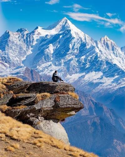
What makes Khalia Top truly special is its raw, untouched beauty. Unlike more commercialised treks, Khalia Top offers an off-beat experience where you can walk through pristine snow even in summer. The trek takes you through dense oak and rhododendron forests, wide alpine meadows, and snow-covered ridges that open into sweeping Himalayan vistas. At the summit, you are rewarded with commanding views of five famous mountain peaks—Panchachuli, Nanda Devi, Hardeol, Nandakot, and Rajrambha.
The trek to Khalia Top, which begins from the picturesque town of Munsiyari—often called the “Little Kashmir” of Uttarakhand—is an accessible yet rewarding adventure. It is a perfect weekend getaway that offers a profound sense of accomplishment and a deep connection with the spiritual heart of the Himalayas.
Key Information at a Glance
History of Khalia Top
A Hidden Gem of the Kumaon Himalayas
Khalia Top has long been a well-kept secret of the Kumaon region, known primarily to local shepherds and indigenous communities who have grazed their livestock on these high-altitude meadows (bugyals) for generations. The Bugyal—a local term for high-altitude grassland—has been an integral part of the region’s pastoral heritage.
The Johari Tribe Connection
The region around Munsiyari is home to the Johari tribe, a community with deep historical and cultural roots in the Kumaon Himalayas. For centuries, the Johari people have been known for their trade routes connecting India and Tibet, and the high-altitude passes and meadows like Khalia Top played a crucial role in this trans-Himalayan trade network.
Growing Recognition
In recent years, Khalia Top has gained recognition as one of the most beautiful yet lesser-known Himalayan treks. The Uttarakhand Tourism Department has promoted it as a hidden gem, and it has become increasingly popular among trekkers seeking an off-beat Himalayan experience.
Scientific Interest
Like many Himalayan glaciers and meadows, the Khalia Top region has drawn the attention of glaciologists and climate scientists studying the impact of climate change on the Kumaon Himalayas. The region’s snow cover patterns and glacial retreat provide valuable data for understanding Himalayan climate dynamics.
Geography of Khalia Top
Location and Topography
Khalia Top is located in the Pithoragarh district of Uttarakhand, within the Kumaon Himalayas. It is the highest point near Munsiyari, offering a commanding view of the surrounding landscape.
The Bugyal
The term “Bugyal” refers to the high-altitude alpine meadows that are characteristic of the Uttarakhand Himalayas. Khalia Bugyal, the meadow at Khalia Top, is one of Kumaon’s most beautiful high-altitude meadows. These meadows are covered with lush green grass in summer and transform into a white wonderland in winter.
Surrounding Peaks
From Khalia Top, trekkers can see some of the most iconic Himalayan peaks:
| Peak | Elevation |
|---|---|
| Panchachuli | 6,904 m |
| Nanda Devi | 7,817 m |
| Hardeol | 7,151 m |
| Nandakot | 6,861 m |
| Rajrambha | 6,527 m |
Zero Point
Located approximately 1–2 km ahead of Khalia Top, Zero Point offers a 360-degree panoramic view at an altitude of about 4,000 metres (13,125 feet). This is the highest point of the trek and provides an even more spectacular vista of the surrounding Himalayan ranges.
Hydrological Significance
The region around Khalia Top feeds into the Goriganga River system, which is a tributary of the Kali River. The melting snow from these high-altitude meadows and surrounding peaks contributes significantly to the region’s water resources.
Flora and Fauna
Flora
The region surrounding Khalia Top is blessed with rich Himalayan biodiversity.
Forests at Lower Elevations:
- Oak forests (Quercus spp.)
- Rhododendron forests (Rhododendron arboreum), locally known as “Buraans”
- Deodar (Cedar), Cypress, Pine, and Spruce trees
The Rhododendron Bloom:
- Rhododendrons blossom in vibrant red and pink during March and April
- The blooming rhododendrons create a spectacular display of colour, making the jungle “fiery red”
Alpine Meadows:
- The Khaliya Bugyal is a vast expanse of lush green summer grasslands
- In summer, the slopes burst into colour with wildflowers
Fauna
The area is home to diverse Himalayan wildlife:
Mammals:
Birds:
Conservation Status
The region is ecologically sensitive. Trekkers are expected to follow Leave No Trace principles and respect the fragile Himalayan ecosystem. The Uttarakhand Forest Department regulates access to the area.
Religious Beliefs and Significance
The Land of the Gods
The Kumaon Himalayas are deeply revered in Hindu mythology and are often referred to as “Devbhoomi” (Land of the Gods). The peaks visible from Khalia Top—Nanda Devi, Panchachuli, and others—are considered sacred.
Nanda Devi: The Goddess’s Abode
Nanda Devi, the second-highest peak in India, is considered the sacred abode of the goddess Nanda Devi, an incarnation of Parvati. According to legend, the goddess Nanda Devi fled to this mountain to escape from a demon, and the area is still regarded as her sanctuary. The presence of this sacred peak adds a spiritual dimension to the Khalia Top trek.
The Johari Culture
The Johari people, who inhabit the Munsiyari region, have a rich cultural and spiritual heritage deeply connected to the mountains. Their traditions reflect a harmonious relationship with nature, and the high-altitude meadows like Khalia Top have been central to their way of life for generations.
The Spiritual Experience
For many trekkers, the journey to Khalia Top is not just a physical adventure but also a spiritual pilgrimage. The silence, openness, and majestic beauty of the Himalayan landscape offer a space for reflection and inner peace.
How to Reach Khalia Top
The journey to Khalia Top requires a combination of road travel and trekking.
By Air
The nearest airport is Pantnagar Airport, approximately 218 km from Munsiyari. From Pantnagar, you can hire a taxi or take a bus to reach Munsiyari.
By Train
The nearest railway station is Kathgodam, approximately 275 km from Munsiyari. Kathgodam is well-connected to Delhi and other major cities.
Recommended Train:
- Take the Ranikhet Express or other trains from Delhi to Kathgodam
- From Kathgodam, take a cab or shared taxi to Munsiyari (8–9 hours)
By Road
| Route | Distance | Travel Time |
|---|---|---|
| Delhi → Kathgodam | ~280 km | 5–6 hours |
| Kathgodam → Almora → Bageshwar → Munsiyari | ~270 km | 8–9 hours |
| Delhi → Munsiyari (Direct Bus) | ~550–575 km | 14–16 hours |
Bus Options:
- State-owned buses and private buses run from Delhi, Dehradun, Almora, Pithoragarh, and Haldwani to Munsiyari
- From Anand Vihar ISBT terminal in Delhi, buses leave at 4 pm and reach Munsiyari at 6 pm the next day
The Trek Route
⚠️ Important:
- The actual climb to the Khalia Top summit begins from Balati Bend, from where the peak is around 6 km away
- The total one-way trekking distance is approximately 10–12 km
- The trek typically takes 2–4 days to complete
- Entry fee: ₹50 per person at Khaliya Dwar
Permits Required
- A forest entry permit is required for trekking in the region
- Permits can be obtained from the forest department office in Munsiyari
Weather and Best Time to Visit
Climate Overview
Khalia Top experiences a high-altitude alpine climate. Days are cool and pleasant, but nights can drop well below freezing, even during the open season. Sudden weather changes are common.
Seasonal Breakdown
| Season | Months | Weather | Trekking Suitability |
|---|---|---|---|
| Spring (Rhododendron Bloom) | March–April | Pleasant, blooming rhododendrons | ⭐ Best |
| Summer (Peak) | May–June | Pleasant, clear skies (15–25°C day) | ⭐ Best |
| Monsoon | July–August | Heavy rainfall, landslides | ❌ Not Recommended |
| Autumn | September–November | Crisp air, clear views | ⭐ Best |
| Winter | December–February | Heavy snow, extreme cold, challenging | ⭐ For Experienced Only |
Best Time to Visit
Temperature Table
| Month | Average Min (°C) | Average Max (°C) |
|---|---|---|
| January | 5 | 16 |
| February | 9 | 20 |
| March | 12 | 24 |
| April | 17 | 27 |
| May | 19 | 28 |
| June | 21 | 29 |
| July | 22 | 26 |
| August | 22 | 27 |
| September | 21 | 27 |
| October | 17 | 24 |
| November | 11 | 22 |
| December | 7 | 19 |
Source: Bugyalvalley.com
Snowfall
- Winter (December to February): Khalia Top is covered in deep snow, making it a great choice for winter trekking and snow camping
- Mid-April to End of November: Snow can be expected on Khalia Top
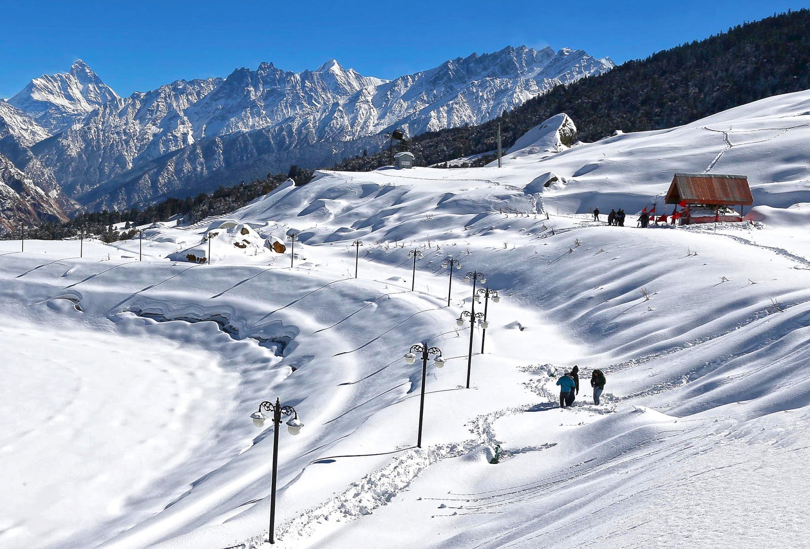
- The meadow transforms into a white wonderland with crystal-clear views of the Panchachuli peaks
Nearby Places
Distance from Major Cities
Frequently Asked Questions (FAQs)
General Questions
Q1: What is Khalia Top also known as?
A: Khalia Top is also known as Khaliya Top and Khaliya Bugyal.
Q2: Where is Khalia Top located?
A: It is located in the Pithoragarh district of Uttarakhand, in the Kumaon Himalayas.
Q3: What is the altitude of Khalia Top?
A: Khalia Top is situated at an altitude of approximately 3,500 metres (11,500 feet) above sea level.
Q4: What is Zero Point?
A: Zero Point is located 1–2 km ahead of Khalia Top at an altitude of approximately 4,000 metres (13,125 feet), offering a 360-degree panoramic view.
Q5: What is the best time to visit Khalia Top?
A: The best time is April to June (summer) and September to November (autumn).
Q6: How long is the trek to Khalia Top?
A: The trek is approximately 10–12 km from Munsiyari, taking 2–4 days round trip.
Q7: Is the Khalia Top trek difficult?
A: The trek is considered easy to moderate. It is suitable for beginners, families, and children with basic physical fitness.
Q8: Do I need a permit to visit Khalia Top?
A: Yes, a forest entry permit is required. The entry fee is ₹50 per person.
Q9: What peaks can I see from Khalia Top?
A: From Khalia Top, you can see Panchachuli, Nanda Devi, Hardeol, Nandakot, and Rajrambha.
Q10: What wildlife can be found in the area?
A: The region is home to mountain antelopes, Himalayan Tahr, Yellow-throated Marten, Himalayan Monal, and various pheasant species.
Q11: What is the nearest town to Khalia Top?
A: Munsiyari is the nearest town and serves as the base camp for the trek.
Q12: Is mobile connectivity available at Khalia Top?
A: BSNL network is available in Munsiyari town. Jio is patchy, and Airtel is absent. There is no signal on the trail or at Khalia Top.
Q13: What is the distance from Delhi to Khalia Top?
A: The distance is approximately 550–575 km by road, taking about 14–16 hours.
Q14: What should I pack for the Khalia Top trek?
A: Pack thermal wear, fleece, a down jacket, waterproof trekking shoes, warm socks, gloves, a woollen cap, sunscreen, sunglasses, a headlamp, and a sleeping bag (comfortable at -10°C).
Q15: How many days are required for the Khalia Top trek?
A: The trek typically takes 2 to 4 days to complete.
Q16: Is Khalia Top suitable for winter trekking?
A: Yes, winter (December to February) transforms Khalia Top into a snow-covered wonderland, making it a great winter trek. However, it is recommended only for experienced trekkers.
Q17: Can I camp at Khalia Top?
A: Yes, camping is permitted at designated campsites like Bhujani and Khaliya Meadow. Camping under the stars is an affordable and memorable option.
Q18: What activities can I do at Khalia Top?
A: You can enjoy trekking, camping, skiing (winter), and paragliding (summer).
Q19: Is food available on the trek?
A: Dhaba food is available along the way. At higher altitudes, you need to carry your own food.
Q20: Are there accommodation options at Khalia Top?
A: KMVN has a guest house near the summit. Tents and camping are also available at base camps. In Munsiyari, there are hotels and lodges.
Essential Tips for Trekkers
- Acclimatisation: Spend at least 1 day in Munsiyari to acclimatise to the altitude
- Physical Fitness: Basic cardiovascular fitness is required due to the altitude
- Guide: Hire an experienced local guide for safety
- Gear: Carry proper high-altitude trekking gear including warm clothing, sturdy boots, and camping equipment
- Weather: Check weather forecasts before starting the trek
- Hydration: Stay well-hydrated; carry water purification tablets
- Winter Clothing: Carry adequate winter clothing even in summer
- Rain Gear: Carry rain gear as weather at higher altitude changes at every moment
- Leave No Trace: Respect the fragile Himalayan ecosystem
- Insurance: Consider travel insurance covering high-altitude trekking
- Inform Family: Let someone know your trek itinerary as there is no mobile signal on the trail
- Permits: Obtain all necessary permits well in advance
Plan Your Khalia Top Adventure with Discover Uttarakhand
At Discover Uttarakhand, we’ve been organising unforgettable Himalayan journeys since 1997. As a trusted local operator with deep knowledge of the Kumaon region, we offer:
✅ Customised Khalia Top trek packages (2 to 4 days)
✅ Combined itineraries with Zero Point, Birthi Falls, and Patal Bhuvaneshwar
✅ Experienced local guides and porters
✅ Comfortable transport with experienced hill drivers
✅ All necessary permits and arrangements
✅ Quality camping equipment and nutritious meals
✅ 24/7 customer support throughout your journey
Recommended Khalia Top Packages
| Package | Duration | Starting Point | Highlights |
|---|---|---|---|
| Khalia Top Weekend Trek | 2 Days / 1 Night | Kathgodam | Munsiyari, Khaliya Bugyal, sunset views |
| Khalia Top & Zero Point Trek | 3 Days / 2 Nights | Kathgodam | Khalia Top, Zero Point, 360° Himalayan views |
| Complete Munsiyari Experience | 4 Days / 3 Nights | Kathgodam | Khalia Top, Zero Point, Birthi Falls, local culture |
📞 Call / WhatsApp: +91-9997187178, 9760222178, 8171977178
📍 Visit Our Office: Himalayan Colony, opposite DSVV, Haripur Kalan, Haridwar, Motichur Range, Uttarakhand 249411
🌐 Website: www.discover-uttarakhand.com
📧 Email: discoveruttarakhand.mail@gmail.com
Plan your expedition to Khalia Top with proper preparation, permits, and respect for the magnificent Himalayan wilderness. This pristine alpine meadow offers an unforgettable journey into one of India’s most breathtaking landscapes.
Discover Uttarakhand – Your Local Partner for Unforgettable Himalayan Journeys Since 1997 🏔️