Introduction: The Ancient Gateway to Tibet
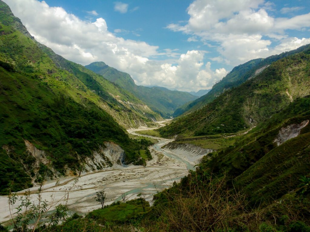
Tucked deep in the Kumaon Himalayas of Uttarakhand’s Pithoragarh district, Johar Valley is one of the most beautiful and culturally rich valleys of Uttarakhand. Located in the Munsiyari region close to the borders of Tibet and Nepal, this breathtaking valley stretches from Munsiyari town towards the high mountains of the Himalayas along the Gori Ganga River, reaching close to the Milam Glacier.
For centuries, the Johar Valley was the centre of Indo-Tibetan trade. Before the 1962 Sino-Indian War, the valley served as a vital corridor for merchants carrying wool, salt, spices, and other goods across the high Himalayan passes. The local Shauka (Bhotiya) tribesmen traded grains, jaggery, and mishri for salt, borax, and wool from Tibet—a barter system that bonded the two communities into a family.
Today, Johar Valley is a paradise for trekkers, nature lovers, historians, and culture enthusiasts. The valley offers spectacular views of the Panchachuli Peaks, one of the most iconic Himalayan ranges, along with access to glaciers like Milam Glacier and Ralam Glacier, alpine meadows, pristine rivers, and remote villages where time seems to have stood still.
Whether you are a seasoned trekker seeking high-altitude adventure, a history enthusiast tracing ancient trade routes, a birdwatcher hoping to spot the Himalayan Monal, or a traveller wanting to experience the rich Shauka culture, Johar Valley promises an unforgettable Himalayan journey.
Key Information at a Glance:
| Aspect | Details |
|---|---|
| Location | Pithoragarh district, Uttarakhand (near Munsiyari) |
| Region | Kumaon Himalayas |
| Altitude | ~3,000 meters and above |
| River | Gori Ganga River |
| Famous For | Ancient Indo-Tibetan trade route, Shauka culture, Panchachuli peaks, Milam Glacier |
| Main Villages | Munsiyari, Milam, Martoli, Ralam, Burfu, Lilam |
| Nearest Airport | Pantnagar (~300 km) |
| Nearest Railway Station | Kathgodam (~280 km) / Tanakpur (~270 km) |
| Distance from Delhi | ~600 km (by road) |
| Best Time to Visit | May–June & September–October |
History: The Ancient Trade Route Frozen in Time
The Indo-Tibetan Trade Corridor
Johar Valley’s history is inseparable from the ancient trans-Himalayan trade routes that connected India with Tibet. Before the 1962 Sino-Indian War, the valley was a vital corridor for merchants carrying wool, salt, spices, and other goods across the high Himalayan passes.
The trade was conducted on a barter system—there was no money involved. The Bhotiya people traded grains, jaggery, and mishri for salt, borax, and wool from Tibet. This trade bonded the Bhotiya and Tibetan communities into a family and sustained generations of families in the Johar Valley.
The first big market called “Bada Haat” was established in Uttarkashi, where Indian traders sold Chinese goods. A big trade market fair was held at Bada Haat every year, where Bhotiya tribesmen brought different kinds of goods from Tibet to be sold.
The Shauka (Bhotiya) Tribe
The Shauka living in the Johar Valley of the Goriganga river in Munsiyari Tehsil are also known as Johari or Johari Shauka. They are part of the larger Uttarakhand ethno-linguistic group and show a rich cultural heritage.
Key facts about the Shauka tribe:
The Shauka people ardently follow the Hindu religion, with Goddess Nanda Devi worshipped profoundly. The Kumaunis strongly believe that the Goddess lives in the Nanda Devi Mountain, at a height of 25,645 feet, being the highest peak in Uttarakhand.
The Famous Explorers of Johar Valley
The Johar Valley is the birthplace of two legendary Indian explorers :
- Nain Singh Rawat (1830–1895): Awarded the C.I.E. by the British Raj, he was one of the first surveyors to fix the location of Lhasa and map vast territories of Tibet on foot.
- Krishna Singh Rawat (1850–1921): Awarded the title of Rai Bahadur, he was the first to map the Ramgarh crater.
These “pundit-explorers” were trained by the British to survey the forbidden lands of Tibet disguised as pilgrims, and their contributions to the mapping of Central Asia remain unparalleled.
The Legend of Rajuli and Malusahi
The legend of Rajuli-Malusahi relates to Rajuli, daughter of Sunpati Shauka (a local lord/king of Johar), and Malusahi, scion of one of the branches of Katyuri Kings based out of Bairath near Dwarahat. This legend is an important part of the valley’s cultural heritage.
The 1962 Closure and Its Aftermath
The Sino-Indian War of 1962 changed everything. The borders were sealed, and the ancient trade routes fell silent. The death of trade disrupted the economy, and the Bhotiya people saw no need for seasonal migration and looked for other means of livelihood in the lower Himalayas.
The government notified the Bhotiya as a Scheduled Tribe (ST) community in 1967 to help the distressed tribe achieve education and employment. Several of the hill State’s Indian Administrative Service officers belong to the Bhotiya tribe.
The Tribal Heritage Museum of Munsiyari
Located in Munsiyari, the Tribal Heritage Museum was established by Prof. Sher Singh Pangti, an octogenarian Bhotiya history professor who collected everything the community was throwing away.
What the museum displays:
- Wooden wine bottles, cooking pots, Tibetan butter tea leaves
- Horses’ bells, bags made of yak skin
- Jewellery made of leopard and bear nails, and musk deer tooth
- Wooden pens and ink made of natural dye
- Woollen clothes, medicinal herbs, and handmade paper
- Musical instruments and stones inscribed with Buddhist sermons
- Different shapes and sizes of hookahs
The museum also showcases traditional Kumaoni woodwork—intricate wooden doors and windows with carvings of flowers, birds, and images of gods brought from high-altitude villages.
Geography and Location
Geographic Setting
Johar Valley is located in the northern part of Pithoragarh district, Uttarakhand. It stretches from Munsiyari town towards the high mountains of the Himalayas.
The valley is surrounded by many important Himalayan peaks, including Panchachuli, Nanda Devi East, and Rajrambha. Geographically, the valley lies in the Kumaon Himalayas and is an important route for trekking towards glaciers and passes like Milam Glacier, Ralam Glacier, and Nanda Devi East Base Camp.
Key Geographic Data:
| Aspect | Details |
|---|---|
| Altitude Range | ~2,200 m (Munsiyari) to ~4,800 m (Milam Glacier) |
| Main River | Gori Ganga |
| Major Passes | Sinla Pass (5,490 m), Mangsha Dhura Pass (5,490 m), Unta Dhura |
| Important Villages | Munsiyari, Lilam, Bogudiyar, Martoli, Burfu, Milam |
Major Villages of Johar Valley
Shauka Culture and Traditions
Language and Communication
The Shaukas mostly speak in the Byangshi language, which is of Tibeto-Burmese origin. Having settled in this Kumaon district for centuries, their language has been greatly influenced by Sanskrit, and now they write in the Devanagari script. Hindi being the official language, most people have adapted to this dialect.
Religious Beliefs
The Shauka people ardently follow the Hindu religion. Goddess Nanda Devi is worshipped profoundly. The Kumaunis strongly believe that the Goddess lives in the Nanda Devi Mountain, at a height of 25,645 feet, being the highest peak in Uttarakhand.
The main deity is Goddess Nanda Devi in Martoli and Milam.
Festivals of the Shauka Tribe
Hurkiyas of Munsiyari
The affluent Shaukas of Munsiyari and adjoining areas, during their cultural ceremonies and celebrations, employ the lesser-known small community of ‘Hurkiyas’ in Uttarakhand, who play a drum-like musical instrument. This drum is known as ‘Hurka’, and from here these people were known as Hurkiyas.
Handicrafts
The Shauka women have mastered the skills of a unique style of carpet making as a cottage industry. In Johar Valley, they still follow the age-old method of using the looms.
Popular handicrafts:
- Hand-woven woollen carpets
- Pashmina shawls
- Blankets made of sheep and rabbit wool
- Wooden artifacts
How to Reach Johar Valley
By Air
Nearest Airport: Pantnagar Airport (approximately 300 km from Munsiyari)
Alternative Airport: Pithoragarh’s Naini Saini Airport sometimes operates small flights.
By Train
Nearest Railway Stations:
| Station | Distance | Travel Time | Connectivity |
|---|---|---|---|
| Kathgodam | 280 km | 10–12 hours by road | Most preferred, well-connected from Delhi |
| Tanakpur | 270 km | 10–12 hours by road | Alternative option |
Popular Train from Delhi to Kathgodam:
| Train Name | From Delhi | Departure | Arrival (Kathgodam) | Duration |
|---|---|---|---|---|
| Ranikhet Express | Delhi | 10:05 PM | 5:05 AM | 7 hours |
From the railway station, taxis and buses are available for Munsiyari via Almora and Bageshwar.
By Road to Munsiyari (Base of Johar Valley)
Munsiyari is well connected by road with major towns of Kumaon like Almora, Bageshwar, Pithoragarh, and Kathgodam.
| Starting Point | Distance | Travel Time | Route |
|---|---|---|---|
| Delhi | 600 km | 14–16 hours | Delhi → Hapur → Moradabad → Rampur → Haldwani → Kathgodam → Almora → Bageshwar → Munsiyari |
| Kathgodam | 280 km | 10–12 hours | Kathgodam → Bhimtal → Almora → Bageshwar → Munsiyari |
| Almora | 200 km | 7–8 hours | Almora → Bageshwar → Munsiyari |
| Pithoragarh | 135 km | 5–6 hours | Pithoragarh → Munsiyari |
Road Conditions: The roads are winding but generally good. The final stretch from Bageshwar to Munsiyari is scenic but has sharp bends. Regular buses and shared jeeps operate, but the journey is long and through mountain roads.
Trekking into Johar Valley
The motorable road ends at Munsiyari. From here, you have to trek to enter the deeper Johar Valley.
Main trek route: Munsiyari → Lilam → Bogudiyar → Martoli → Burfu → Milam (following the Gori Ganga River).
Treks to Ralam Glacier, Nanda Devi East Base Camp, and Panchachuli Glacier also begin from Munsiyari.
Distances from Major Cities
| City | Distance (km) |
|---|---|
| Delhi | 600 |
| Kathgodam | 280 |
| Almora | 200 |
| Pithoragarh | 135 |
| Munsiyari | 0 (base) |
| Lilam | ~20 km (trek) |
| Martoli | ~54 km (trek) |
| Milam | ~70 km (trek) |
Weather and Best Time to Visit
Climate Overview
Johar Valley lies at a high altitude, so the climate is cold for most of the year. The valley is at an altitude of about 3,000 metres and above, making it a cold and remote area.
Month-by-Month Guide
| Month | Day Temp (°C) | Night Temp (°C) | Conditions | Travel Suitability |
|---|---|---|---|---|
| April | 10–15 | 0–5 | Snow melting, roads opening | ⭐ Good |
| May | 15–20 | 3–8 | Pleasant, clear skies | ⭐ Best |
| June | 15–20 | 5–10 | Pleasant, ideal | ⭐ Best |
| July–August | 10–15 | 8–12 | Monsoon, heavy rain, landslides | ❌ Avoid |
| September | 12–18 | 2–8 | Post-monsoon, clear skies | ⭐ Best |
| October | 10–15 | -5–0 | Crisp, clear, valley closes mid-Oct | ⭐ Good |
| November–April | -5–10 | -15–-5 | Heavy snow, villages closed | ❌ Closed |
Best Time to Visit by Season
Why Avoid Monsoon
The monsoon months (July–August) are not a good time due to heavy rainfall, landslides, and slippery trails.
Winter Closure
The valley is covered in snow from November to April. Most residents migrate to lower areas, and treks are closed.
Top Treks in Johar Valley
Johar Valley is the starting point for several high-altitude treks to glaciers and passes.
Trek Comparison Table
1. Milam Glacier Trek – The Classic Johar Valley Trek
The Milam Glacier Trek is the most famous trek in the Johar Valley, taking you through the heart of the valley to one of the largest glaciers in Kumaon.
Route: Munsiyari → Lilam → Bogudiyar → Martoli → Burfu → Milam Village → Milam Glacier
Key Highlights:
- The trek passes through ancient trade villages like Martoli and Milam, now mostly abandoned but with impressive stone houses and wood carvings
- Spectacular views of the Panchachuli, Nanda Devi, and Trishul peaks
- Walk along the Gori Ganga River through pine forests and alpine meadows
- The glacier itself is massive, stretching 16 km and ranging from 3,870 m at its snout to 5,500 m at its origin
Best Time: May–June and September–October
2. Martoli Village – The Crown of the Johar Valley
Martoli is one of the most impressive abandoned villages in the valley. Its huge stone houses with slate roofs and intricately carved window and doorframes speak of the wealth and prosperity of its former inhabitants . The village offers breathtaking views of the surrounding peaks and is a highlight of the trek.
3. Sinla Pass Trek – The Ancient Trade Route
The Sinla Pass Trek takes you along one of the ancient trade routes that connected the Johar Valley to Tibet. Sitting at about 5,490 meters, it is one of the top passes in Kumaon. From there, you can see the snow tops of Nanda Devi, Nanda Kot, and Api Himal in Nepal.
What makes Sinla Pass special:
- It’s a path less taken, perfect for experienced trekkers who love quiet and raw beauty
- The trail goes past old trade paths used for centuries by Johari traders to reach Gyanima in Tibet
- You pass through green fields, ice streams, thick woods, and old Himalayan towns
Best Time: May–June and September–October
4. Mangsha Dhura Pass – The Strategic Border Crossing
The word “Dhura” in the local Kumaoni language means mountain pass. Mangsha Dhura Pass is located at an elevation of about 5,490 metres above sea level and is among the lesser-known but strategically important Himalayan passes.
Best Time: May–June and September–October
Flora and Fauna
Forests and Vegetation
The Johar Valley region is exquisitely beautiful and still pristine. The region is home to exotic birds like Monal, Snow Cock, Snow Partridge, Himalayan Vultures, Serpent and Golden eagles .
| Elevation Zone | Vegetation Type | Characteristics |
|---|---|---|
| Lower Forests | Pine, Deodar, Oak | Dense forests, rich birdlife |
| Mid-Altitude | Rhododendron, Birch | Spring blooms (March-April) |
| High-Altitude | Alpine meadows | Grasses, wildflowers |
Birdlife
The forests around Johar Valley are excellent for birdwatching. Notable bird species include:
- Himalayan Monal – State bird of Uttarakhand
- Snow Partridge
- Bearded Vulture
- Golden Eagle
- Satyr Tragopan
- Spotted Laughing Thrush
- Great Throated Parrotbill
- Black Throated Parrotbill
- Pied Thrush
- Fire-breasted Flycatcher
- Himalayan Cutia
- Green-tailed Sunbird
The best birdwatching spots are Betuli Dhar Forest, Sarmoli Village, and Kalamuni Top.
Wildlife
The valley is part of the Himalayan ecosystem and supports various wildlife species:
| Species | Habitat | Likelihood of Sighting |
|---|---|---|
| Snow Leopard | High alpine zones | Extremely rare |
| Musk Deer | High-altitude forests | Rare |
| Himalayan Black Bear | Forested areas | Rare |
| Himalayan Tahr | Rocky slopes | Rare |
| Bharal (Blue Sheep) | High-altitude meadows | Rare |
Nearby Places to Visit
Munsiyari – The Gateway to Johar Valley
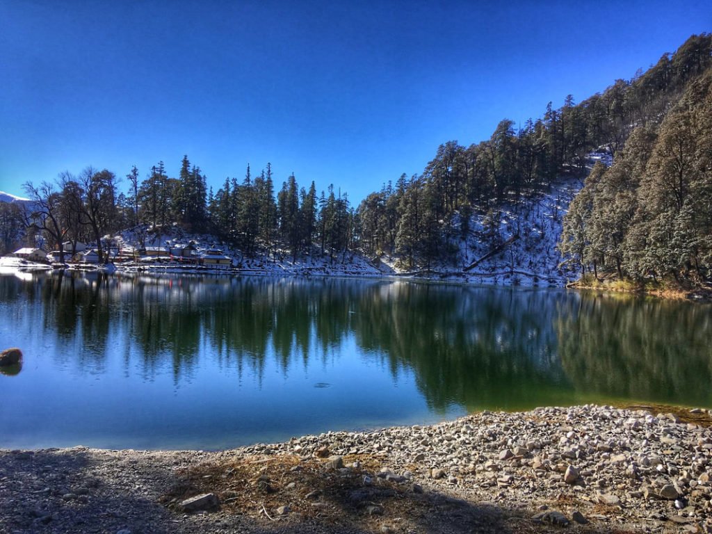
Munsiyari acts as the base camp for treks to Milam, Ralam, and Namik Glaciers. It stands at an altitude of 2,135 metres above sea level, and the entire region is known as Johar Valley. Situated around Munsiyari are the alpine lakes of Maheshwari Kund and Thamri Kund.
Pithoragarh – The District Headquarters
Pithoragarh is the district headquarters and a beautiful town often called “Little Kashmir.” Key attractions include:
- Pithoragarh Fort – Built by Gorkhas in 1789
- Kapileshwar Mahadev – Cave temple 3 km from town, dedicated to Lord Shiva
- Dhwaj Temple – 10 km by road, 4 km trek; dedicated to Lord Shiva and Maa Jayanti
- Nakuleshwara – 10 km away; believed to be built by Nakul and Sahdev (Pandavas)
Chaukori – The Tea Garden Paradise
Chaukori provides great weather and majestic views of snow-capped peaks. The entire area is filled with tea gardens and orchards.
Local Cuisine: What to Eat
The Johar Valley region offers authentic Kumaoni cuisine made from locally sourced ingredients.
Must-Try Kumaoni Dishes
| Dish | Description |
|---|---|
| Aloo Ke Gutke | Traditional Kumaoni sweet wrapped in a leaf |
| Bhatt ki Churkani | Spiced fried potatoes with local Kumaoni flavours |
| Chainsoo | Protein-rich black gram curry |
| Gahat Ki Dal | Horse gram lentil soup, warming and nutritious |
| Mandua Roti | Black soybean curry, a regional speciality |
| Jhangora Kheer | Barnyard millet sweet pudding |
| Singauri | Traditional Kumaoni sweet wrapped in leaf |
Where to Eat
- Homestays in Munsiyari – Authentic Kumaoni meals
- Local Dhabas – Simple Indian meals, parathas, chai
- Tribal Heritage Museum Cafe – Snacks and refreshments
Dining Tips
- Most homestays offer meal packages
- Pure vegetarian options are widely available
- Carry packaged snacks for treks
- Try the local chai (tea) at small stalls
Accommodation Options
In Munsiyari (Base Camp)
| Category | Price Range (per night) | Examples | Features |
|---|---|---|---|
| Mid-Range Hotels | ₹2,500 – ₹5,000 | Vikramaditya Resort, Hotel Milam Inn | Comfortable rooms, hot water, mountain views |
| Budget Hotels | ₹800 – ₹2,000 | Local guesthouses | Basic amenities, affordable |
| Homestays | ₹1,500 – ₹3,500 | Sarmoli Village homestays | Authentic Kumaoni experience, home-cooked food |
During Treks
| Location | Accommodation Type | Features |
|---|---|---|
| Lilam | Camping | Basic camp, river nearby |
| Martoli | Camping | Near the glacier, stunning views |
| Milam | Camping | Near glacier, stunning views |
Booking Tips:
- Book well in advance for peak trekking season (May–June, September–October)
- Homestays in Sarmoli Village are highly recommended for cultural immersion
- Treks require advance booking through registered tour operators
Sample Itineraries
5-Day Johar Valley Introduction (From Kathgodam)
Day 1: Kathgodam to Munsiyari
- Morning: Depart from Kathgodam early (by 6:00 AM)
- Afternoon: Drive via Almora and Bageshwar (10–12 hours)
- Evening: Arrive in Munsiyari, check into homestay/hotel
- Night: Overnight in Munsiyari
Day 2: Munsiyari Exploration
- Morning: Visit Tribal Heritage Museum
- Morning: Explore Sarmoli Village
- Afternoon: Visit Maheshwari Kund (alpine lake)
- Evening: Sunset views of Panchachuli peaks
- Night: Overnight in Munsiyari
Day 3: Birthi Falls and Darkot Village
- Morning: Drive to Birthi Falls (35 km), photography
- Afternoon: Visit Darkot Village, explore local culture
- Evening: Return to Munsiyari
- Night: Overnight in Munsiyari
Day 4: Kalamuni Top and Birdwatching
- Morning: Drive to Kalamuni Top (30 km), birdwatching
- Afternoon: Nature walk in Betuli Dhar Forest
- Evening: Return to Munsiyari
- Night: Overnight in Munsiyari
Day 5: Munsiyari to Kathgodam
- Morning: Depart for Kathgodam (10–12 hours)
- Evening: Arrive in Kathgodam, depart for Delhi
8-Day Milam Glacier Trek
Day 1: Kathgodam → Munsiyari (drive), overnight Munsiyari
Day 2: Munsiyari → Lilam (trek, 5–6 hours), overnight in Lilam
Day 3: Lilam → Bogudiyar (trek, 5–6 hours), overnight camp
Day 4: Bogudiyar → Martoli (trek, 4–5 hours), overnight camp
Day 5: Martoli → Burfu → Milam Village (trek, 5–6 hours), overnight camp
Day 6: Milam Village → Milam Glacier → Milam Village (trek, 6–7 hours), overnight camp
Day 7: Milam Village → Bogudiyar (trek), overnight camp
Day 8: Bogudiyar → Munsiyari → Kathgodam
Travel Tips and Important Information
Before You Go
- Physical Fitness: Treks in Johar Valley are long and at high altitude. Prepare with regular walking, jogging, and stair climbing for 4–6 weeks before.
- Medical Check-up: Consult your doctor before undertaking high-altitude trekking, especially if you have heart or respiratory conditions.
- Carry Cash: ATMs are limited in Munsiyari and non-existent on the trek; bring sufficient cash from Kathgodam or Almora.
- Check Weather: Avoid monsoon (July–August); the valley is closed in winter (November–April).
- Book Through Registered Operators: Treks require permits and local knowledge. Book through registered tour operators in Munsiyari.
During Your Visit
- Acclimatise Properly: Spend a day in Munsiyari (2,200 m) before starting high-altitude treks.
- Stay Hydrated: Drink plenty of water to prevent altitude sickness. Purify water from natural sources.
- Dress in Layers: Temperatures can change rapidly—layers allow adjustment throughout the day.
- Start Early: Begin treks early to complete sections before afternoon weather changes.
- Hire Local Guides: Local guides are essential for navigation, safety, and cultural insights.
Safety Tips
- Altitude Awareness: Above 3,000 m, altitude sickness is possible. Stay hydrated, walk slowly, and descend if symptoms worsen.
- Road Safety: Mountain roads require patience; avoid night driving.
- Monsoon Travel: Avoid July–August due to landslide risk.
- Wildlife: Do not feed animals; maintain a safe distance.
- Emergency Numbers: Keep local contacts handy.
Packing Checklist
| Category | Items |
|---|---|
| Clothing | Thermal inners, fleece jacket, down jacket, waterproof outer shell, trekking pants (2 pairs), woollen gloves, muffler, woollen cap, heavy woolen socks, sturdy trekking shoes |
| Gear | Trekking poles, headlamp/torch with extra batteries, power bank, reusable water bottle, water purification tablets |
| Health | Personal medications, first-aid kit, altitude sickness medication (consult doctor), ORS packets |
| Documents | Valid ID proof (Aadhaar/Passport), travel insurance, permit copies |
| Other | Thermal inners, fleece jacket, down jacket, waterproof outer shell, trekking pants (2 pairs), woollen gloves, muffler, woollen cap, heavy woollen socks, sturdy trekking shoes |
Photography Tips
- Best Spots: Panchachuli peaks from Munsiyari, Birthi Falls, Martoli village, Milam Glacier
- Best Time: Early morning for clear mountain views; golden hour (4:00–5:30 PM) for landscapes
- Camera Gear: Carry extra batteries—cold drains them quickly; telephoto lens for wildlife
- Note: Ask permission before photographing local people
Responsible Tourism
- Leave No Trace: Carry back all non-biodegradable waste
- Respect Local Culture: The Shauka community has unique traditions; be respectful and ask permission before photographing
- Support Local Economy: Hire local guides, stay in homestays, buy local handicrafts
Frequently Asked Questions (FAQs)
Q1: Why is Johar Valley famous?
A: Johar Valley is famous for being the centre of the ancient Indo-Tibetan trade route, its rich Shauka (Bhotiya) culture, stunning views of the Panchachuli peaks, and as the base for high-altitude treks to Milam Glacier, Ralam Glacier, and Sinla Pass.
Q2: What is the best time to visit Johar Valley?
A: The best time to visit is May to June (summer) and September to October (autumn). The valley remains closed from November to April due to heavy snowfall.
Q3: How far is Johar Valley from Delhi?
A: The distance from Delhi to Munsiyari (gateway to Johar Valley) is approximately 600 km, with a travel time of 14–16 hours by road.
Q4: How do I reach Johar Valley?
A: By road to Munsiyari (via Kathgodam, Almora, and Bageshwar), by train to Kathgodam (280 km) followed by taxi, or by flight to Pantnagar Airport (300 km) followed by taxi.
Q5: What is the altitude of Johar Valley?
A: The valley ranges from approximately 2,200 meters at Munsiyari to 3,434 meters at Milam Village, with passes reaching over 5,490 meters.
Q6: Do I need a permit to trek in Johar Valley?
A: Yes, permits are required for treks as the area is near the Indo-Tibetan border. Most tour operators arrange these permits as part of their packages.
Q7: Is Johar Valley safe for solo travellers?
A: The base town of Munsiyari is safe for solo travellers. However, for treks into the deeper valley, it is strongly recommended to trek with registered groups or experienced guides.
Q8: What is the Milam Glacier trek distance?
A: The Milam Glacier trek from Munsiyari is approximately 70 km one way, taking 8–10 days round trip.
Q9: What is the Shauka tribe?
A: The Shauka (also called Bhotiya or Johari) are the indigenous people of Johar Valley. They are of Tibeto-Burmese origin and were traditionally traders on the Indo-Tibetan route.
Q10: What is the Tribal Heritage Museum?
A: The Tribal Heritage Museum in Munsiyari was established by Prof. Sher Singh Pangti and displays artefacts of Bhotiya culture, including wooden utensils, jewellery, musical instruments, and traditional tools.
Q11: Can I see the Panchachuli peaks from Johar Valley?
A: Yes, the Panchachuli peaks are clearly visible from Munsiyari and many points along the trek.
Q12: Is there a mobile network in Johar Valley?
A: Mobile connectivity is available in Munsiyari, but becomes very poor or non-existent on treks. BSNL works in some pockets. Inform family of your travel plans in advance.
Q13: What is the Nanda Devi festival?
A: The Nanda Devi festival is celebrated in mid-September by the Shauka community. Devotees worship the goddess with dance, song, and offerings of Brahmakamal flowers.
Q14: How many days are enough for Johar Valley?
A: 3–5 days are sufficient for exploring Munsiyari and nearby attractions. For the Milam Glacier trek, allow 8–10 days. For Sinla Pass, allow 7–9 days.
Q15: What is the Sinla Pass altitude?
A: Sinla Pass sits at an altitude of approximately 5,490 meters (18,000 feet) and is one of the top passes in Kumaon.
Plan Your Johar Valley Adventure with Discover Uttarakhand
At Discover Uttarakhand, we’ve been organising unforgettable Himalayan journeys across Devbhoomi since 1997. As a trusted local operator with deep knowledge of the Kumaon region and the Johar Valley, we offer:
- ✅ Customised Johar Valley tour packages (5 to 12 days)
- ✅ Trekking packages for Milam Glacier, Ralam Glacier, and Sinla Pass
- ✅ Comfortable transport with experienced hill drivers
- ✅ Verified accommodations in Munsiyari (homestays to mid-range hotels)
- ✅ Cultural experiences, including Tribal Heritage Museum visits and Shauka homestays
- ✅ Local guides for all treks
- ✅ Permit assistance for restricted areas
- ✅ 24/7 customer support throughout your journey
Recommended Johar Valley Packages
| Package | Duration | Starting Point | Highlights |
|---|---|---|---|
| Johar Valley Explorer | 4 Nights / 5 Days | Kathgodam | Munsiyari, Tribal Museum, Birthi Falls, Sarmoli Village |
| Milam Glacier Trek | 9 Nights / 10 Days | Kathgodam | Lilam, Martoli, Milam Village, Milam Glacier |
| Sinla Pass Trek | 8 Nights / 9 Days | Kathgodam | Ancient trade pass, Panchachuli views, high-altitude adventure |
Book your Johar Valley journey today and walk through history in the land of the Shauka traders.
📞 Call / WhatsApp: +91-9997187178, 9760222178, 8171977178
📍 Visit Our Office: Himalayan Colony, opposite DSVV, Haripur Kalan, Haridwar, Motichur Range, Uttarakhand 249411
🌐 Website: www.discover-uttarakhand.com
📧 Email: info@discover-uttarakhand.com
Discover Uttarakhand – Your Local Partner for Unforgettable Himalayan Journeys Since 1997 🏔️