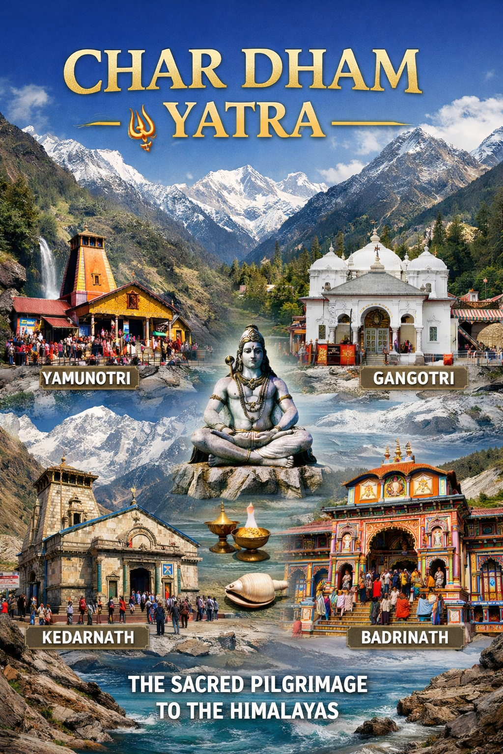
Introduction: The Land Where Shiva Dwells
Nestled in the Garhwal Himalayas of Uttarakhand, the Kedar Valley—also known as Kedar Ghati—is one of the most sacred landscapes in the Hindu world. This pristine valley, named after the Kedar Khand (the historical name of the region), is believed to be the earthly abode of Lord Shiva and forms the spiritual heart of the Garhwal Himalayas.
The Kedar Valley is not a single destination but a sprawling sacred landscape that encompasses the famous Kedarnath Temple—one of the twelve Jyotirlingas—along with the four other temples of the Panch Kedar circuit: Tungnath, Rudranath, Madhyamaheshwar, and Kalpeshwar. The valley is drained by the Kedar Ganga River, a fast-flowing tributary that joins the Bhagirathi at Gangotri, and is rimmed by breathtaking peaks including Thalay Sagar, Bhrigupanth, and Jogin.
What makes Kedar Valley truly unique is the seamless blend of mythology, spirituality, and raw Himalayan beauty. According to the Shiva Purana, this is where the great sages Nara and Narayana performed penance, and where Lord Shiva promised to reside forever as a Jyotirlinga. The valley is also deeply connected to the Pandavas, who are said to have built the original Kedarnath temple to atone for their sins after the Kurukshetra war.
Whether you are a pilgrim seeking the blessings of Lord Shiva at one of the holiest shrines in Hinduism, a trekker looking to conquer the Panch Kedar circuit, a nature lover drawn to alpine meadows and glacial lakes, or a spiritual seeker wanting to meditate in a landscape charged with divine energy, Kedar Valley promises an experience that is both transformative and unforgettable.
Key Information at a Glance:
| Aspect | Details |
|---|---|
| Location | Rudraprayag/Uttarkashi districts, Uttarakhand |
| Key Destinations | Kedarnath, Kedar Tal, Panch Kedar temples |
| River | Kedar Ganga, Mandakini River |
| Altitude Range | 2,200 m (Kalpeshwar) to 4,750 m (Kedar Tal) |
| Famous For | Kedarnath Temple (Jyotirlinga), Panch Kedar circuit, Kedar Tal glacial lake |
| Nearest Airport | Jolly Grant Airport, Dehradun (~250 km) |
| Nearest Railway Station | Rishikesh (~240 km) / Haridwar (~250 km) |
| Best Time to Visit | May–June & September–October |
History and Mythology: The Legends of Kedar
The Kedar Valley is steeped in mythology that dates back to the Mahabharata and beyond. Every rock, river, and peak in this sacred landscape has a story to tell.
The Legend of the Pandavas
The most famous legend associated with Kedar Valley involves the Pandavas, the heroes of the Mahabharata. After the bloody Kurukshetra war, the Pandavas were burdened by the sin of killing their own kinsmen (gotra hatya) and Brahmins (Brahmahatya). On the advice of Lord Krishna, they renounced their kingdom and set out in search of Lord Shiva to seek his blessings and atonement.
However, Lord Shiva was deeply incensed by the death and dishonesty at the Kurukshetra war and wanted to avoid the Pandavas. He assumed the form of a bull (Nandi) and hid in the Garhwal region, at a place now known as Guptakashi (literally “hidden Kashi”).
The Pandavas tracked Shiva to Guptakashi. Bhima, the second Pandava brother, recognised the bull and caught hold of it by its tail and hind legs. But the bull-formed Shiva disappeared into the ground, only to reappear in five different parts across the Garhwal Himalayas.
The five locations where different parts of Shiva’s bull form appeared became the Panch Kedar temples:
| Temple | Body Part of Shiva | Altitude | Location |
|---|---|---|---|
| Kedarnath | Hump (Kubja) | 3,583 m | Rudraprayag district |
| Tungnath | Arms (Bahubhuja) | 3,680 m | Near Chopta |
| Rudranath | Face | 3,600 m | Chamoli district |
| Madhyamaheshwar | Navel (Nabhi) | 3,497 m | Near Ukhimath |
| Kalpeshwar | Hair (Jata) | 2,200 m | Urgam Valley |
The Pandavas, pleased with this reappearance, built temples at these five locations to venerate and worship Lord Shiva, and were thus freed from their sins .
The Legend of Nara and Narayana
According to the Shiva Purana, the great sages Nara and Narayana—avatars of Lord Vishnu—performed intense penance on the Kedarnath peak of the Himalayas for years. Their devotion was so deep that Lord Shiva appeared before them and, pleased with their faith, granted their wish to reside forever as a Jyotirlinga at this sacred site. This is why Kedarnath is revered as one of the twelve supreme Jyotirlingas of India.
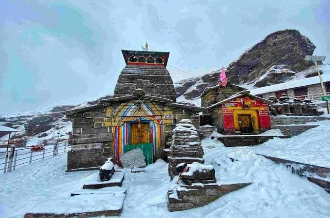
The Kedarnath Jyotirlinga
The Kedarnath lingam is unique among the twelve Jyotirlingas. It is a triangular-shaped, self-manifested (Swayambhu) lingam that is believed to have been naturally formed by earth, air, water, and fire. Unlike other Shiva lingams that are usually cylindrical, the Kedarnath lingam is irregular and pyramidal in shape, adding to its mystique.
The Mystery of the 400 Years Under Snow
One of the most fascinating historical mysteries of Kedarnath is that the temple remained buried under snow for nearly 400 years. Scientists from the Wadia Institute of Himalayan Geology in Dehradun conducted studies on the temple walls and discovered yellowish lines indicating prolonged exposure to ice.
Research revealed that a mini ice age occurred between the 13th and 17th centuries, during which large areas of the Himalayas, including the temple region, remained under massive ice sheets. Remarkably, even after this period, the temple remained completely intact without a single crack—a testament to the advanced engineering skills of its builders, who designed the structure to withstand even the most extreme climatic conditions.
Adi Shankaracharya and the Kedarnath Temple
While the original Kedarnath temple is attributed to the Pandavas, the current structure was revived and restored by the great philosopher-saint Adi Shankaracharya in the 8th century CE. Shankaracharya travelled from his birthplace in Kerala to Kedarnath, and along the way established several mathas, temples, and pilgrimage centres. He is believed to have spent a significant part of his life in Kedarnath and also took his last breath here. His samadhi (shrine) is located behind the main temple.
Kedarnath and Pashupatinath: The Complete Lingam
According to tradition, the Kedarnath Temple in Uttarakhand is considered an Ardha Jyotirlinga (half Jyotirlinga). When combined with the Pashupatinath Temple in Nepal, where Shiva’s head is worshipped, it forms the complete Shivalinga . This connection highlights the ancient spiritual bond between the two sacred sites.
Geography: The Lay of the Sacred Land
The Kedar Valley is not a single valley but a complex landscape spanning the districts of Rudraprayag and Uttarkashi. It comprises several interconnected valleys, rivers, and mountain ranges.
The Kedar Ganga Valley
The Kedar Ganga Valley lies immediately south of Gangotri, as part of the extended Gangotri complex. It covers approximately 144 square kilometres and is rimmed by a series of breathtaking mountains of exceptional difficulty and grandeur.
The valley is bounded by:
- North & Northeast: The Bhagirathi River
- West & East: Rudurgaira Bamak and Meru peaks
- South: Khatling and Phating glaciers
- Far East: Gangotri glacier
At the head of the valley, occupying almost the complete valley floor, is the mighty Kedar Bamak glacier, covering approximately 10×15 km. The meltwater from this glacier gives birth to the Kedar Ganga River and feeds the sacred Kedar Tal.
Key Geographic Features
| Feature | Details |
|---|---|
| Kedar Ganga River | A fast-flowing tributary that joins the Bhagirathi at Gangotri |
| Kedar Bamak | A massive glacier at the head of the valley (10×15 km) |
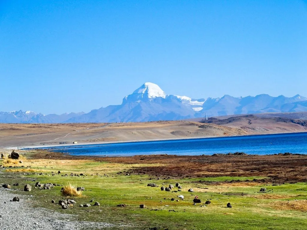
| Kedar Tal | A glacial lake at 4,752 m, also known as “Shiva’s Lake” |
| Prominent Peaks | Thalay Sagar (6,904 m), Bhrigupanth (6,772 m), Jogin I & II (6,465 m) |
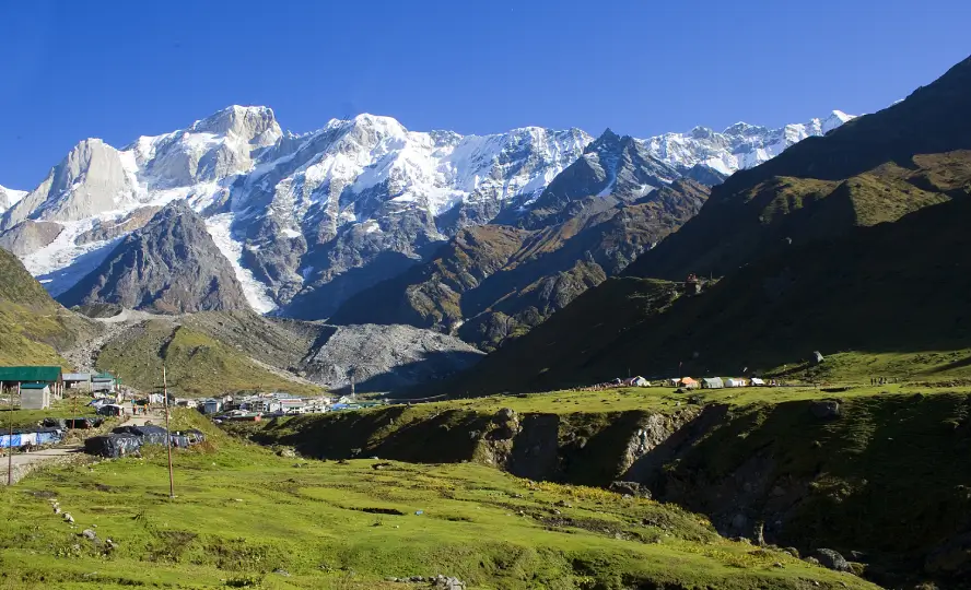
The Kedarnath Temple Area
Kedarnath town is situated at an altitude of 3,583 meters (11,755 feet) on the edge of a mountain slope in the remote northern region of the Garhwal Himalayas. The Kedarnath ranges drain into the Mandakini River, which originates from the steady terminus of the Chorabari glacier and flows through the scenic Mandakini Valley.
Near the temple, there are four sacred ponds: Retah, Udak, Rudra, and Rishi. The temple is surrounded by three major peaks: Kedar (22,000 ft), Kharsakund (21,600 ft), and Bhartakund (22,700 ft).
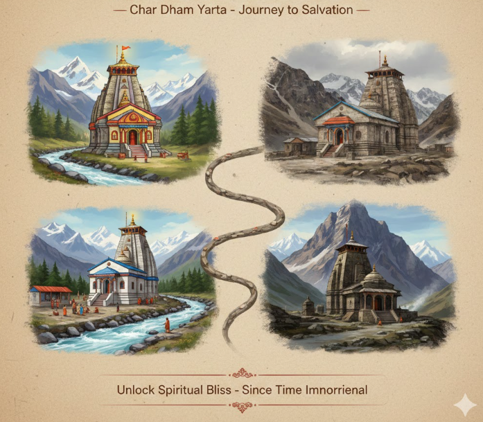
Panch Kedar: The Five Temples of Shiva
The Panch Kedar circuit is the spiritual backbone of the Kedar Valley. These five temples, located across the Garhwal Himalayas, are considered the most sacred Shaivite shrines in the region.
Overview of Panch Kedar Temples
| Temple | Body Part of Shiva | Altitude | Trek Distance | Best Time |
|---|---|---|---|---|
| Kedarnath | Hump | 3,583 m | 16 km from Gaurikund | May–Oct |
| Tungnath | Arms | 3,680 m | 3.5 km from Chopta | May–Oct |
| Rudranath | Face | 3,600 m | 20 km from Sagar | May–Oct |
| Madhyamaheshwar | Navel | 3,497 m | 16 km from Ransi | May–Oct |
| Kalpeshwar | Hair | 2,200 m | 2 km from Helang | Year-round |
Kedarnath – The Main Temple
Kedarnath is the most prominent among the Panch Kedar temples and is also part of the Chota Char Dham pilgrimage circuit. It houses one of the 12 Jyotirlingas of India, known as Kedareswar Jyotirlinga.
Key Facts:
| Aspect | Details |
|---|---|
| Altitude | 3,583 m (11,755 ft) |
| Deity | Lord Shiva (triangular Swayambhu lingam) |
| Trek Distance | 16 km from Gaurikund |
| Trek Duration | 6–8 hours |
| Difficulty | Moderate to Difficult |
| Temple Timings | 4:00 AM – 9:00 PM (during yatra season) |
Architecture: The temple is built from huge, brown-cut stones, interlocked without mortar. It stands on a six-foot platform, measuring 85 feet high, 187 feet long, and 80 feet wide, with walls 12 feet thick.
Winter Closure: The temple closes on Bhai Dooj (October/November) and reopens on Akshaya Tritiya (April/May). During winter, the deity is moved to Omkareshwar Temple in Ukhimath.
Tungnath – The Highest Shiva Temple
Tungnath is the highest Shiva temple in the world, located at an altitude of 3,680 meters. The temple has an impressive backdrop of the peaks of Panchachuli, Nanda Devi, Dunagiri, Kedarnath, and Bandar Poonch.
Trek: 3.5 km from Chopta (2–3 hours)
Best Time: May–October
Rudranath – The Natural Rock Shrine
Rudranath is unique among the Panch Kedar as it is a natural rock shrine in a cave, rather than a constructed temple. The temple is located at 3,600 meters and is considered the most challenging to reach.
Trek: 20 km from Sagar village (7–9 hours)
Best Time: May–October
Madhyamaheshwar – The Temple in the Meadows
Madhyamaheshwar is located at 3,497 meters, set against a backdrop of snow-covered peaks and alpine meadows. The temple architecture is similar to Kedarnath.
Trek: 16 km from Ransi village (5–7 hours)
Best Time: May–October
Kalpeshwar – The Only Year-Round Temple
Kalpeshwar is the only Panch Kedar temple that remains accessible throughout the year. Located at 2,200 meters in the picturesque Urgam Valley, the temple is reached via a short 2 km trek.
Best Time: Year-round
Flora and Fauna: A Biodiversity Hotspot
The Kedar Valley lies within the Kedarnath Wildlife Sanctuary (also known as the Kedarnath Musk Deer Sanctuary), one of the largest protected areas in the Western Himalayas. The sanctuary spans an altitudinal range of approximately 1,100 to 7,068 meters, resulting in a rich diversity of flora and fauna.
Forests and Vegetation
The sanctuary harbours a diverse array of vegetation types typical of the Western Himalaya :
| Elevation Zone | Vegetation Type | Characteristics |
|---|---|---|
| Lower Forests (1,500–2,500 m) | Oak, Pine, Deodar | Dense forests, rich birdlife |
| Mid-Altitude (2,500–3,500 m) | Rhododendron, Birch, Coniferous | Grasses, wildflowers, and medicinal herbs |
| High-Altitude (3,500–4,500 m) | Alpine meadows, Juniper | Grasses, wildflowers, medicinal herbs |
Plant Diversity: The sanctuary is home to over 1,100 plant species, with a field guide documenting more than 575 species with photographs.
Wildlife
The sanctuary is home to a variety of Himalayan wildlife:
| Species | Scientific Name | Status | Habitat |
|---|---|---|---|
| Musk Deer | Moschus chrysogaster | Endangered | Alpine meadows |
| Himalayan Black Bear | Ursus thibetanus | Vulnerable | Forested areas |
| Himalayan Tahr | Hemitragus jemlahicus | Near Threatened | Rocky slopes |
| Snow Leopard | Uncia uncia | Endangered | High alpine zones (rare) |
| Bharal (Blue Sheep) | Pseudois nayaur | Schedule I | Alpine meadows |
| Himalayan Monal | Lophophorus impejanus | State bird of Uttarakhand | Forests, meadows |
Bird Diversity
The sanctuary is home to a rich diversity of birds, including several globally threatened pheasant species:
- Himalayan Monal – State bird of Uttarakhand, known for its vibrant plumage
- Satyr Tragopan – Globally threatened
- Koklass Pheasant – Resident breeder
- Cheer Pheasant – Globally threatened
- Kaleej Pheasant – Resident
A total of 185 bird species have been recorded in the region.
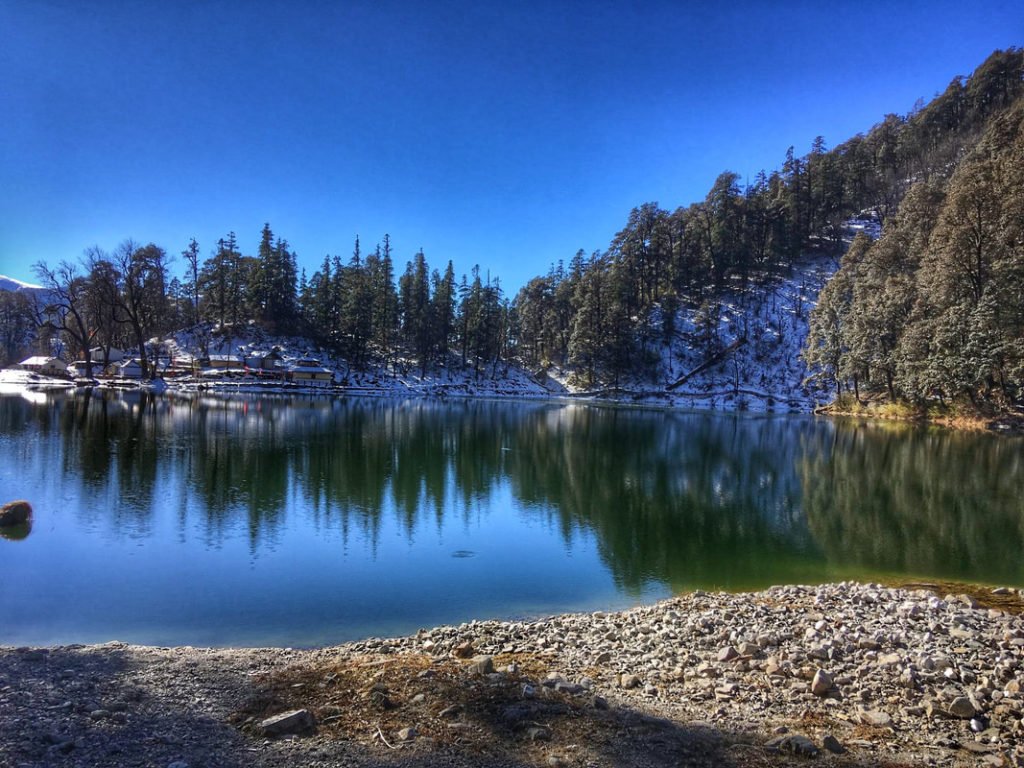
Kedar Tal – A High-Altitude Wetland
Kedar Tal (also known as Shiva’s Lake) is a glacial lake located in the upper Kedar Ganga valley, approximately 17 km south of Gangotri, at an altitude of 4,752 meters. The lake is approximately 1,200 x 300 meters in size and is one of the main feeders to the Kedar Ganga River.
On clear days, especially during the pre-monsoon period, the near-placid waters of the lake reflect the peaks of Thalay Sagar and Bhrigupanth, creating a truly sublime sight.
How to Reach Kedar Valley
The Kedar Valley is accessible via multiple routes, depending on which part of the valley you wish to visit.
By Air
Nearest Airport: Jolly Grant Airport, Dehradun
| Details | Information |
|---|---|
| Distance to Kedarnath | ~250 km |
| Travel Time | 8–10 hours by taxi to Gaurikund |
| Airlines | Regular flights from Delhi to Dehradun (approx. 1 hour) |
| Onward Travel | Taxis available from the airport to Gaurikund via Rishikesh and Rudraprayag |
By Train
Nearest Railway Stations:
| Station | Distance to Kedarnath | Travel Time | Connectivity |
|---|---|---|---|
| Rishikesh | ~240 km | 7–8 hours by road | Most preferred |
| Haridwar | ~250 km | 8–9 hours by road | Major station, well-connected |
Popular Trains from Delhi to Haridwar/Rishikesh:
| Train Name | From Delhi | Departure | Arrival | Destination |
|---|---|---|---|---|
| Shatabdi Express | Delhi | 6:00 AM | 11:40 AM | Haridwar |
| Jan Shatabdi | Delhi | 3:20 PM | 9:00 PM | Haridwar |
| Mussoorie Express | Delhi | 10:05 PM | 5:30 AM | Haridwar |
From the railway station, taxis and buses are available for Gaurikund via Rudraprayag and Guptkashi.
By Road to Kedarnath Base (Gaurikund)
| Starting Point | Distance | Travel Time | Route |
|---|---|---|---|
| Delhi | ~450 km | 12–14 hours | Delhi → Haridwar → Rishikesh → Devprayag → Srinagar → Rudraprayag → Guptkashi → Sonprayag → Gaurikund |
| Rishikesh | ~240 km | 7–8 hours | Rishikesh → Devprayag → Srinagar → Rudraprayag → Guptkashi → Sonprayag → Gaurikund |
| Haridwar | ~250 km | 8–9 hours | Haridwar → Rishikesh → Devprayag → Srinagar → Rudraprayag → Guptkashi → Sonprayag → Gaurikund |
Important Notes:
- Private vehicles are allowed only up to Sonprayag
- From Sonprayag, take a shared jeep (₹50–100) to Gaurikund (6 km)
- Alternatively, you can walk from Sonprayag to Gaurikund
The Kedarnath Trek (Gaurikund to Kedarnath)
The trek from Gaurikund to Kedarnath is the traditional route to the temple :
| Segment | Distance | Trek Time | Terrain |
|---|---|---|---|
| Gaurikund → Jungle Chatti | 4 km | 1.5–2 hours | Gradual incline |
| Jungle Chatti → Bheembali | 3 km | 1.5–2 hours | Relatively easy |
| Bheembali → Linchauli | 4 km | 2–2.5 hours | Steep climb begins |
| Linchauli → Kedarnath Base Camp | 4 km | 2 hours | Paved path |
| Base Camp → Kedarnath Temple | 1 km | 30–45 minutes | Final ascent |
| Total | 16 km | 6–8 hours | Moderate to Difficult |
Alternative Transport Options
| Option | Cost (approx.) | Notes |
|---|---|---|
| Pony/Mule | ₹2,500–4,000 one way | Available at Gaurikund, book at official counters |
| Palki/Doli | ₹5,000–8,000 one way | Ideal for senior citizens |
| Helicopter | ₹6,000–12,000 one way | From Phata, Guptkashi, or Sersi helipads |
Distances from Major Cities
| City | Distance (km) |
|---|---|
| Delhi | ~450 |
| Haridwar | ~250 |
| Rishikesh | ~240 |
| Dehradun | ~250 |
| Rudraprayag | ~75 |
| Guptkashi | ~35 |
| Sonprayag | ~30 |
| Gaurikund | 0 (trek start) |
| Kedarnath | 16 km (trek) |
Weather and Best Time to Visit
Climate Overview
The Kedar Valley experiences a high-altitude alpine climate. The region is accessible only during specific months due to heavy snowfall in winter.
Month-by-Month Guide
| Month | Day Temp (°C) | Night Temp (°C) | Conditions | Trek Suitability |
|---|---|---|---|---|
| April | 8–15 | -2–5 | Snow melting, trails opening | ⭐ Good |
| May | 10–18 | 0–6 | Pleasant, clear skies | ⭐ Best |
| June | 12–20 | 2–8 | Warm, ideal for trekking | ⭐ Best |
| July | 10–16 | 5–10 | Monsoon, heavy rain | ❌ Avoid |
| August | 10–16 | 5–10 | Monsoon, landslides | ❌ Avoid |
| September | 8–15 | 0–5 | Post-monsoon, clear | ⭐ Best |
| October | 5–12 | -5–0 | Crisp, clear, valley closes mid-Oct | ⭐ Good |
| November–March | -5–10 | -15–-5 | Heavy snow, temple closed | ❌ Closed |
Best Time to Visit by Season
| Season | Months | Suitability | Conditions | Best For |
|---|---|---|---|---|
| Summer | May–June | ⭐ Best | 10°C–20°C, clear skies, pleasant days | Trekking, temple darshan, photography |
| Autumn | September–October | ⭐ Excellent | 5°C–15°C, crystal-clear skies, crisp air | Clear mountain views, photography |
| Monsoon | July–August | ❌ Avoid | 10°C–16°C, heavy rainfall, landslides | Not recommended |
| Winter | November–April | ❌ Closed | Below freezing, heavy snow | Temple closed, region inaccessible |
Why Avoid Monsoon
The monsoon months (July–August) are not recommended for the Kedarnath trek due to:
- Heavy rainfall is making trails slippery and dangerous
- High risk of landslides and road blockages
- Overflowing streams and river crossings
- Possibility of cloudbursts and flooding
Winter in Kedar Valley
During winter (November–April), the Kedarnath temple is closed, and the entire region is covered in a thick blanket of snow. The deity is moved to Omkareshwar Temple in Ukhimath for the winter months. The temperature can drop to -15°C or even lower.
Trekking Routes in Kedar Valley
The Kedar Valley offers several trekking routes, from the popular Kedarnath trek to the challenging Panch Kedar circuit.
1. Kedarnath Trek (Gaurikund to Kedarnath)
| Aspect | Details |
|---|---|
| Distance | 16 km (one way) |
| Duration | 6–8 hours |
| Difficulty | Moderate to Difficult |
| Start Point | Gaurikund |
| End Point | Kedarnath Temple |
| Best Time | May–June & September–October |
What to Expect:
- The trek follows the Mandakini River
- The trail is well-laid and clearly marked
- Several rest stops and tea stalls along the way
- Railing is provided on some stretches for senior citizens
- Stunning views of snow-capped peaks and the Chorabari Glacier
2. Panch Kedar Trek
The Panch Kedar Trek covers all five Shiva temples in the Kedar Valley circuit.
| Aspect | Details |
|---|---|
| Total Distance | 120 km |
| Duration | 15–18 days |
| Difficulty | Moderate to Difficult |
| Starting Point | Kalpeshwar / Helang |
| Ending Point | Kedarnath |
Route Sequence (Traditional):
Kalpeshwar → Rudranath → Tungnath → Madhyamaheshwar → Kedarnath
Estimated Costs:
| Package Type | Price Range (approx.) |
|---|---|
| Budget | ₹25,000 – 35,000 |
| Standard | ₹40,000 – 55,000 |
| Premium | ₹60,000 – 80,000 |
3. Kedar Tal Trek
The Kedar Tal trek takes you to the glacial lake known as “Shiva’s Lake”.
| Aspect | Details |
|---|---|
| Distance | 17 km from Gangotri (one way) |
| Altitude | 4,752 m |
| Duration | 2–3 days (one way) |
| Difficulty | Moderate to Challenging |
Route: Gangotri → Bhoj Kharak (8 km) → Kedar Kharak → Kedar Tal
Trekking Tips
- Acclimatise: Spend a day at lower altitudes (Guptkashi or Sonprayag) before trekking
- Start Early: Begin your trek by 5:00–6:00 AM to complete before afternoon weather changes
- Stay Hydrated: Drink water at regular intervals to prevent altitude sickness
- Take Breaks: Don’t over-exert yourself; rest when needed
- Carry Essentials: Rain gear, warm layers, torch, snacks, and water
- Don’t Litter: Maintain the cleanliness of the sacred landscape
Accommodation Options
In Kedarnath
| Accommodation Type | Price Range (per night) | Features |
|---|---|---|
| GMVN Guest Houses | ₹1,500 – ₹3,000 | Well-maintained, neat and clean, recommended |
| Tented Camps | ₹1,500 – ₹3,000 | Pre-fabricated tents, warm bedding, near helipad |
| Dharamshalas | ₹500 – ₹1,500 | Simple, spiritual atmosphere |
| Private Guesthouses | ₹2,000 – ₹4,000 | Basic amenities |
Note: More than 5,000 pilgrims can stay at a time in the tented accommodations near the Kedarnath helipad.
In Gaurikund/Sonprayag
| Location | Features |
|---|---|
| Gaurikund | Basic hotels, sub-par conditions (only open during yatra season) |
| Sonprayag | Good staying options with basic facilities |
In Guptkashi
| Category | Price Range | Features |
|---|---|---|
| Mid-Range Hotels | ₹2,000 – ₹4,000 | Comfortable rooms, hot water, good food |
| Budget Guesthouses | ₹800 – ₹2,000 | Basic amenities |
Booking Tips
- Book well in advance for peak seasons (May–June, September–October)
- GMVN properties offer the most reliable stays
- Carry warm clothing even in summer (nights are cold at high altitude)
Packing List for Kedar Valley
Clothing
| Layer | Items | Quantity |
|---|---|---|
| Base Layer | Thermal innerwear (top & bottom) | 2 sets |
| Mid Layer | Fleece jacket, woolen sweater | 1–2 each |
| Outer Layer | Down jacket, waterproof windcheater | 1 each |
| Bottoms | Trekking pants (quick-dry) | 2 pairs |
| Head | Fleece jacket, woollen sweater | 1 each |
| Hands | Waterproof gloves | 2 pairs |
| Feet | Woolen socks | 4–5 pairs |
Footwear
- Trekking shoes: Sturdy, waterproof, high ankle support, broken-in
- Camp shoes: Sandals or floaters for evening
Gear and Accessories
| Category | Items |
|---|---|
| Backpack | 2-litre capacity |
| Trekking Poles | Highly recommended for steep sections |
| Headlamp/Torch | With extra batteries |
| Water Bottles | 2 liters capacity |
| Sunglasses | UV protection |
| Rain Protection | Poncho or raincoat |
Health and Hygiene
| Category | Items |
|---|---|
| First Aid | Wet wipes, hand sanitiser, toilet paper |
| Medications | Personal prescription medicines, Diamox (consult doctor) |
| Hygiene | Wet wipes, hand sanitizer, toilet paper |
| Sun Protection | Sunscreen (SPF 50+), lip balm |
Documents and Other Essentials
- Valid ID proof (Aadhaar/Passport)
- Yatra registration (mandatory)
- Travel insurance
- Cash (ATMs are limited)
- Power bank
- Camera with extra batteries
- Energy bars, glucose packs, ORS solution
Travel Tips and Important Information
Before You Go
- Medical Check-up: Get a complete medical check-up before undertaking the yatra. People with heart conditions, high blood pressure, or respiratory issues should consult their doctor.
- Physical Preparation: Start walking, jogging, or doing yoga 4–6 weeks before the trek to build stamina.
- Yatra Registration: Complete mandatory registration through the official Uttarakhand tourism portal.
- Check Weather: Avoid monsoon (July–August); the temple closes in winter.
- Carry Cash: ATMs are limited in the higher reaches; carry sufficient cash.
During the Yatra
- Acclimatise: Spend a day at Guptkashi or Sonprayag before trekking.
- Stay Hydrated: Drink water at regular intervals to prevent altitude sickness.
- Dress in Layers: Temperatures can change rapidly; layers allow adjustment.
- Start Early: Begin the trek by 5:00–6:00 AM to avoid afternoon weather changes.
- Listen to Your Body: If you feel dizzy or breathless, stop and rest. Don’t push beyond your limits.
- Do Not Smoke or Consume Alcohol: While trekking or at high altitude.
Health and Safety
- Altitude Sickness: Symptoms include headache, nausea, and breathlessness. If symptoms worsen, descend immediately.
- Hyperbaric Chambers: Available at Lincholi and Base Camp for emergency use.
- Medical Facilities: Basic medical counters are available along the trek route and at Kedarnath.
Facilities Available on the Trek
- Small shops, dhabas, and tea stalls serving basic food (maggi, chowmein, tea)
- Tented accommodations at various points for overnight halts
- Medical counters with basic facilities
- Railing on some stretches for senior citizens
Frequently Asked Questions (FAQs)
Q1: What is Kedar Valley?
A: Kedar Valley (also known as Kedar Ghati) is a sacred landscape in the Garhwal Himalayas, home to the Kedarnath Temple (one of the 12 Jyotirlingas) and the four other Panch Kedar temples. It is considered the earthly abode of Lord Shiva.
Q2: What is the best time to visit Kedar Valley?
A: The best time to visit is May to June (summer) and September to October (autumn). The region remains closed from November to April due to heavy snowfall.
Q3: How far is Kedar Valley from Delhi?
A: The distance from Delhi to Gaurikund (Kedarnath base) is approximately 450 km, with a travel time of 12–14 hours by road.
Q4: How do I reach Kedarnath Temple?
A: By road to Gaurikund (via Haridwar, Rishikesh, Rudraprayag, and Guptkashi), then a 16 km trek (6–8 hours). Alternatively, helicopter services are available from Phata, Guptkashi, or Sersi.
Q5: What is the altitude of Kedarnath Temple?
A: Kedarnath Temple is situated at an altitude of 3,583 meters (11,755 feet) above sea level.
Q6: What is the Panch Kedar?
A: Panch Kedar refers to the five sacred Shiva temples in the Garhwal Himalayas: Kedarnath, Tungnath, Rudranath, Madhyamaheshwar, and Kalpeshwar.
Q7: Is the Kedarnath trek difficult?
A: The trek is moderate to difficult. The 16 km trek from Gaurikund takes 6–8 hours, with steep sections after Bheembali. Good physical fitness is recommended.
Q8: Are pony and palanquin services available?
A: Yes, pony and palki services are available at Gaurikund. Ponies cost ₹2,500–4,000, and palkis cost ₹5,000–8,000 one way.
Q9: When does Kedarnath Temple open and close?
A: The temple opens on Akshaya Tritiya (April/May) and closes on Bhai Dooj (October/November). During winter, the deity is moved to Ukhimath.
Q10: What is Kedar Tal?
A: Kedar Tal is a glacial lake at 4,752 meters in the upper Kedar Ganga valley, known as “Shiva’s Lake.” It is located 17 km from Gangotri and is a trekking destination.
Q11: What is the mystery of the Kedarnath temple surviving 400 years under snow?
A: Scientists have discovered that the Kedarnath temple remained buried under snow for nearly 400 years during a mini ice age (13th–17th centuries), yet remained completely intact—a testament to its advanced engineering.
Q12: How many people visit Kedarnath each year?
A: The number of visitors to Kedarnath was 1,652,000 in 2024, a significant increase from 87,629 in 1987.
Q13: Is there a mobile network in Kedar Valley?
A: Mobile connectivity is limited. BSNL works in some pockets. Inform family of your travel plans in advance.
Q14: Can senior citizens visit Kedarnath?
A: Yes, with proper preparation. Helicopter services and palki/pony options are available. However, those with heart conditions or respiratory issues should consult their doctor first.
Q15: What is the Kedarnath temple’s connection to Pashupatinath?
A: According to tradition, Kedarnath is considered an Ardha Jyotirlinga (half Jyotirlinga). When combined with the Pashupatinath Temple in Nepal, it forms the complete Shivalinga.
Plan Your Kedar Valley Journey with Discover Uttarakhand
At Discover Uttarakhand, we’ve been organising unforgettable sacred journeys across Devbhoomi since 1997. As a trusted local operator with deep knowledge of the Kedar Valley and the Garhwal Himalayas, we offer:
- ✅ Customised Kedarnath Yatra packages (3 to 6 days)
- ✅ Panch Kedar Trek packages (15–18 days)
- ✅ Helicopter Yatra arrangements
- ✅ Complete permit assistance (yatra registration)
- ✅ Comfortable transport with experienced hill drivers
- ✅ Verified accommodations in Guptkashi, Sonprayag, and Kedarnath
- ✅ Trekking arrangements with local guides
- ✅ 24/7 customer support throughout your journey
Recommended Kedar Valley Packages
| Package | Duration | Starting Point | Highlights |
|---|---|---|---|
| Kedarnath Yatra (Road) | 3 Nights / 4 Days | Haridwar | Gaurikund trek, Kedarnath darshan |
| Kedarnath by Helicopter | 2 Nights / 3 Days | Dehradun | Direct helicopter to Kedarnath |
| Panch Kedar Trek | 14 Nights / 15 Days | Haridwar | All five temples, complete circuit |
| Kedar Valley & Gangotri | 5 Nights / 6 Days | Haridwar | Kedarnath, Kedar Tal, Gangotri |
Book your Kedar Valley journey today and experience the divine presence of Lord Shiva in the sacred Himalayas.
📞 Call / WhatsApp: +91-9997187178, 9760222178, 8171977178
📍 Visit Our Office: Himalayan Colony, opposite DSVV, Haripur Kalan, Haridwar, Motichur Range, Uttarakhand 249411
🌐 Website: www.discover-uttarakhand.com
📧 Email: info@discover-uttarakhand.com
Om Namah Shivaya! Jai Kedarnath! 🙏
Discover Uttarakhand – Your Local Partner for Sacred Himalayan Journeys Since 1997