Introduction: A Paradise Hidden in the Himalayas
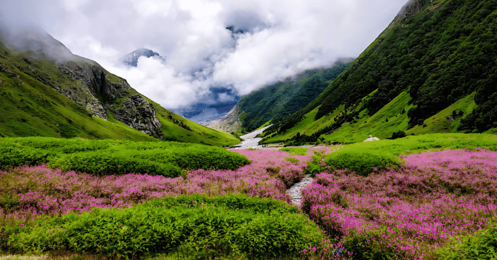
Nestled in the Garhwal Himalayas of Uttarakhand’s Chamoli district, the Valley of Flowers National Park is a breathtaking natural wonder that seems to have sprung from a dream. This UNESCO World Heritage Site, discovered by accident in 1931, has captivated travellers, botanists, and nature lovers from around the globe with its extraordinary display of alpine flowers against a backdrop of snow-capped peaks.
The valley is part of the Nanda Devi Biosphere Reserve, one of the most outstanding protected areas in the Himalayas. It is renowned for its outstanding natural beauty, endangered animals, and endemic alpine flowers. Spread over approximately 87.5 square kilometers, the valley sits at an altitude ranging from 3,200 to 3,600 meters (10,500–11,800 feet).
What makes the Valley of Flowers truly unique is its ever-changing canvas. Over 600 species of flowering plants bloom here in a carefully orchestrated sequence, with the landscape transforming from blue primulas in May to purple-red geraniums in June, and finally to a riot of colours during the peak monsoon months. The valley is also home to rare and endangered wildlife, including the snow leopard, Asiatic black bear, and musk deer.
Whether you are a trekker seeking high-altitude adventure, a botanist wanting to study rare alpine flora, a photographer chasing the perfect shot of Brahma Kamal, or a pilgrim combining this journey with Hemkund Sahib, the Valley of Flowers promises an experience that lingers in memory long after the trek ends.
Key Information at a Glance:
| Aspect | Details |
|---|---|
| Location | Chamoli district, Uttarakhand |
| Altitude | 3,200–3,600 m (10,500–11,800 ft) |
| Area | 87.5 sq km (notified area) |
| UNESCO Status | World Heritage Site (2005) |
| Part of | Nanda Devi Biosphere Reserve |
| Famous For | 600+ alpine flower species, Himalayan wildlife |
| Trek Distance | ~38 km round trip from Govindghat |
| Trek Duration | 4–6 days |
| Difficulty | Easy to Moderate |
| Nearest Airport | Jolly Grant Airport, Dehradun (~285 km) |
| Nearest Railway Station | Rishikesh (~270 km) |
| Base Camp | Ghangaria (3,050 m) |
| Entry Fee (Indian) | ₹150 for 3 days + ₹50/additional day |
| Entry Fee (Foreigner) | ₹600 for 3 days + ₹250/additional day |
| Best Time to Visit | Mid-July to Mid-August |
History: The Accidental Discovery and UNESCO Recognition
The 1931 Discovery by Frank Smythe
The Valley of Flowers was discovered quite by accident. In 1931, a team of British mountaineers—Frank S. Smythe, R.L. Holding, and Eric Shipton—was returning from a successful expedition to Mount Kamet, the second-highest mountain in the Garhwal region. Lost in the dense forests, they stumbled upon a valley carpeted with vibrant, exotic flowers.
Smythe was so enchanted by the valley that he returned in 1937 specifically to collect seeds and conduct research. He later authored a book titled “The Valley of Flowers,” which brought this hidden paradise to the world’s attention.
National Park Status and UNESCO Recognition
| Year | Milestone |
|---|---|
| 1982 | Declared a National Park to protect its fragile ecosystem |
| 2005 | Designated a UNESCO World Heritage Site for its outstanding universal value |
| Part of | Nanda Devi Biosphere Reserve (core zone) |
The UNESCO designation was granted due to the valley’s exceptional biodiversity, its role in conserving rare and endangered species, and its stunning natural beauty. The valley is a transition zone between the Zanskar and Himalayan ranges, as well as between the Eastern and Western Himalayas, resulting in a unique convergence of flora from different regions.
The Mythological Connection: Ramayana Legend
Beyond its natural history, the Valley of Flowers holds deep spiritual significance. According to local folklore and Hindu mythology, this is the place where Lord Hanuman came in search of the Sanjeevani Booti (life-saving herb) to revive Lord Lakshmana during the epic Ramayana war.
This mythological connection has given the valley a sacred dimension, and many locals regard it as a blessed space. The belief in the healing powers of the valley’s flora continues to this day, with some visitors coming not only to witness its beauty but also to experience its mystical energy.
Geography: The Lay of the Sacred Land
Location and Setting
The Valley of Flowers is situated in the Chamoli district of Uttarakhand, in the Garhwal region of the Himalayas. It lies close to the Indo-China border and is nestled within the larger Nanda Devi Biosphere Reserve.
The valley is bounded by snow-capped peaks from all sides, with the Pushpawati River flowing through its centre, dividing it into two sections. Numerous streams cascade down the surrounding slopes, irrigating the valley before merging with the Pushpawati.
Altitude Profile
| Location | Altitude |
|---|---|
| Govindghat | ~1,800 m (5,900 ft) |
| Pulna | ~2,000 m (6,560 ft) |
| Ghangaria (Base Camp) | 3,050 m (10,000 ft) |
| Valley of Flowers | 3,200–3,600 m (10,500–11,800 ft) |
| Hemkund Sahib | 4,329 m (14,200 ft) |
Adjacent Protected Areas
The Valley of Flowers is one of two core zones of the Nanda Devi Biosphere Reserve, along with the Nanda Devi National Park. Together, these protected areas form a UNESCO World Heritage Site covering a vast expanse of the Western Himalayas.
Flora: A Botanical Wonderland
Overview of Floral Diversity
The Valley of Flowers is home to over 600 species of flowering plants, making it one of the richest botanical regions in the world. The valley’s flora changes with the seasons, with different flowers taking centre stage throughout the summer and monsoon months.
The Changing Canvas
| Time of Year | Dominant Flowers |
|---|---|
| May–June | Blue Primulas (carpet the valley) |
| June–July | Purple-red Geraniums |
| Mid-July to Mid-August | Peak bloom: Brahma Kamal, Blue Poppy, Cobra Lily, Primulas, Marigolds, Anemones, Daisies |
| September–October | Late bloomers, lush greenery |
Iconic Flowers of the Valley
Medicinal Plants
The valley is also rich in plants with tremendous medicinal value, including:
- Saussurea Abvallata (Brahma Kamal) – Used in traditional medicine
- Aconite – Potent medicinal properties
- Delphinium, Ranunculus, Corydalis, Inula, Campanula, Pedicularis, Dactylorhiza – Various therapeutic uses
Sub-alpine Forests
Parts of the park are covered with sub-alpine birch forests and rhododendrons, which provide habitat for the valley’s diverse wildlife.
Fauna: The Hidden Inhabitants
Mammals
The Valley of Flowers is not just a paradise for plant lovers; it also serves as a sanctuary for several rare and endangered animals.
Birds
The valley is a haven for birdwatchers, with several notable high-altitude species:
| Species | Description |
|---|---|
| Himalayan Monal | State bird of Uttarakhand, iridescent plumage, most striking high-altitude bird |
| Snow Partridge | Found in alpine zones |
| Bearded Vulture | Also known as Lammergeier |
Butterflies and Insects
The valley is also rich in insect life, with many species of butterflies adding to the vibrant colours of the meadows.
How to Reach the Valley of Flowers
Reaching the Valley of Flowers is a multi-stage journey, as the park is not directly accessible by road and requires a significant trek.
By Air
Nearest Airport: Jolly Grant Airport, Dehradun (approximately 285 km from Govindghat)
From the airport, you can hire a taxi or take a shared cab to Joshimath via Rishikesh and Chamoli, and then proceed to Govindghat.
By Train
Nearest Railway Stations:
| Station | Distance to Govindghat | Travel Time | Connectivity |
|---|---|---|---|
| Rishikesh | ~270 km | 10–11 hours by road | Most preferred |
| Haridwar | ~285 km | 10–11 hours by road | Major station, well-connected |
Popular Trains from Delhi to Haridwar/Rishikesh:
| Train Name | From Delhi | Departure | Arrival | Destination |
|---|---|---|---|---|
| Shatabdi Express | Delhi | 6:00 AM | 11:40 AM | Haridwar |
| Jan Shatabdi | Delhi | 3:20 PM | 9:00 PM | Haridwar |
| Mussoorie Express | Delhi | 10:05 PM | 5:30 AM | Haridwar |
From the railway station, you’ll need to drive or take a bus to reach Govindghat, the starting point of the trek.
By Road
Route from Rishikesh to Govindghat:
Rishikesh → Devprayag → Srinagar → Rudraprayag → Karnaprayag → Gopeshwar → Pipalkoti → Joshimath → Govindghat
| Starting Point | Distance to Govindghat | Travel Time |
|---|---|---|
| Rishikesh | ~270 km | 10–11 hours |
| Haridwar | ~285 km | 10–11 hours |
| Dehradun | ~285 km | 10–11 hours |
| Delhi | ~550 km | 14–16 hours |
Road Conditions: The route is scenic but winding. Regular buses, private taxis, and shared jeeps are available from Haridwar, Rishikesh, and Dehradun to Joshimath and further to Govindghat.
Distances from Major Cities
| City | Distance (km) |
|---|---|
| Delhi | ~550 |
| Dehradun | ~285 |
| Rishikesh | ~270 |
| Haridwar | ~285 |
| Joshimath | ~42 |
| Auli | ~48 |
| Nainital | ~231 |
Valley of Flowers Trek: Complete Guide
Trek Overview
| Aspect | Details |
|---|---|
| Total Trek Distance | ~38 km round trip |
| Trek Duration | 4–6 days |
| Difficulty | Easy to Moderate |
| Suitable for | Beginners with basic fitness |
| Maximum Altitude | 3,600 m (11,800 ft) |
Getting to the Trek Starting Point
Step 1: Reach Govindghat
Govindghat is the last motorable point and the gateway to the trek. It is located at the confluence of the Alaknanda and Lakshman Ganga rivers .
Step 2: Govindghat to Pulna (4 km drive)
From Govindghat, you can take a shared jeep or taxi to Pulna village, which shortens the trek by 6 km.
Step 3: Pulna to Ghangaria (10 km trek)
The actual trek begins at Pulna. The trail follows the Pushpawati River through waterfalls, bridges, and lush forest terrain.
Step 4: Ghangaria to Valley of Flowers (4 km trek)
From Ghangaria, the valley is a 4 km trek (one way) along a well-defined but steadily ascending trail.
Day-by-Day Trek Itinerary (5 Days)
Day 1: Rishikesh/Haridwar to Govindghat (Drive)
| Aspect | Details |
|---|---|
| Distance | 270–285 km |
| Duration | 10–11 hours |
| Overnight | Govindghat |
Highlights:
- Scenic drive through the Garhwal Himalayas
- Confluence views at Devprayag, Rudraprayag, and Karnaprayag
- Arrive at Govindghat, rest and prepare for the trek
Day 2: Govindghat to Ghangaria (Drive + Trek)
| Aspect | Details |
|---|---|
| Drive to Pulna | 4 km (shared jeep) |
| Trek Distance | 10 km (Pulna to Ghangaria) |
| Trek Duration | 6–7 hours |
| Altitude | ~1,800 m → 3,050 m |
| Overnight | Ghangaria |
Highlights:
- Gradual ascent through forests
- Views of the Pushpawati River and waterfalls
- Arrive at Ghangaria, the base camp
- Note: Aim to reach Ghangaria before sunset (6:30 PM) as the terrain is rocky and steep
Day 3: Ghangaria to Valley of Flowers and Return
| Aspect | Details |
|---|---|
| Trek Distance | 8 km round trip (4 km each way) |
| Trek Duration | 4–5 hours |
| Altitude | 3,050 m → 3,600 m |
| Overnight | Ghangaria |
Highlights:
- The highlight of the entire trek
- Enter the UNESCO World Heritage Site
- Carpet of hundreds of alpine blooms
- The Pushpawati River flows through the valley
- Waterfalls cascading from surrounding peaks
- Return to Ghangaria by evening
Important: No overnight stay is allowed inside the park. All visitors must exit by 5:00 PM.
Day 4: Optional – Trek to Hemkund Sahib
| Aspect | Details |
|---|---|
| Trek Distance | 12 km round trip |
| Trek Duration | 3–4 hours each way |
| Altitude | 3,050 m → 4,329 m |
| Overnight | Ghangaria |
Highlights:
- One of the highest Gurudwaras in the world
- Glacial Hemkund Lake beside the Gurudwara
- Surrounded by seven snow-clad peaks
- Temple dedicated to Lakshman (brother of Lord Rama)
Note: This trek is steep and challenging. Start very early (by 5:00 AM) to avoid afternoon weather changes.
Day 5: Ghangaria to Govindghat to Rishikesh
| Aspect | Details |
|---|---|
| Trek Distance | 10 km (Ghangaria to Pulna) |
| Drive | Pulna to Govindghat (4 km), then to Rishikesh |
| Duration | Full day |
Highlights:
- Downhill return trek
- Last views of the Himalayan landscape
- Depart for home with unforgettable memories
Entry Timings and Restrictions
| Aspect | Details |
|---|---|
| Entry Timings | 7:00 AM – 2:00 PM |
| Exit Deadline | Must exit by 5:00 PM |
| Overnight Stay | Not allowed inside the park |
| Ponies | Not allowed beyond Ghangaria into the valley |
Permits and Fees (2026)
| Visitor Type | Entry Fee | Additional Day Fee |
|---|---|---|
| Indian Citizens | ₹150 (for 3 days) | ₹50 per additional day |
| Foreign Nationals | ₹600 (for 3 days) | ₹250 per additional day |
| Videography (Indian) | ₹500 | – |
| Videography (Foreigner) | ₹1,500 | – |
Photo ID required at forest check posts
Trek Difficulty and Preparation
Ghangaria: The Base Camp Village
Ghangaria (also known as Gobind Dham) is a small village located at an altitude of approximately 3,050 meters (10,000 feet). It serves as the last human settlement before the Valley of Flowers National Park and the Hemkund Sahib treks.
Facilities in Ghangaria
Key Features
- Situated at the confluence of the Pushpawati and Laxman Ganga rivers
- Becomes lively with visitors from June through October
- Serves as the starting point for both the Valley of Flowers (4 km) and Hemkund Sahib (6 km) treks
- High enough to help with acclimatisation
Nearby Places to Visit
1. Hemkund Sahib
One of the most iconic high-altitude pilgrimage sites in India, Hemkund Sahib is located at an altitude of 4,329 meters (14,200 feet) .
| Aspect | Details |
|---|---|
| Distance from Ghangaria | 6 km (one way) |
| Trek Duration | 3–4 hours each way |
| Difficulty | Steep, challenging |
| Highlights | Star-shaped Gurudwara, glacial Hemkund Lake, seven snow-clad peaks, Lakshman Temple |
The trek is very steep, and visitors have the option to either walk or hire mules and porters.
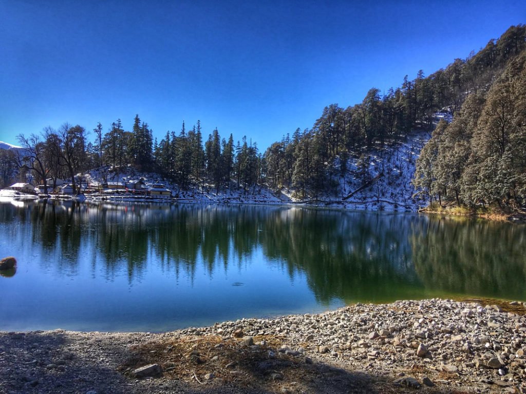
2. Hemkund Lake
Situated beside the Gurudwara, this alpine glacial lake adds beauty by reflecting the sky and surrounding peaks. Many Sikh devotees take a ritualistic dip in its icy waters.
3. Govindghat Gurudwara
Govindghat is where most trekkers begin their journey. The Gurudwara here offers free lodging and meals, easing costs for pilgrims .
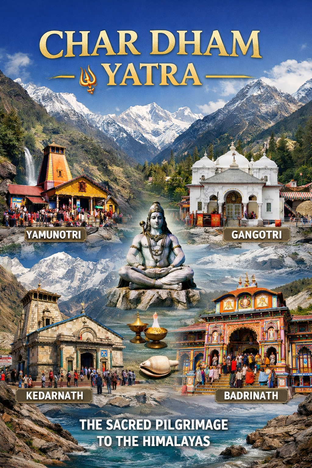
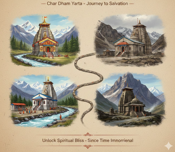
4. Badrinath Temple
Located a few hours’ drive from Joshimath, Badrinath is one of the four Char Dham pilgrimage sites. Dedicated to Lord Vishnu, it is a must-visit for spiritual travellers.
5. Mana Village
Known as “India’s last village” before the Tibetan border, Mana is located near Badrinath. Visitors can explore Vyas Gufa, Bhim Pul, and the sacred Saraswati River.
6. Auli
The skiing capital of India, Auli, offers panoramic views of Nanda Devi. It is a great place to visit before or after the Valley of Flowers trek.
7. Joshimath
The winter seat of Lord Badrinath, Joshimath, is a sacred hub and a convenient stopover on the way to Govindghat.
Weather and Best Time to Visit
Climate Overview
The Valley of Flowers experiences a high-altitude alpine climate. The valley remains covered in snow from November to April and is closed to visitors during this period.
Month-by-Month Guide
| Month | Season | Day Temp (°C) | Night Temp (°C) | Conditions | Trek Suitability |
|---|---|---|---|---|---|
| June | Summer | 15–20 | 5–10 | Trails open, flowers begin to appear | ⭐ Good |
| Mid-July to Mid-August | Monsoon (Peak Bloom) | 15–20 | 7–12 | Valley in full bloom, lush greenery | ⭐ Best |
| Late August to September | Post-Monsoon | 12–18 | 5–10 | Late bloomers, fewer crowds | ⭐ Good |
| October | Autumn | 10–15 | 2–8 | Clear skies, flowers fading | ⭐ Moderate |
| November–May | Winter | -5–10 | -15–-5 | Heavy snow, valley closed | ❌ Closed |
Best Time to Visit
Weather Precautions
- Monsoon means rain, mist, and slippery trails. Carry a raincoat, waterproof shoes, and extra layers.
- Weather can change rapidly—be prepared for sudden rain, cold winds, and sunshine all in one day.
- Daytime temperatures are pleasant (15–20°C), but nights are chilly (7–12°C).
Essential Packing List
Clothing
| Layer | Items | Quantity |
|---|---|---|
| Base Layer | Thermal innerwear (top & bottom) | 2 sets |
| Mid Layer | Fleece jacket, woolen sweater | 1–2 each |
| Outer Layer | Waterproof windcheater, raincoat | 1 each |
| Bottoms | Trekking pants (quick-dry) | 2 pairs |
| Head | Fleece jacket, woollen sweater | 1 each |
| Hands | Waterproof gloves | 1 pair |
| Feet | Woolen socks | 3–4 pairs |
Footwear
- Trekking shoes: Sturdy, waterproof, high ankle support, broken-in
- Camp shoes: Sandals or floaters for evening
Gear and Accessories
| Category | Items |
|---|---|
| Backpack | 2-litre capacity |
| Trekking Poles | Highly recommended for steep sections |
| Headlamp/Torch | With extra batteries |
| Water Bottles | 2 liters capacity |
| Water Purification | Tablets or filter |
| Sunglasses | UV protection |
Health and Hygiene
| Category | Items |
|---|---|
| First Aid | Wet wipes, hand sanitiser, toilet paper |
| Medications | Personal prescription medicines, Diamox (consult doctor) |
| Hygiene | Wet wipes, hand sanitizer, toilet paper |
| Sun Protection | Sunscreen (SPF 50+), lip balm |
Documents and Other Essentials
- Valid ID proof (Aadhaar/Passport)
- Entry permit (obtained at Ghangaria check post)
- Travel insurance
- Cash (no ATMs in Ghangaria)
- Power bank
- Camera with extra batteries
- Energy bars, ORS solution
- Binoculars (for birdwatching and wildlife)
Travel Tips and Important Information
Before You Go
- Medical Check-up: Get a complete medical check-up before the trek. People with bronchial asthma, heart disease, or high blood pressure should consult their doctor.
- Physical Preparation: Start walking, jogging, or doing cardio at least 2 months before the trek.
- Check Weather: The monsoon season (July–August) brings heavy rain. Be prepared for wet and slippery trails.
- Book Accommodation in Advance: Ghangaria fills up quickly during peak bloom season (July–August).
- Carry Cash: No ATMs in Ghangaria. Bring sufficient cash from Rishikesh or Joshimath.
- Permits: Entry permits are available at the Forest Check Post in Ghangaria.
During the Trek
- Acclimatise: Spend a day in Ghangaria before trekking to the valley to adjust to the altitude.
- Stay Hydrated: Drink water at regular intervals to prevent altitude sickness.
- Dress in Layers: Weather can change rapidly; layers allow adjustment.
- Start Early: Begin the trek to the valley by 7:00–8:00 AM to have ample time for exploration before the exit deadline (5:00 PM).
- Carry Food: No food stalls inside the valley; carry lunch and snacks from Ghangaria.
- Don’t Litter: Maintain the pristine beauty of this UNESCO World Heritage Site.
Safety Tips
- Altitude Sickness: Symptoms include headache, nausea, and breathlessness. If symptoms worsen, descend immediately.
- Monsoon Risks: Trails can be slippery; wear good grip shoes and walk carefully.
- Pony Safety: If hiring a mule/pony, ensure it is from a registered vendor.
- Children: Children below 10 years may find the trek very difficult.
Photography Tips
- Best Spots: Within the valley—anywhere! The Pushpawati River, waterfalls, and surrounding peaks
- Best Time: Early morning for soft light; the valley is often misty and magical
- Camera Gear: Carry extra batteries—cold drains them quickly; macro lens for flowers; telephoto lens for wildlife
- Note: Videography requires an additional fee (₹500 for Indians, ₹1,500 for foreigners)
Frequently Asked Questions (FAQs)
Q1: Why is the Valley of Flowers famous?
A: The Valley of Flowers is famous for its extraordinary display of over 600 species of alpine flowers, its UNESCO World Heritage status, and its mythological connection to the Ramayana, where Lord Hanuman is believed to have found the Sanjeevani herb.
Q2: What is the best time to visit the Valley of Flowers?
A: The best time to visit is mid-July to mid-August, when the valley is in full bloom with vibrant flowers.
Q3: How far is the Valley of Flowers from Delhi?
A: The distance from Delhi to Govindghat is approximately 550 km, with a travel time of 14–16 hours by road.
Q4: How do I reach the Valley of Flowers?
A: By road to Govindghat (via Rishikesh and Joshimath), then a 4 km drive to Pulna, followed by a 10 km trek to Ghangaria, and finally a 4 km trek to the valley.
Q5: What is the altitude of the Valley of Flowers?
A: The valley sits at an altitude of approximately 3,200 to 3,600 meters (10,500–11,800 feet).
Q6: Is the Valley of Flowers trek difficult?
A: The trek is considered easy to moderate. It is suitable for beginners with basic physical fitness.
Q7: How long does the Valley of Flowers trek take?
A: The total trek distance is approximately 38 km round trip, typically covered in 4–6 days .
Q8: Can I stay overnight in the Valley of Flowers?
A: No, overnight stays are not allowed inside the national park. Visitors must stay in Ghangaria and return before 5:00 PM.
Q9: What is the entry fee for the Valley of Flowers?
A: For Indian citizens: ₹150 for 3 days, plus ₹50 per additional day. For foreign nationals: ₹600 for 3 days, plus ₹250 per additional day.
Q10: What is the nearest airport to the Valley of Flowers?
A: Jolly Grant Airport, Dehradun, is the nearest airport, approximately 285 km from Govindghat.
Q11: What is the nearest railway station to the Valley of Flowers?
A: Rishikesh Railway Station is the nearest, approximately 270 km from Govindghat.
Q12: What is Ghangaria?
A: Ghangaria is the base camp village for both the Valley of Flowers and Hemkund Sahib treks, located at 3,050 meters.
Q13: Can I combine the Valley of Flowers trek with Hemkund Sahib?
A: Yes, the two treks share the same base camp (Ghangaria). Hemkund Sahib is a 6 km trek (one way) from Ghangaria.
Q14: Is the Valley of Flowers open in winter?
A: No, the valley remains closed from November to April due to heavy snowfall.
Q15: What wildlife can I see in the Valley of Flowers?
A: The valley is home to the snow leopard, musk deer, Asiatic black bear, Himalayan tahr, blue sheep, and the Himalayan monal (state bird) .
Plan Your Valley of Flowers Journey with Discover Uttarakhand
At Discover Uttarakhand, we’ve been organising unforgettable Himalayan journeys across Devbhoomi since 1997. As a trusted local operator with deep knowledge of the Garhwal Himalayas, we offer:
- ✅ Valley of Flowers trek packages (5 to 7 days)
- ✅ Combined itineraries including Hemkund Sahib, Badrinath, and Auli
- ✅ Comfortable transport from Rishikesh/Haridwar to Govindghat
- ✅ Verified accommodations in Ghangaria (guesthouses, camps)
- ✅ Experienced local guides familiar with the region
- ✅ Permit assistance for entry to the national park
- ✅ 24/7 customer support throughout your journey
Recommended Valley of Flowers Packages
| Package | Duration | Starting Point | Highlights |
|---|---|---|---|
| Valley of Flowers Trek (5 Days) | 4 Nights / 5 Days | Haridwar | Ghangaria, Valley of Flowers |
| Valley of Flowers & Hemkund Sahib | 5 Nights / 6 Days | Haridwar | Both treks, Ghangaria base |
| Valley of Flowers with Badrinath | 6 Nights / 7 Days | Haridwar | Valley trek + Badrinath Dham |
| Complete Garhwal Expedition | 8 Nights / 9 Days | Delhi | Valley of Flowers, Hemkund Sahib, Auli, Badrinath |
Book your Valley of Flowers journey today and experience one of the most beautiful treks in the Himalayas.
📞 Call / WhatsApp: +91-9997187178, 9760222178, 8171977178
📍 Visit Our Office: Himalayan Colony, opposite DSVV, Haripur Kalan, Haridwar, Motichur Range, Uttarakhand 249411
🌐 Website: www.discover-uttarakhand.com
📧 Email: info@discover-uttarakhand.com
Discover Uttarakhand – Your Local Partner for Unforgettable Himalayan Journeys Since 1997 🏔️