Introduction: The Sanctuary of the Goddess
Hidden deep within the Garhwal Himalayas of Uttarakhand’s Chamoli district lies the Nanda Devi National Park—one of the most spectacular wilderness areas on earth. Established in 1982 and inscribed as a UNESCO World Heritage Site in 1988, this pristine sanctuary is named after the second-highest mountain in India, Nanda Devi (7,816 m), which rises like a goddess from within its core.
The park is not merely a protected area—it is a sacred landscape. The name “Nanda Devi” means “Bliss-Giving Goddess,” and local communities revere the mountain as a manifestation of Goddess Parvati, who is known as Nanda in the Garhwal and Kumaon regions. The entire park forms a glacial basin known as the Nanda Devi Sanctuary, surrounded by a ring of peaks between 6,000 m and 7,500 m high, drained by the Rishi Ganga through the steep, almost impassable Rishi Ganga Gorge.
What makes Nanda Devi National Park truly extraordinary is its inaccessibility—the sanctuary was explored only in 1934, and the peak itself was first climbed in 1936. For decades, the area remained one of the least disturbed ecosystems in the Himalayas, preserving a wealth of rare and endangered species. Today, the park is part of the larger Nanda Devi Biosphere Reserve and, together with the Valley of Flowers National Park, forms a UNESCO World Heritage Site of outstanding natural beauty.
Whether you are a dedicated trekker seeking the challenge of the Nanda Devi Interpretive Trek, a wildlife enthusiast hoping to spot the elusive snow leopard, a birder drawn to 114 recorded species, or a pilgrim wanting to connect with the goddess of the Himalayas, Nanda Devi National Park promises an experience that is both spiritually profound and wild beyond compare.
Key Information at a Glance:
History: From Forbidden Sanctuary to UNESCO Heritage
The Forbidden Sanctuary (1883–1934)
For centuries, the Nanda Devi Sanctuary remained unexplored due to its natural defences—a ring of towering peaks and the treacherous Rishi Ganga Gorge. The first recorded attempt to explore the sanctuary was in 1883 by W. W. Graham, who could only proceed up to the Rishi Ganga. Other attempts by explorers in 1870, 1926, 1927, and 1932 did not yield fruitful results.
The Breakthrough: Shipton and Tilman (1934)
In 1934, British explorers Eric Shipton and H. W. Tilman finally discovered a way through the Rishi Ganga Gorge into the sanctuary, opening the inner sanctuary for exploration. This breakthrough was described by Hugh Ruttledge as more difficult than reaching the North Pole.
The First Ascent of Nanda Devi (1936)
In 1936, a British-American expedition made the first ascent of Nanda Devi. The summit team consisted of H. W. Tilman and Noel Odell. At the time, this was the highest peak ever climbed by man (until the 1950 ascent of Annapurna).
The CIA Mission (1965–1968)
During the Cold War, the CIA, in cooperation with India’s Intelligence Bureau, planned a secret mission to install a nuclear-powered listening device on the summit of Nanda Devi to intercept missile telemetry from China. The expedition retreated due to dangerous weather, leaving the device behind. Follow-up expeditions failed to retrieve it, and in 2018, concerns were raised that the plutonium might be polluting the Ganges.
Conservation Milestones
Reopening for Eco-Tourism (2003)
After a sustained campaign by the local community reflected in the Nanda Devi Declaration of 2001, the core zone was opened for limited eco-tourism in 2003. Currently, a maximum of 500 trekkers are allowed to enter the core zone per season.
Geography: The Lay of the Sacred Land
Location and Area
Nanda Devi National Park is situated in the Chamoli district of Uttarakhand, in the Garhwal Himalayas. The park covers an area of 630.33 square kilometres (243.37 sq mi) and lies at an elevation of more than 3,500 m (11,500 ft) above mean sea level.
The park is embedded in the 2,236.74 sq km Nanda Devi Biosphere Reserve, which is in turn encompassed in a 5,148.57 sq km buffer zone around the UNESCO site.
The Nanda Devi Sanctuary
Within the park lies the Nanda Devi Sanctuary—a glacial basin surrounded by a ring of peaks between 6,000 m and 7,500 m high. The sanctuary is drained by the Rishi Ganga through the Rishi Ganga Gorge, a steep, almost impassable defile.
The sanctuary can be divided into two parts :
| Section | Description |
|---|---|
| Inner Sanctuary | Occupies the eastern two-thirds; contains Nanda Devi peak, Uttari Rishi Glacier, Dakshini Rishi Glacier |
| Outer Sanctuary | Occupies the western third; separated from Inner Sanctuary by high ridges; contains Ramani Glacier, Trisul Glacier |
Mountain Peaks
The park contains or is delimited by 24 peaks at least 6,000 m above sea level.
Notable Peaks within the Park:
Peaks on the Park Boundary:
| Peak | Height |
|---|---|
| Hanuman | 6,075 m |
| Kalanka | 6,931 m |
| Mangraon | 6,568 m |
| Deo Damla | 6,620 m |
| Bamchu | 6,303 m |
| Sakram | 6,254 m |
| Nanda Khat | 6,611 m |
| Panwali Dwar | 6,663 m |
| Trisul II | 6,690 m |
| Trisul III | 6,008 m |
| Bethartoli | 6,352 m |
Flora: The Alpine Garden of the Gods
Nanda Devi National Park is home to a wide variety of flora, with some 312 floral species, including 17 rare species, documented within the park.
Dominant Vegetation Types
| Vegetation Type | Dominant Species | Characteristics |
|---|---|---|
| Sub-alpine Forests | Fir (Abies), Birch (Betula) | Found at lower elevations of the park |
| Alpine Scrub | Rhododendron, Juniper | Dwarf shrubs adapted to harsh conditions |
| Alpine Meadows | Grasses, Sedges, Wildflowers | Summer grazing grounds |
| High-Altitude Desert | Mosses, Lichens, Ramani | Sparse vegetation near glaciers |
Iconic Flowers
| Flower | Significance |
|---|---|
| Brahma Kamal | Sacred white flower; state flower of Uttarakhand; blooms at high altitudes |
| Blue Poppy | Rare Himalayan flower; prized by botanists |
| Rhododendron | Bright red blooms in spring |
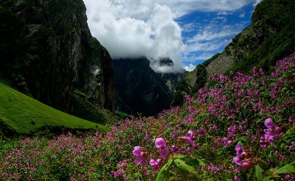
The park is also renowned for its meadows of endemic alpine flora, which burst into colour during the summer months.
Fauna: The Hidden Inhabitants
Mammals
Nanda Devi National Park is home to several rare and endangered mammal species.
| Species | Scientific Name | Status | Habitat |
|---|---|---|---|
| Snow Leopard | Uncia uncia | Endangered | High alpine zones |
| Himalayan Musk Deer | Moschus chrysogaster | Endangered | Alpine meadows |
| Himalayan Tahr | Hemitragus jemlahicus | Near Threatened | Rocky slopes |
| Bharal (Blue Sheep) | Pseudois nayaur | Schedule I | Alpine meadows |
| Mainland Serow | Capricornis sumatraensis | Vulnerable | Forested slopes |
| Himalayan Black Bear | Ursus thibetanus | Vulnerable | Forested areas |
| Himalayan Brown Bear | Ursus arctos | Endangered | High alpine zones |
| Common Langur | Semnopithecus entellus | Least Concern | Forests |
Note: Himalayan goral are not found within the park but occur in the vicinity.
Birds
A scientific expedition in 1993 recognised a total of 114 bird species within the park. Notable species include:
- Himalayan Monal – State bird of Uttarakhand
- Snow Partridge – Found in alpine zones
- Bearded Vulture (Lammergeier) – High-altitude scavenger
- Golden Eagle – Apex predator of the skies
Butterflies and Insects
The park is rich in insect life, including many species of butterflies that add to the vibrant colours of the meadows during summer.
The Bhotiya Community: Guardians of the Sanctuary
The Niti Valley region on the periphery of the park is inhabited by the indigenous Bhotiya tribal community. There are 22 villages in the region.
Transhumance Lifestyle
A majority of the villages practice transhumance—they live for six months in the upper villages and move down to winter villages to avoid the extreme climate.
Cultural Traditions
The Chipko Connection
The prompt action taken by Gaura Devi and a few other village women is a milestone in the non-violent struggle of tribal communities in saving their forest wealth. The political leadership in the Niti Valley Painkhanda region was provided by Comrade Govind Singh Rawat.
Religious Beliefs: The Goddess Nanda Devi
Nanda Devi: The Bliss-Giving Goddess
Mount Nanda Devi is regarded as Goddess Parvati, who is known as Nanda in the Garhwal and Kumaon areas. The name “Nanda Devi” means “Bliss-Giving Goddess”.
The goddess has many shrines and temples dedicated to Her in the region, with one of the better-known located at Almora. The annual Nanda Devi Mela is held here in the month of September.
Nanda Devi Raj Jat – The 12-Year Pilgrimage
Nanda Devi Raj Jat is a Hindu pilgrimage stretching 280 km through the central Himalayas, held in the months of August and September every 12 years. Dating back to the 9th century AD, this pilgrimage is symbolic of seeing off Goddess Nanda to her consort Lord Shiva’s abode in the higher Himalayas after her stay at her parents’ place in the lower Himalayas.
The pilgrimage is led by a four-horned ram on its 19-day schedule from Nauti to Hemkund. The ram is said to be born every 12 years in the Chandpurpatti region of Karnaprayag.
How to Reach Nanda Devi National Park
By Air
Nearest Airport: Jolly Grant Airport, Dehradun (approximately 295 km from Joshimath)
| Details | Information |
|---|---|
| Flight Duration | Delhi to Dehradun: ~1 hour |
| Drive from Airport | Dehradun to Joshimath: ~10–12 hours by taxi |
| Airlines | IndiGo, other domestic carriers |
Alternative Airport: Pantnagar Airport (approximately 392 km from Joshimath)
By Train
Nearest Railway Stations:
| Station | Distance to Joshimath | Travel Time | Connectivity |
|---|---|---|---|
| Haridwar | ~275 km | 10–11 hours by road | Most convenient |
| Rishikesh | ~272 km | 10–11 hours by road | Well-connected |
| Dehradun | ~295 km | 10–12 hours by road | Major station |
Popular Trains from Delhi to Haridwar:
| Train Name | From Delhi | Departure | Arrival | Duration |
|---|---|---|---|---|
| Shatabdi Express | Delhi | 6:00 AM | 11:40 AM | 5h 40m |
| Jan Shatabdi | Delhi | 3:20 PM | 9:00 PM | 5h 40m |
| Mussoorie Express | Delhi | 10:05 PM | 5:30 AM | 7h 25m |
By Road
Route from Delhi to Joshimath:
Delhi → Haridwar → Rishikesh → Devprayag → Srinagar → Rudraprayag → Karnaprayag → Chamoli → Joshimath
| Starting Point | Distance | Travel Time |
|---|---|---|
| Delhi | ~500 km | 14–16 hours |
| Haridwar | ~275 km | 10–11 hours |
| Rishikesh | ~272 km | 10–11 hours |
| Dehradun | ~295 km | 10–12 hours |
Getting to the Park Gateway
From Joshimath, drive 25 km upstream on the Niti-Malari highway to reach Lata Village—the gateway to the Nanda Devi National Park. The Nanda Devi Interpretive Trek starts from Lata.
Distances from Major Cities
| City | Distance (km) |
|---|---|
| Delhi | ~500 |
| Dehradun | ~295 |
| Rishikesh | ~272 |
| Haridwar | ~275 |
| Joshimath | 0 (base town) |
| Lata Village | 25 km from Joshimath |
Nanda Devi Interpretive Trek: Complete Guide
The Nanda Devi National Park Interpretive Trek is the only way to experience the inner sanctuary. It is managed by the local community and designed as an immersive experience for travellers.
Trek Overview
Day-by-Day Itinerary
Day 1: Lata Village to Camp Kanook
| Aspect | Details |
|---|---|
| Trek Distance | ~7–8 km |
| Trek Duration | 4–5 hours |
| Overnight | Camp Kanook |
| Purpose | Acclimatization before high altitude |
Highlights:
- Start from Lata village, visit the Interpretation Centre on Bio-Cultural Diversity of Niti Valley
- Gradual ascent through forests
- Camp at Kanook, midway between Lata village and Lata Kharak
- Acclimatisation is crucial—avoid zipped itineraries that propose trekking straight to Lata Kharak in a single day
Day 2: Camp Kanook to Lata Kharak
| Aspect | Details |
|---|---|
| Trek Distance | ~5–6 km |
| Trek Duration | 4–5 hours |
| Overnight | Camp at Lata Kharak |
Highlights:
- Steeper ascent to Lata Kharak (high-altitude meadow)
- First views of the Himalayan peaks
- Camp at the edge of the sanctuary
Day 3: Lata Kharak to Dharansi
| Aspect | Details |
|---|---|
| Trek Distance | ~6–7 km |
| Trek Duration | 5–6 hours |
| Overnight | Camp at Dharansi |
Highlights:
- Enter the Nanda Devi National Park core zone
- Spectacular views of the sanctuary peaks
- Wildflowers bloom during the summer
Day 4: Dharansi to Suraithota and Return
| Aspect | Details |
|---|---|
| Trek Distance | ~5–6 km |
| Trek Duration | 4–5 hours |
| Highest Elevation | 13,700 ft (4,200 m) |
Highlights:
- Reach Suraithota—the culmination point
- Breathtaking views of the Nanda Devi massif
- Return trek to Lata
Permits and Fees
| Aspect | Details |
|---|---|
| Issuing Authority | DFO Joshimath |
| Permit Type | Entry permit for Nanda Devi National Park |
| Best Time to Apply | 1–2 months in advance |
| Fee | Contact DFO office for current rates |
Trekking Tips
Where to Stay: Accommodation Options
In Lata Village
In Joshimath
In Auli
| Property | Features |
|---|---|
| Auli Faraway Cottages | Mountain views, comfortable cottages |
| Himalayan Holiday Hotel | Good amenities |
Booking Tips:
- Book accommodation in Joshimath well in advance for peak season (May–October)
- The Nanda Devi Interpretive Trek includes camping arrangements
- For stays in Lata, contact Shepherds Lodge Devangan directly
Nearby Places to Visit
Joshimath – The Base Town
Joshimath is the nearest major town to the park. Key attractions include:
- Narasimha Temple: Dedicated to Lord Vishnu’s fourth incarnation (half-lion, half-man); open 4:30 AM – 9 PM; no entry fee
- Kalpavriksha: The oldest tree in India (1,200 years old)
- Shankaracharya Math: One of the four cardinal mathas established by Adi Shankaracharya
Auli – The Skiing Capital of India
Auli is a popular hill station known for:
- Skiing: One of the best skiing destinations in Asia
- Ropeway: The second-highest cable car ride in Asia, offering stunning views
- Panoramic views: Nanda Devi, Trishul, and Dronagiri peaks
Weather and Best Time to Visit
Climate Overview
Nanda Devi National Park experiences a high-altitude alpine climate. The park is open for only six months from May to October.
Month-by-Month Guide
| Month | Season | Day Temp (°C) | Night Temp (°C) | Conditions | Trek Suitability |
|---|---|---|---|---|---|
| May | Summer (start) | 7–15 | 0–5 | Snow melting, trails opening | ⭐ Good |
| June | Summer | 10–18 | 2–8 | Pleasant, wildflowers begin | ⭐ Best |
| July | Monsoon | 10–16 | 5–10 | Heavy rain, Valley of Flowers blooms | ⭐ Moderate |
| August | Monsoon | 10–16 | 5–10 | Heavy rain, landslides risk | ⚠️ Avoid |
| September | Autumn | 8–15 | 0–5 | Post-monsoon, clear | ⭐ Best |
| October | Autumn | 5–12 | -5–0 | Clear skies, cold nights | ⭐ Good |
| November–April | Winter | -5–10 | -15–-5 | Heavy snow, park closed | ❌ Closed |
Best Time to Visit by Season
| Season | Months | Suitability | Conditions | Best For |
|---|---|---|---|---|
| Summer | May–June | ⭐ Best | 7°C–18°C, pleasant, clear skies | Nanda Devi trek, wildlife spotting, photography |
| Post-Monsoon | September–October | ⭐ Excellent | 5°C–15°C, crystal-clear skies | Clear mountain views, photography |
| Monsoon | July–August | ⚠️ Moderate | 10°C–16°C, rain, Valley of Flowers in bloom | Valley of Flowers visit (not Nanda Devi core zone) |
| Winter | November–April | ❌ Closed | Below freezing, heavy snow | Park inaccessible |
When to See Specific Wildlife
| Wildlife | Best Time |
|---|---|
| Snow Leopard | Rare; sightings not guaranteed |
| Himalayan Tahr | Summer months |
| Musk Deer | May–June |
| Bharal (Blue Sheep) | Summer, early autumn |
| Birds | May–October |
Park Closure
The park is closed during the winter months due to heavy snowfall, which can make the treks dangerous and access to the park difficult.
Sample Itineraries
5-Day Nanda Devi Interpretive Trek
| Day | Route | Distance | Time | Overnight |
|---|---|---|---|---|
| 1 | Haridwar → Joshimath (drive) | 275 km | 10–11 hours | Joshimath |
| 2 | Joshimath → Lata → Camp Kanook (trek) | 25 km drive + 7–8 km trek | 5–6 hours | Camp Kanook |
| 3 | Camp Kanook → Lata Kharak (trek) | 5–6 km | 4–5 hours | Lata Kharak |
| 4 | Lata Kharak → Dharansi → Suraithota → return | 12 km | 8–10 hours | Lata Kharak/Camp Kanook |
| 5 | Return to Lata → Joshimath → Haridwar | 25 km drive + 275 km drive | Full day | – |
7-Day Nanda Devi & Valley of Flowers Combo
| Day | Route | Highlights |
|---|---|---|
| 1 | Delhi → Haridwar → Joshimath | Drive, overnight Joshimath |
| 2 | Joshimath → Lata → Camp Kanook | Start Nanda Devi trek |
| 3 | Camp Kanook → Lata Kharak | Acclimatization |
| 4 | Lata Kharak → Dharansi → Suraithota | Nanda Devi views |
| 5 | Return to Joshimath | Rest day |
| 6 | Joshimath → Govindghat → Ghangaria → Valley of Flowers | Valley trek |
| 7 | Ghangaria → Govindghat → Joshimath → Delhi | Return |
Travel Tips and Important Information
Before You Go
- Physical Fitness: The Nanda Devi trek is challenging due to high altitude and vertical terrain. Prepare with regular walking, jogging, and stair climbing 2–3 months before.
- Medical Check-up: Consult your doctor before undertaking high-altitude trekking, especially if you have heart or respiratory conditions.
- Permits: Obtain necessary permits from DFO Joshimath in advance.
- Carry Cash: ATMs are limited in Joshimath; bring sufficient cash.
- Check Weather: Avoid monsoon (July–August) due to landslide risk.
During the Trek
- Acclimatise Properly: Spend a night at Camp Kanook before attempting higher altitudes. Most health issues in the region are due to rapid altitude gain.
- Stay Hydrated: Drink 3–4 litres of water daily to prevent altitude sickness.
- Dress in Layers: Temperatures can change rapidly—layers allow adjustment.
- Hire a Local Guide: Essential for navigation, safety, and cultural insights.
- Carry Essentials: Warm clothing, sturdy trekking shoes, water purification tablets, first-aid kit.
Safety Tips
- Altitude Sickness (AMS): Symptoms include headache, nausea, and breathlessness. If symptoms worsen, descend immediately.
- The terrain is almost vertical—follow best practices for acclimatisation.
- Avoid zipped itineraries that propose trekking straight to Lata Kharak in a single day.
- Wildlife: Do not feed animals; maintain a safe distance.
- Emergency Numbers: Keep local contacts handy (DFO Joshimath, SDRF, ITBP).
Responsible Tourism
- Limited Entry: Only 500 trekkers are allowed in the core zone per season—preserve the fragile ecosystem.
- Leave No Trace: Carry back all non-biodegradable waste.
- Respect Local Culture: The Bhotiya community has unique traditions; ask permission before photographing people.
- Support Local Economy: Hire local guides, stay in community-run lodges, buy local products.
Packing Checklist
| Category | Items |
|---|---|
| Clothing | Thermal innerwear, fleece jacket, down jacket, waterproof outer shell, trekking pants (2 pairs), woollen gloves, muffler, woollen cap, heavy woollen socks, sturdy trekking shoes |
| Gear | Trekking poles, headlamp/torch with extra batteries, power bank, reusable water bottle, water purification tablets |
| Health | Personal medications, first-aid kit, Diamox (consult doctor), ORS packets |
| Documents | Valid ID proof (Aadhaar/Passport), permit copies, travel insurance |
| Other | Cash, energy bars, camera, extra batteries, sleeping bag |
Photography Tips
- Best Spots: Nanda Devi peak from Suraithota, Lata Kharak meadows, Rishi Ganga valley
- Best Time: Early morning for golden light on the peaks; autumn for clearest skies
- Camera Gear: Carry extra batteries—cold drains them quickly; telephoto lens for wildlife
Frequently Asked Questions (FAQs)
Q1: Why is Nanda Devi National Park famous?
A: Nanda Devi National Park is famous for being a UNESCO World Heritage Site, the second-highest peak in India (Nanda Devi, 7,816 m), and one of the most pristine wilderness areas in the Himalayas. It is also known for its rare wildlife, including the snow leopard, Himalayan musk deer, and Himalayan tahr.
Q2: What is the best time to visit Nanda Devi National Park?
A: The best time to visit is May to October. The park is closed during winter (November–April) due to heavy snowfall. May–June offers pleasant weather, while September–October offers crystal-clear mountain views.
Q3: How far is Nanda Devi National Park from Delhi?
A: The distance from Delhi to Joshimath is approximately 500 km, with a travel time of 14–16 hours by road.
Q4: How do I reach Nanda Devi National Park?
A: By road to Joshimath (via Haridwar and Rishikesh), then 25 km to Lata village, followed by a 4-day trek. The nearest airport is Dehradun (~295 km), and the nearest railway station is Haridwar (~275 km).
Q5: What is the altitude of Nanda Devi National Park?
A: The entire park lies at an elevation of more than 3,500 m (11,500 ft) above mean sea level, with peaks reaching up to 7,816 m.
Q6: Is a permit required to visit Nanda Devi National Park?
A: Yes, a permit is required for trekking inside the park. Permits are issued by the DFO Joshimath.
Q7: How many trekkers are allowed per year?
A: A maximum of 500 trekkers are allowed to enter the core zone per season.
Q8: What is the Nanda Devi Interpretive Trek?
A: The Nanda Devi Interpretive Trek is a 4-day community-managed trek from Lata village to Suraithota, offering an immersive experience of the Nanda Devi Sanctuary. It includes camping at Kanook, Lata Kharak, and Dharansi.
Q9: What is the Lata village?
A: Lata village is the gateway to Nanda Devi National Park, located 25 km from Joshimath on the Niti-Malari highway. It has an Interpretation Centre on Bio-Cultural Diversity and the Shepherds Lodge Devangan for accommodation.
Q10: What wildlife can I see in Nanda Devi National Park?
A: The park is home to snow leopards, Himalayan musk deer, Himalayan tahr, bharal (blue sheep), serow, Himalayan black bear, and 114 bird species.
Q11: What is the Nanda Devi Raj Jat?
A: The Nanda Devi Raj Jat is a 280 km pilgrimage held every 12 years (August–September), dating back to the 9th century AD. It is led by a four-horned ram from Nauti to Hemkund.
Q12: What is the connection between Nanda Devi and the CIA?
A: During the Cold War, the CIA attempted to place a nuclear-powered listening device on the summit of Nanda Devi to spy on China’s missile program. The device was lost and remains missing.
Q13: Is Nanda Devi National Park suitable for beginners?
A: The park is not suitable for beginners due to high altitude, vertical terrain, and the need for proper acclimatisation. Prior trekking experience and good physical fitness are essential.
Q14: What is the entry fee for Nanda Devi National Park?
A: Entry fee is approximately ₹150 for adults and ₹75 for children. Additional costs apply for trekking permits and guide services.
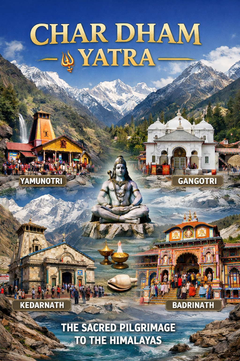
Q15: Can I combine Nanda Devi with the Valley of Flowers?
A: Yes, the Valley of Flowers National Park is located nearby (part of the same UNESCO site). July–August is the best time for the Valley of Flowers, but this coincides with the monsoon, which is not ideal for the Nanda Devi trek.
Plan Your Nanda Devi Journey with Discover Uttarakhand
At Discover Uttarakhand, we’ve been organising unforgettable Himalayan journeys across Devbhoomi since 1997. As a trusted local operator with deep knowledge of the Garhwal Himalayas, we offer:
- ✅ Nanda Devi Interpretive Trek packages (5 to 8 days)
- ✅ Permit assistance (DFO Joshimath clearance)
- ✅ Combined itineraries covering Nanda Devi, Valley of Flowers, and Auli
- ✅ Comfortable transport from Haridwar/Rishikesh to Joshimath
- ✅ Verified accommodations in Joshimath and Auli
- ✅ Local guides from the Bhotiya community
- ✅ Community-managed camping at Kanook and Lata Kharak
- ✅ 24/7 customer support throughout your journey
Recommended Nanda Devi Packages
| Package | Duration | Starting Point | Highlights |
|---|---|---|---|
| Nanda Devi Interpretive Trek | 4 Nights / 5 Days | Haridwar | Lata, Kanook, Lata Kharak, Suraithota |
| Nanda Devi & Valley of Flowers | 6 Nights / 7 Days | Haridwar | Both UNESCO sites, Auli |
| Complete Nanda Devi Sanctuary Trek | 7 Nights / 8 Days | Haridwar | Extended trek into the sanctuary |
Book your Nanda Devi National Park journey today and experience the goddess’s Himalayan sanctuary.
📞 Call / WhatsApp: +91-9997187178, 9760222178, 8171977178
📍 Visit Our Office: Himalayan Colony, opposite DSVV, Haripur Kalan, Haridwar, Motichur Range, Uttarakhand 249411
🌐 Website: www.discover-uttarakhand.com
📧 Email: info@discover-uttarakhand.com
Jai Nanda Devi! Om Namah Shivaya! 🙏
Discover Uttarakhand – Your Local Partner for Unforgettable Himalayan Journeys Since 1997 🏔️