Introduction: The Forgotten Border Village of Uttarakhand
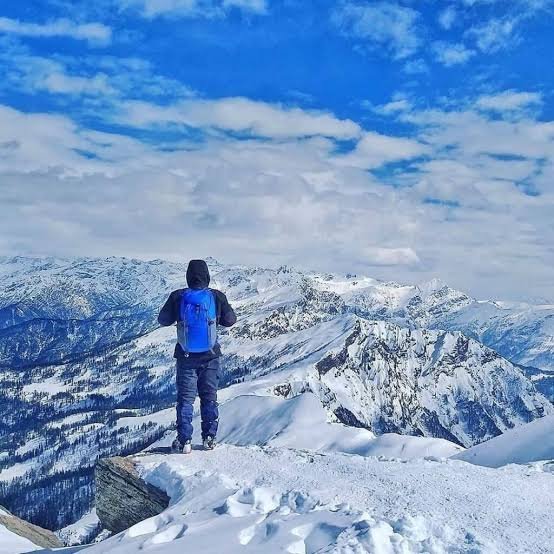
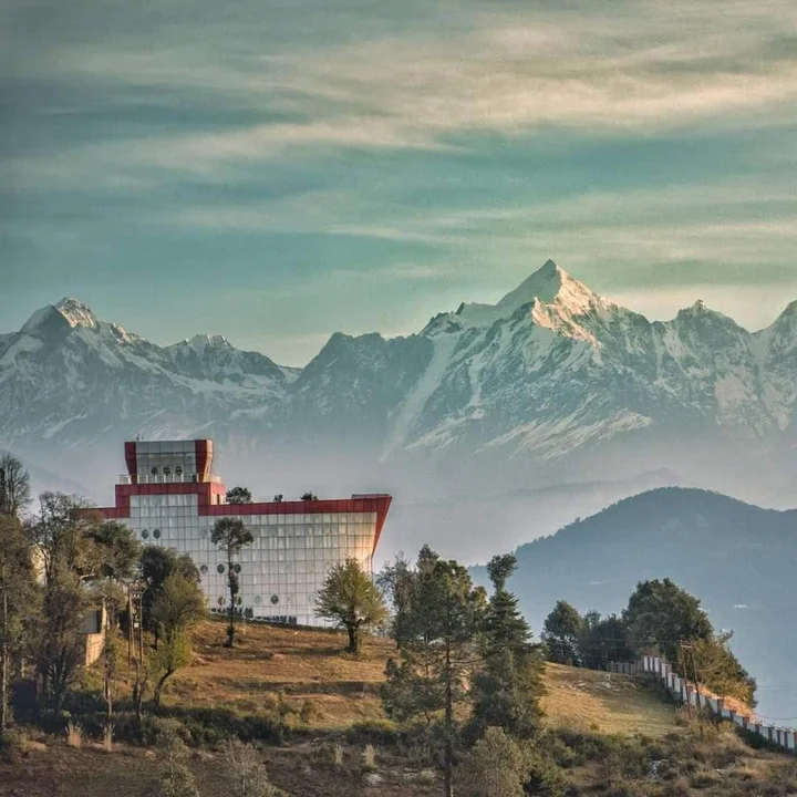
Nestled in the remote reaches of the Garhwal Himalayas, Niti Village is one of Uttarakhand’s most fascinating and offbeat destinations. Often referred to as the “Last Village on the Indo-Tibet Border,” this ancient settlement in the Chamoli district offers a unique glimpse into a world that time forgot.
Perched at an elevation of approximately 3,600 metres (11,811 feet) above sea level, Niti is one of the highest inhabited villages in Uttarakhand. The village is situated near the Indo-Tibet border, approximately 40 kilometres from Mana and 65 kilometres from Badrinath. It is the last civilian settlement before the border, making it a place of immense strategic, historical, and cultural significance.
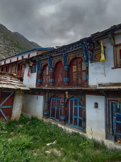
The village is home to the Bhotiya community, an indigenous tribal group with deep cultural and trade connections to Tibet. The Bhotiyas are known for their traditional wool-weaving, trade skills, and rich cultural heritage. Niti serves as a living museum of their ancient way of life, offering visitors a rare opportunity to experience a culture that has remained largely unchanged for centuries.
Whether you are a history enthusiast, a cultural explorer, a nature lover, or an adventure seeker, Niti Village promises a journey into the heart of the Himalayas, where India’s border meets the vast Tibetan plateau.
Key Information at a Glance
| Aspect | Details |
|---|---|
| Location | Chamoli district, Uttarakhand, India |
| Altitude | 3,600 m (11,811 ft) |
| Best Time to Visit | June–September |
| Distance from Delhi | 540–560 km |
| Distance from Badrinath | ~65 km |
| Distance from Mana | ~40 km |
| Nearest Airport | Jolly Grant Airport, Dehradun (~350 km) |
| Nearest Railway Station | Rishikesh Railway Station (~320 km) |
| Nearest Town | Mana (40 km), Badrinath (65 km) |
| Climate | Alpine; cold summers, extremely cold winters |
| Major Attractions | Niti Temple, Mana Pass, Bhotiya culture, Indo-Tibet border |
| Languages | Hindi, Garhwali, Bhotiya |
| Famous For | Indo-Tibet border, Bhotiya culture, traditional wool weaving |
| Permits Required | Yes (Inner Line Permit for border areas) |
History of Niti Village
Ancient Origins and the Bhotiya Legacy
The history of Niti is intrinsically linked to the Bhotiya community, an indigenous tribal group that has inhabited the high-altitude regions of the Garhwal Himalayas for centuries. The Bhotiyas were traditionally pastoralists and traders who maintained strong cultural and economic ties with Tibet.
The village’s name is believed to be derived from the Bhotiya word “Niti,” meaning “a place of meditation.” According to local tradition, the village was established by Bhotiya traders who used this strategic location as a resting point on the ancient trans-Himalayan trade route.
The Ancient Trade Route
Niti was once a crucial stop on the ancient trade route connecting India with Tibet. Traders from both sides would cross the Mana Pass, carrying wool, salt, and other goods. The village served as the last Indian outpost before the border, making it a vital centre of commerce and cultural exchange.
The village’s architecture, customs, and language reflect centuries of interaction between Indian and Tibetan cultures. The Bhotiya people developed a unique syncretic culture, blending Hindu and Buddhist traditions in their daily lives and religious practices.
The 1962 War and Its Impact
The Sino-Indian War of 1962 brought profound changes to Niti Village. The conflict led to the closure of the border, ending centuries of cross-border trade and cultural exchange. The village, once a thriving centre of trans-Himalayan commerce, became a strategic military outpost.
Despite these challenges, the Bhotiya community has preserved its unique cultural identity. The village remains a living testament to their resilience and adaptability in the face of changing political and economic realities.
Modern Niti Village
Today, Niti Village is a fascinating blend of tradition and modernity. While the border remains closed, the village has gradually opened to tourism, offering visitors a rare glimpse into its unique culture and history. The village is also a base for treks to the Mana Pass, one of the highest motorable passes in the world.
Geography of Niti Village
Location and Topography
Niti Village is located in the Chamoli district of Uttarakhand, India. It is situated in the Garhwal Himalayan ranges, near the Indo-Tibet border, characterised by steep slopes, deep valleys, and high-altitude deserts.
| Feature | Details |
|---|---|
| Coordinates | 30.56°N, 80.06°E (approx.) |
| Elevation | 3,600 m (11,811 ft) |
| District | Chamoli, Uttarakhand |
| Distance from Delhi | ~540–560 km |
| Distance from Badrinath | ~65 km |
| Distance from Mana | ~40 km |
| Distance from Joshimath | ~140 km |
| Nearest Town | Mana (40 km), Badrinath (65 km) |
| Border | Indo-Tibet border (approx. 15 km) |
Physical Features
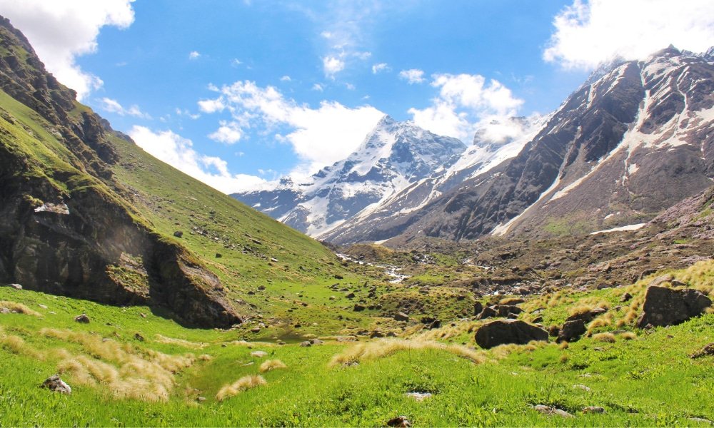
The village is nestled in a high-altitude valley surrounded by barren mountains and snow-capped peaks. The terrain is harsh and unforgiving, with sparse vegetation and extremely cold temperatures. The region is part of the Nanda Devi Biosphere Reserve, one of the most significant protected areas in the Himalayas.
Flora and Fauna of Niti Village
Flora — High-Altitude Vegetation
Niti is located in a high-altitude desert region with sparse vegetation. The plant life is adapted to the harsh alpine conditions:
| Species | Type |
|---|---|
| Juniper (Juniperus indica) | Alpine shrub |
| Himalayan Birch (Betula utilis) | Deciduous tree |
| Rhododendron (Rhododendron anthopogon) | Alpine shrub |
| Medicinal Herbs | Various species |
| Alpine Mosses and Lichens | Ground cover |
Fauna — Wildlife in the High Himalayas
The region is home to a variety of high-altitude wildlife species:
Mammals:
- Snow Leopard — the elusive apex predator
- Himalayan Black Bear — found in the lower reaches
- Musk Deer — a shy and rare species
- Bharal (Blue Sheep) — found in the higher altitudes
- Himalayan Tahr — a mountain goat
- Tibetan Wolf — a rare and endangered species
Birds:
The region hosts several high-altitude bird species:
- Himalayan Monal — the colourful state bird of Uttarakhand
- Tibetan Snowcock — a high-altitude bird
- Golden Eagle — a majestic bird of prey
- Himalayan Griffon — a large vulture species
Religious Beliefs and Sacred Sites
Niti Temple — The Spiritual Heart of the Village
The Niti Temple is the spiritual centre of the village. Dedicated to Lord Shiva and local deities, this ancient temple is a testament to the region’s rich spiritual heritage.
Key Features:
- Age: Over 500 years old
- Deity: Lord Shiva and local deities
- Architecture: Traditional Garhwali and Tibetan influences
- Significance: Blend of Hindu and Buddhist traditions
- Festivals: Maha Shivaratri (February–March), local harvest festivals
| Detail | Information |
|---|---|
| Timings | 6:00 AM – 6:00 PM |
| Entry | Free |
| Highlights | Blend of Hindu and Buddhist architecture, ancient idols |
| Festivals | Maha Shivaratri (Feb–Mar), local festivals |
Mana Pass — The Gateway to Tibet
The Mana Pass, located approximately 15 km from Niti, is one of the highest motorable passes in the world at an altitude of 5,630 metres (18,471 feet). It is the traditional gateway to Tibet and holds significant spiritual importance for both Hindus and Buddhists.
| Detail | Information |
|---|---|
| Altitude | 5,630 m (18,471 ft) |
| Distance from Niti | ~15 km |
| Significance | Indo-Tibet border, ancient trade route |
| Permits Required | Yes (special permits required) |
Bhotiya Buddhist Shrines
The village also features small Buddhist shrines and prayer flag poles, reflecting the Bhotiya community’s Buddhist heritage. These shrines are used for meditation and prayer.
How to Reach Niti Village
By Air — Nearest Airports
| Detail | Information |
|---|---|
| Nearest Airport | Jolly Grant Airport, Dehradun |
| Distance from Village | ~350 km (approx. 12-14 hours drive) |
| Connectivity | Connected to Delhi and other major cities |
| Alternative | Indira Gandhi International Airport, Delhi (~540 km) |
From Dehradun Airport to Niti:
- Hire a taxi to Badrinath (approx. 10-12 hours), then continue to Niti
By Train — Nearest Railway Stations
| Detail | Information |
|---|---|
| Nearest Station | Rishikesh Railway Station |
| Distance from Village | ~320 km (approx. 12-14 hours drive) |
| Alternative Stations | Haridwar, Dehradun |
From Rishikesh to Niti:
- Take a taxi or bus to Badrinath, then continue to Niti
By Road (Most Popular)
| Route | Distance | Travel Time |
|---|---|---|
| Delhi to Niti | 540–560 km | 18–20 hours |
| Dehradun to Niti | 350 km | 12–14 hours |
| Badrinath to Niti | 65 km | 2.5–3 hours |
| Mana to Niti | 40 km | 1.5–2 hours |
Route from Delhi:
Delhi → Meerut → Muzaffarnagar → Roorkee → Haridwar → Rishikesh → Chamba → Rudraprayag → Karnaprayag → Nandprayag → Chamoli → Joshimath → Badrinath → Mana → Niti
Transport Options:
- Private Taxi: Most convenient and flexible (4×4 recommended)
- State Transport Buses: Buses from Dehradun to Badrinath, then local transport
- Self-Drive: Scenic but challenging roads; 4×4 vehicle essential
- Shared Taxis: Available from Badrinath and Joshimath
Important Notes:
- The road from Badrinath to Niti is narrow and winding
- 4×4 vehicles are essential for the last stretch
- The road is often closed during winter (November–May)
- Special permits are required for Niti due to its proximity to the border
Distances from Major Cities
| City | Distance (km) | Travel Time |
|---|---|---|
| Delhi | 540–560 | 18–20 hours |
| Dehradun | 350 | 12–14 hours |
| Haridwar | 330 | 11–13 hours |
| Rishikesh | 320 | 12–14 hours |
| Joshimath | 140 | 6–7 hours |
| Badrinath | 65 | 2.5–3 hours |
| Mana | 40 | 1.5–2 hours |
Weather and Best Time to Visit
Climate Overview
Niti experiences an alpine climate with extremely cold conditions throughout the year. The village is accessible only during the summer months (June–September).
Month-by-Month Guide
| Month | Season | Day Temp (°C) | Night Temp (°C) | Conditions | Suitability |
|---|---|---|---|---|---|
| June | Summer | 5–15 | -5 to 5 | Snow melting, roads open | ⭐ Good |
| July | Summer | 8–18 | 0–8 | Pleasant, clear skies | ⭐ Best |
| August | Summer | 8–18 | 0–8 | Pleasant, clear skies | ⭐ Best |
| September | Autumn | 5–15 | -5 to 5 | Clearing, crisp air | ⭐ Good |
| October | Autumn | -5 to 5 | -15 to -5 | Cold, roads closing | ❌ Avoid |
| November–May | Winter | -20 to -5 | -30 to -20 | Heavy snow, roads closed | ❌ Avoid |
Best Time to Visit by Season
| Season | Months | Suitability | Conditions | Best For |
|---|---|---|---|---|
| Summer | July–August | ⭐ Best | 0°C–18°C, clear skies | Border visits, cultural exploration |
| Early Summer | June | ⭐ Good | -5°C–15°C, snow melting | Trekking, nature photography |
| Autumn | September | ⭐ Good | -5°C–15°C, crisp air | Photography, peaceful retreats |
| Winter | October–May | ❌ Avoid | -30°C to -5°C, heavy snow | Not recommended |
Packing Guide
| Season | What to Pack |
|---|---|
| Summer | Heavy woollens, thermal wear, insulated jacket, gloves, woollen cap, comfortable trekking shoes |
| All Seasons | Sunscreen, sunglasses, water bottle, personal medication, power bank, cash |
Top Places to Visit in and Around Niti
Within Niti Village
| Attraction | Highlights |
|---|---|
| Niti Temple | Ancient temple, blend of Hindu-Buddhist architecture |
| Bhotiya Village | Traditional Bhotiya culture, wool weaving, architecture |
| Indo-Tibet Border | Strategic border, Mana Pass views |
| High-Altitude Desert | Unique landscape, barren mountains |
Nearby Destinations
| Destination | Distance | Highlights |
|---|---|---|
| Mana | 40 km | Last village before the border, Vyas Gufa, Bhim Pul |
| Mana Pass | 15 km | One of the highest motorable passes, Indo-Tibet border |
| Badrinath | 65 km | Char Dham pilgrimage site, Badrinath Temple |
| Joshimath | 140 km | Winter seat of Badrinath, Adi Shankara Temple |
| Valley of Flowers | ~200 km | UNESCO World Heritage Site |
| Auli | ~180 km | Skiing destination, cable car |
| Kedarnath | ~220 km | Char Dham pilgrimage site |
Things to Do in Niti
1. Visit the Indo-Tibet Border
The highlight of any visit to Niti is visiting the Indo-Tibet border and the Mana Pass. The pass offers stunning views of the Tibetan plateau and is a place of immense strategic and historical significance.
2. Explore Bhotiya Culture
Immerse yourself in the unique culture of the Bhotiya community:
- Visit traditional Bhotiya homes
- Observe wool weaving and handicrafts
- Taste local Bhotiya cuisine
- Learn about their traditional customs and way of life
3. Visit Niti Temple
Pay respects at the ancient Niti Temple, which reflects a fascinating blend of Hindu and Buddhist traditions.
4. Explore the High-Altitude Desert
The landscape around Niti is a high-altitude desert, offering unique photographic opportunities and a sense of isolation unlike any other.
5. Trekking
Niti serves as a base for treks to:
- Mana Pass — one of the highest motorable passes
- Border areas — with proper permits
6. Photography
From the barren mountains to the colourful prayer flags and traditional Bhotiya architecture, Niti offers endless photography opportunities.
7. Cultural Immersion
Interact with the local Bhotiya community and learn about their traditional way of life, including:
- Sheep and goat herding
- Wool weaving and spinning
- Traditional trade practices
- Cultural festivals and celebrations
Accommodation Options
Niti offers extremely limited accommodation options:
| Type | Features | Price Range |
|---|---|---|
| Homestays | Authentic local experience; home-cooked meals; warm hospitality | ₹800 – ₹2,000 |
| Guesthouses | Basic facilities; comfortable stay | ₹1,000 – ₹2,500 |
| Camping | Basic camping facilities; booking required | ₹500 – ₹1,200 |
| Hotels in Badrinath | More options available; comfortable stays | ₹1,500 – ₹5,000 |
Travel With Monk Recommendation: For the most authentic experience, stay in a homestay to immerse yourself in Bhotiya culture. Badrinath (65 km) and Joshimath (140 km) offer more comfortable hotel options.
Local Cuisine — A Taste of Bhotiya Culture
Niti offers simple, authentic Bhotiya cuisine:
| Dish | Description |
|---|---|
| Thukpa | Noodle soup with vegetables or meat (Tibetan influence) |
| Churpi | Traditional Bhotiya cheese, hard and chewy |
| Tsampa | Roasted barley flour, a staple in Bhotiya cuisine |
| Butter Tea | Traditional Tibetan tea with butter and salt |
| Gahat ka Shorba | Nutritious soup made from horse gram |
| Chainsoo | Black gram curry, a Garhwali speciality |
| Jhangora Kheer | Sweet pudding made from barnyard millet |
Where to Eat
- Homestays: Enjoy authentic home-cooked Bhotiya meals
- Local Dhabas: Simple meals in Mana and Badrinath
Shopping in Niti
| What to Buy | Where | Price Range |
|---|---|---|
| Traditional Bhotiya Woolens | Village artisans | ₹200 – ₹2,000 |
| Handicrafts | Local artisans | ₹100 – ₹1,000 |
| Prayer Flags | Local shops | ₹50 – ₹500 |
| Bhotiya Souvenirs | Local shops | ₹50 – ₹500 |
Travel Tip: Niti is not a shopping destination. Focus on cultural experiences and local handicrafts.
Frequently Asked Questions (FAQs)
General Questions
Q1: Why is Niti Village famous?
Niti Village is famous for being the last inhabited village on the Indo-Tibet border in Uttarakhand. It is also known for its unique Bhotiya culture and its proximity to the Mana Pass.
Q2: What is the altitude of Niti Village?
Niti is situated at an elevation of approximately 3,600 metres (11,811 feet) above sea level.
Q3: What is the best time to visit Niti Village?
The best time to visit is from June to September when the weather is relatively mild, and the roads are open. The village is inaccessible during winter (October–May) due to heavy snowfall.
Q4: Is Niti Village safe for tourists?
Yes, Niti is generally safe for tourists. However, the village is located in a sensitive border area, and visitors must obtain permits. It is also a remote area with limited facilities. Travel With Monk ensures safe and guided experiences for all travellers.
Q5: Do I need a permit to visit Niti Village?
Yes. Niti is located in a sensitive border area, and visitors require an Inner Line Permit (ILP) from the competent authority. Permits can be obtained from the District Magistrate’s office in Chamoli or Joshimath.
Travel Logistics
Q6: How can I reach Niti from Delhi?
You can reach Niti by:
- Road: Via Delhi → Haridwar → Rishikesh → Joshimath → Badrinath → Mana → Niti (~540 km, 18–20 hours)
- Air: Fly to Dehradun (~1.5 hours) + taxi to Niti (12–14 hours)
- Train: Train to Rishikesh (~5–6 hours) + taxi to Niti (12–14 hours)
Q7: What is the distance between Delhi and Niti?
The road distance is approximately 540–560 km.
Q8: Is the road to Niti open all year?
No. The road to Niti is open only from June to September (depending on weather conditions). It remains closed during winter (October–May) due to heavy snowfall.
Q9: What type of vehicle is recommended for Niti?
A 4×4 vehicle is essential for the last stretch to Niti. The roads are narrow, winding, and often challenging.
Practical Information
Q10: What should I pack for Niti?
Pack heavy woollens, thermal wear, an insulated jacket, gloves, a woollen cap, comfortable trekking shoes, sunscreen, sunglasses, a water bottle, personal medication, a power bank, and sufficient cash.
Q11: Do mobile networks work in Niti?
Mobile connectivity is extremely limited in Niti. BSNL tends to have the best coverage in the region.
Q12: Are ATMs available in Niti?
ATMs are not available in Niti. It is advisable to carry sufficient cash from Badrinath or Joshimath.
Q13: What is the local language spoken in Niti?
The official language is Hindi. The regional languages are Garhwali and Bhotiya. English is understood in tourist areas.
Q14: What is the Bhotiya community?
The Bhotiya community is an indigenous tribal group that inhabits the high-altitude regions of the Garhwal Himalayas. They have strong cultural and historical connections to Tibet and are known for their wool-weaving and trading skills.
Q15: What is the Mana Pass?
The Mana Pass is one of the highest motorable passes in the world at 5,630 metres. It is the traditional gateway to Tibet and is located approximately 15 km from Niti.
Q16: Is there an entry fee for Niti Village?
There is no specific entry fee, but visitors must pay a nominal fee for the Inner Line Permit.
Q17: What are the accommodation options in Niti?
Accommodation options are extremely limited and include basic homestays and guesthouses. Camping is also possible with permission.
Q18: What is the food like in Niti?
The cuisine is simple and influenced by both Garhwali and Tibetan traditions. Local dishes include Thukpa, Churpi, and Butter Tea.
Plan Your Niti Journey with Discover Uttarakhand
At Discover Uttarakhand, we’ve been organising unforgettable Himalayan journeys since 1997. As a trusted local operator with deep knowledge of the Garhwal region and its border villages, we offer:
✅ Customised Niti Village tour packages
✅ Combined itineraries covering Niti, Mana, Badrinath, and Joshimath
✅ Comfortable 4×4 transport with experienced hill drivers
✅ Verified homestay and accommodation options
✅ Local guides for border visits and cultural exploration
✅ Assistance with Inner Line Permits
✅ 24/7 customer support throughout your journey
Recommended Niti Packages
| Package | Duration | Starting Point | Highlights |
|---|---|---|---|
| Niti Border Experience | 3 Nights / 4 Days | Joshimath/Badrinath | Niti Village, Bhotiya culture, Indo-Tibet border |
| Niti & Mana Explorer | 4 Nights / 5 Days | Joshimath/Badrinath | Niti, Mana, Vyas Gufa, Bhim Pul, Mana Pass |
| Garhwal Border Trek | 5 Nights / 6 Days | Dehradun | Niti, Mana, Badrinath, Joshimath |
| Indo-Tibet Border Expedition | 6 Nights / 7 Days | Dehradun | Niti, Mana Pass, Badrinath, Valley of Flowers |
📞 Call / WhatsApp: +91-9997187178, 9760222178, 8171977178
📍 Visit Our Office: Himalayan Colony, opposite DSVV, Haripur Kalan, Haridwar, Motichur Range, Uttarakhand 249411
🌐 Website: www.discover-uttarakhand.com
📧 Email: info@discover-uttarakhand.com
Discover Uttarakhand – Your Local Partner for Unforgettable Himalayan Journeys Since 1997 🏔️