Overview: The Overlooked Legacy of the Man Who Measured the World
While millions of tourists flock to Mussoorie’s Mall Road, Kempty Falls, and Gun Hill each year, fewer than 200 visitors per day reach George Everest Peak on a typical spring weekend—a striking contrast to the roughly 3,000 tourists who ride the Gun Hill ropeway on the same days. This 6-kilometre ridge walk, beginning near the Hathipaon ridge, terminates at the ruins and partially restored estate of Sir George Everest—the British surveyor-general after whom the world’s highest mountain was named.
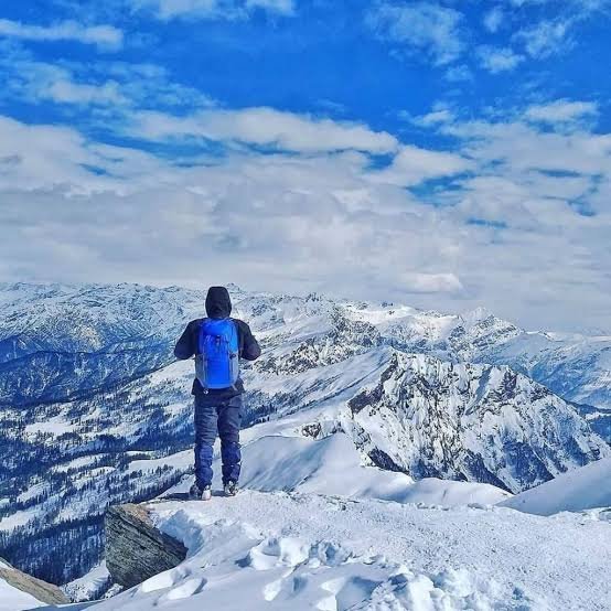
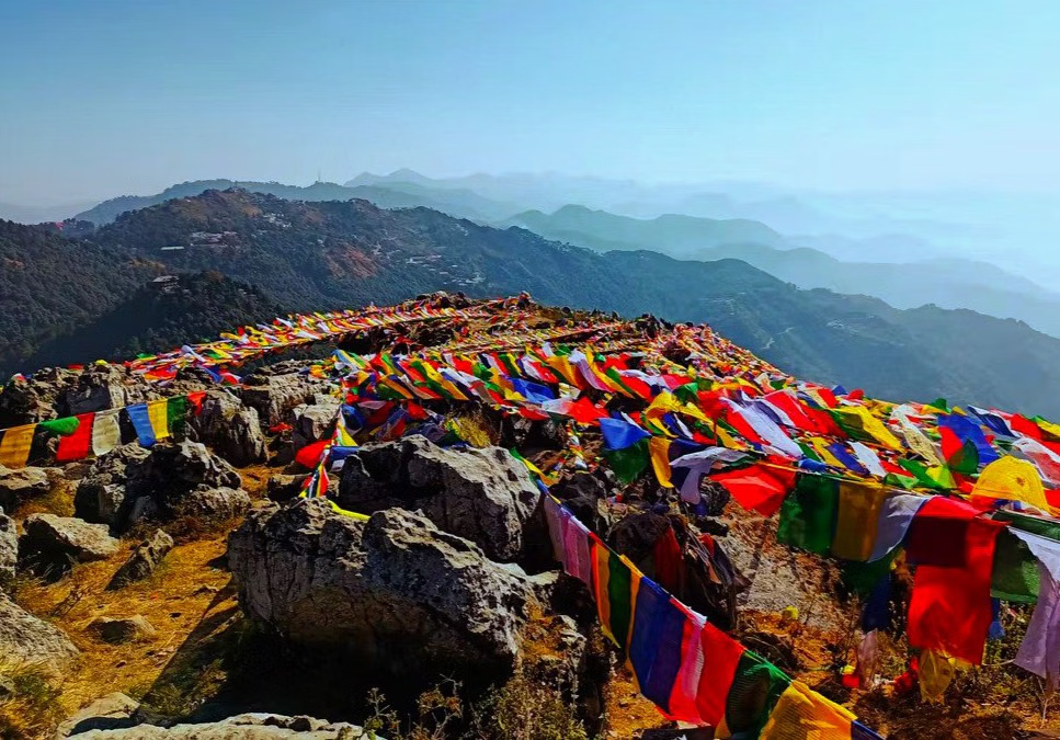
The site sits at approximately 2,000–2,290 metres above sea level, and on clear mornings, it offers sightlines across the Doon Valley to the south and toward the Bandarpunch massif (6,316 m) and the Swargarohini peaks to the northeast.
Key Information at a Glance
History of George Everest Peak
The Great Trigonometrical Survey
The story of George Everest Peak begins with the Great Trigonometrical Survey of India—one of the most ambitious mapping projects in human history. Sir George Everest (1790–1866) served as Surveyor General of India from 1830 to 1843. From this very ridge between 1832 and 1843, Everest and his team used the location as a working observatory and rest house, triangulating measurements that would eventually determine the height of Peak XV—later renamed Mount Everest in his honour in 1865.
The Estate and Laboratory
What remains at the summit today consists of two stone structures: the main residential bungalow and a smaller laboratory building to the northeast, both constructed in the 1830s. The residential structure retains its arched doorways and partial exterior walls. The laboratory, where Everest conducted his longitudinal and latitudinal measurements, still has a roofline intact on two of its four sides.
Protected Heritage Status
The Archaeological Survey of India (ASI) has classified the estate as a protected monument and placed informational signage at the site. Active restoration work has been limited in recent years, but the ruins remain a powerful testament to one of history’s most significant cartographic achievements.
The Abandonment
The estate was abandoned in the decades following Everest’s tenure, and the structures gradually fell into decay. Today, visitors are permitted to walk through the grounds but not to climb the walls.
Geography of George Everest Peak
Location and Topography
George Everest Peak is located approximately 6 kilometres west of Mussoorie’s Library Chowk along the Char Dukan road, on the Hathipaon ridge. The trailhead begins at Park Estate, a locality on the western edge of Mussoorie.
| Feature | Details |
|---|---|
| Coordinates | Approx. 30°28’N, 78°01’E |
| Elevation | 2,060 – 2,290 m (6,760 – 7,513 ft) |
| Terrain | Ridge walk, mixed oak and rhododendron forest |
| Panoramic Views | Doon Valley, Aglar River valley, Bandarpunch, Swargarohini |
The Summit Panorama
From the summit, the panorama spans roughly 270 degrees on a clear day, taking in:
- The Aglar River valley to the south
- The Doon Valley and Dehradun city to the southeast
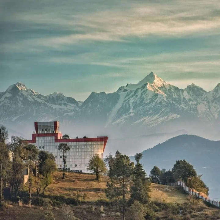
- The high Garhwal peaks—including Bandarpunch (6,316 m) and the Swargarohini massif—to the northeast
Local trekking operators describe the George Everest viewpoint as offering a wider Himalayan panorama than either Gun Hill or Lal Tibba.
Flora and Fauna of George Everest Peak
Flora — A Forest of Oak and Rhododendron
The trail to George Everest Peak passes through dense oak and rhododendron forest for the first three kilometres. The canopy keeps the route cooler than the exposed Mall Road by an estimated 3 to 4 degrees Celsius during afternoon hours.
| Species | Type |
|---|---|
| Ban Oak (Quercus incana) | Dominant tree species |
| Rhododendron (Rhododendron arboreum) | Flowering shrub—blooms March–April |
| Deodar (Cedrus deodara) | Coniferous |
| Pine | Coniferous |
Rhododendron Blooms
In March and April, rhododendron blooms make the trail particularly photogenic. The deep red flowers carpet the hillsides, creating a stunning contrast against the blue Himalayan sky.
Fauna
The forests around the trail support typical Himalayan wildlife, though sightings are rare due to the trail’s popularity and proximity to the town.
| Species | Status |
|---|---|
| Langur | Commonly seen |
| Himalayan Birds | Various species, including pheasants and laughingthrushes |
| Small Mammals | Occasional sightings |
Religious Beliefs and Sacred Sites
A Secular Heritage Site
Unlike many Himalayan destinations, George Everest Peak does not have a temple or shrine at its summit. The site is primarily a historic and heritage attraction, valued for its connection to the Great Trigonometrical Survey rather than its religious significance.
Nearby Sacred Sites
| Site | Distance | Significance |
|---|---|---|
| Surkanda Devi Temple | ~45 km | Ancient hilltop temple dedicated to Goddess Durga |
| Kempty Falls | ~15 km | Sacred water body, pilgrimage site |
| Lakshman Jhula | ~75 km | Iconic bridge over the Ganges, spiritual significance |
How to Reach George Everest Peak
Step 1: Reach Mussoorie
By Air — Nearest Airports
| Airport | Distance | Details |
|---|---|---|
| Jolly Grant Airport, Dehradun | ~60 km from Mussoorie | Connected to Delhi; flights available |
| Indira Gandhi International Airport, Delhi | ~273 km | Major international hub |
From Dehradun Airport:
- Hire a taxi to Mussoorie (approx. 1.5–2 hours)
By Train — Nearest Railway Stations
| Station | Distance | Details |
|---|---|---|
| Dehradun Railway Station | ~35 km from Mussoorie | Well-connected to Delhi and other cities |
| Rishikesh Railway Station | ~75 km | Alternative station |
From Dehradun to Mussoorie:
- Hire a taxi or take a bus (approx. 1–1.5 hours)
By Road
| Route | Distance | Travel Time |
|---|---|---|
| Delhi → Mussoorie | ~273–274 km | 4.5–5 hours |
| Dehradun → Mussoorie | ~35 km | 1–1.5 hours |
Step 2: Reach the Trailhead at Park Estate / Hathipaon
From Library Chowk (Mall Road), Mussoorie:
Important: The road to George Everest Peak passes through a restricted cantonment zone. Private vehicles may be stopped at the cantonment checkpoint. Carrying a valid photo ID is recommended.
The Trail
The trail begins at Park Estate, where a dirt path climbs steadily through oak and rhododendron forest before opening onto the exposed ridge that leads to the summit ruins.
Trail Details:
- Distance: 6 km round-trip from Park Estate
- Elevation Gain: Roughly 200 metres
- Time: 2.5–3.5 hours for average fitness
Trail Difficulty
The trail is moderate—suitable for novices as well as experienced hikers. There are no technical sections, but the trail does involve sustained elevation gain across loose stones in several stretches. The final kilometre is the steepest.
⚠️ Important: The trail has no signage for the final 1.5 km and shares a fork with a forest department fire track. First-time visitors should either hire a local guide (₹300–₹500 for a half-day) or download an offline GPX route, as mobile data signals are unreliable past the 2 km mark.
Distance from Major Cities
| City | Distance to George Everest Peak | Travel Time |
|---|---|---|
| Delhi | 273–274 km | 4.5–5 hours |
| Dehradun | ~35 km | 1–1.5 hours |
| Haridwar | ~90 km | 2.5–3 hours |
| Rishikesh | ~75 km | 2–2.5 hours |
| Chandigarh | ~200 km | 5–6 hours |
Weather and Best Time to Visit
Climate Overview
George Everest Peak experiences a temperate highland climate. The trail is accessible year-round except during heavy monsoon rains.
Seasonal Breakdown
Best Time to Visit by Season
| Season | Months | Suitability | Best For |
|---|---|---|---|
| Spring | March–May | ⭐ Best | Rhododendron blooms, clear skies, pleasant temperatures |
| Autumn | September–November | ⭐ Best | Post-monsoon clarity, golden forests, crisp air |
| Summer | June | ⭐ Good | Clear Himalayan views, warmer weather |
| Monsoon | July–August | ❌ Avoid | Slippery trails, unpredictable weather |
| Winter | December–February | ⭐ Moderate | Fewer crowds, cold weather |
Why Visit in Spring (March–May)
- Rhododendrons in full bloom
- Clear morning skies with excellent Himalayan views
- Pleasant temperatures
- Ideal for photography
Why Visit in Autumn (September–November)
- Post-monsoon clarity with crisp, clear air
- Golden forests
- Comfortable temperatures
- Excellent visibility of the Himalayan peaks
Why to Avoid Monsoon (July–August)
- Heavy rainfall makes trails slippery and dangerous
- Reduced visibility
- Trekking becomes difficult or impossible
Best Time of Day to Visit
| Time | Experience |
|---|---|
| Before 9:00 AM | Best for clear Himalayan views |
| Sunrise | Spectacular views of the Garhwal peaks |
| Late Morning | Haze and cloud cover may reduce visibility during pre-monsoon months |
What to Pack
Nearby Places to Visit
| Destination | Distance | Highlights |
|---|---|---|
| Mussoorie Mall Road | 6 km | Colonial charm, shopping, dining |
| Lal Tibba | ~6 km | Highest point in Mussoorie, Himalayan views |
| Kempty Falls | ~15 km | Popular waterfall, picnic spot |
| Cloud’s End | ~3 km | Heritage estate (1838), forest walks |
| Gun Hill | ~6 km | Second-highest point, ropeway, panoramic views |
| Company Garden | ~4 km | Botanical garden, rose collection |
| Happy Valley | ~5 km | Scenic valley in central Mussoorie |
| Surkanda Devi Temple | ~45 km | Ancient hilltop temple |
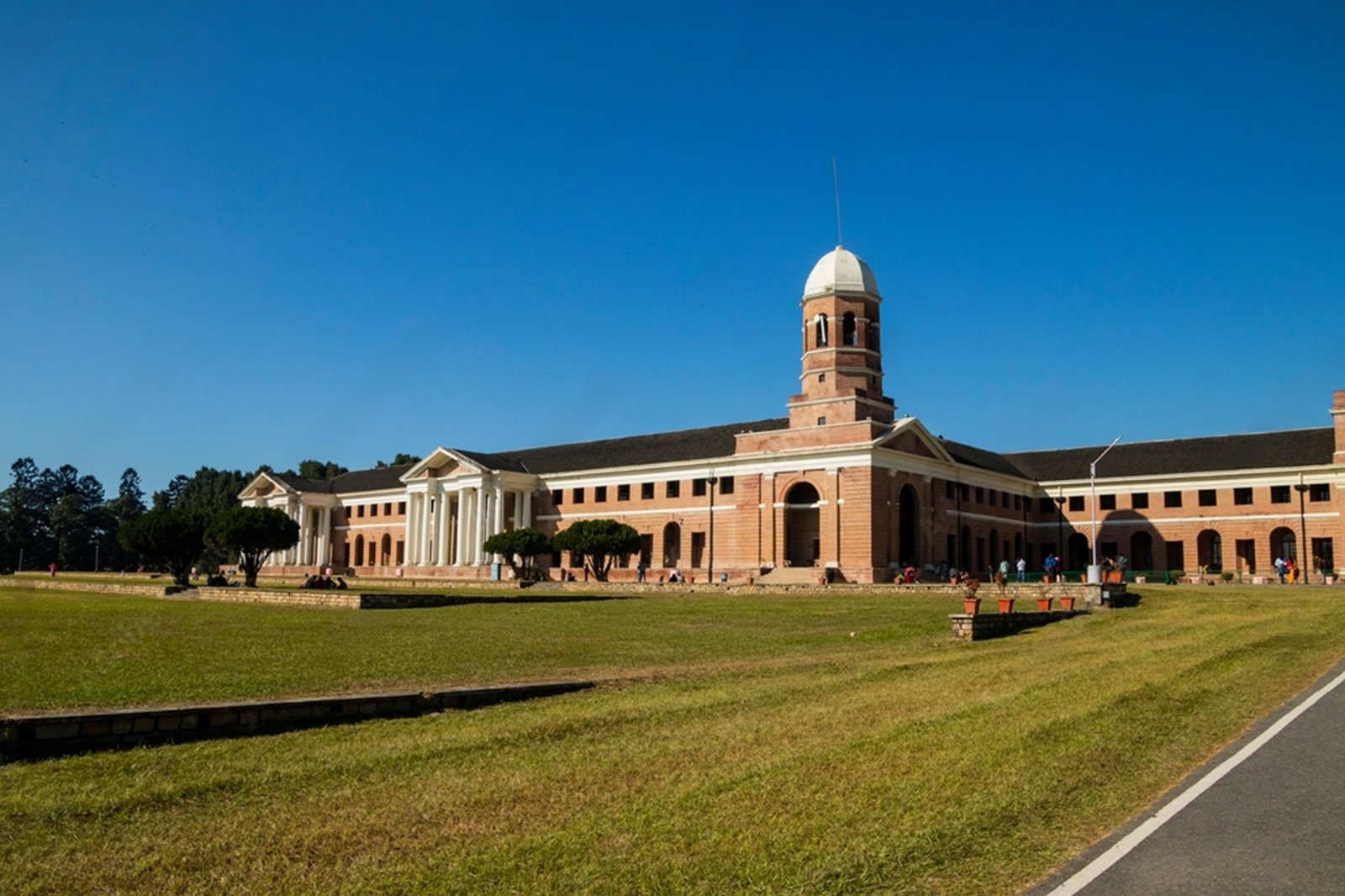
| Forest Research Institute | ~35 km | Historic institute in Dehradun |
| Rishikesh | ~75 km | Yoga capital, Ganga Aarti, adventure sports |
Things to Do at George Everest Peak
1. Trek to the Summit
The main attraction is the 6 km round-trip trek through oak and rhododendron forests to the summit ruins. The trail offers stunning views, historical ruins, and a sense of solitude that is rare in Mussoorie.
2. Explore the Historic Ruins
Visit the two stone structures—the residential bungalow and the laboratory—that remain from Sir George Everest’s 19th-century estate. Walk through the grounds and imagine the cartographic work that took place here.
3. Witness the Panoramic Himalayan Views
From the summit, enjoy a 270-degree panorama of the Doon Valley, Aglar River valley, and the high Garhwal peaks, including Bandarpunch (6,316 m) and Swargarohini.
4. Photography
From the rhododendron blooms in spring to the ruins and panoramic mountain views, George Everest Peak offers endless photography opportunities.
5. Birdwatching
The oak and rhododendron forests along the trail are home to various Himalayan bird species.
6. Picnic at the Summit
The broad, grassy summit plateau is an excellent spot for a picnic. Food stalls selling maggi and momos are available at the base of the climb.
7. Camping
Camp George Everest offers a unique camping experience near the trek’s starting point.
8. Heritage Walk
Combine your trek with a visit to the nearby Cloud’s End estate for a full colonial heritage experience.
Accommodation Options
Travel Tip: Camp George Everest provides a unique camping experience near the trek’s starting point, allowing trekkers to immerse themselves in the serene environment and embark on the trek early.
Local Cuisine — A Taste of Mussoorie
Must-Try Dishes
| Dish | Description |
|---|---|
| Maggi & Momos | Available at stalls near the base of the climb |
| Kafuli | Traditional Garhwali spinach and fenugreek curry |
| Phanu | Lentil-based dish, a Garhwali speciality |
| Aloo Ke Gutke | Spiced fried potatoes, a Kumaoni speciality |
| Bal Mithai | Famous chocolate-like sweet from Kumaon |
Where to Eat
- Everest Cafe: Located 400 metres from George Everest House and 500 metres before the Peak, offering delicious snacks and meals
- Food stalls at the base: Maggi, momos, and snacks
- Mall Road, Mussoorie: Wide range of restaurants and cafes
Frequently Asked Questions (FAQs)
General Questions
Q1: What is George Everest Peak famous for?
A: George Everest Peak is famous for being the site of the ruins of Sir George Everest’s 19th-century estate, where the Surveyor General of India conducted the Great Trigonometrical Survey that led to the calculation of Mount Everest’s height.
Q2: What is the altitude of George Everest Peak?
A: The peak sits at approximately 2,060–2,290 metres (6,760–7,513 feet) above sea level.
Q3: How long is the George Everest Peak trek?
A: The trek is approximately 6 km round-trip from Park Estate / Hathipaon. From Library Bus Stand, the full round-trip is approximately 12 km.
Q4: How long does the trek take?
A: The trek takes 2.5 to 5 hours depending on pace and photo stops.
Q5: What is the best time to visit George Everest Peak?
A: The best time to visit is from March to May (spring) and September to November (autumn).
Q6: Is there an entry fee?
A: Yes, the Archaeological Survey of India charges a nominal ₹25 entry fee at the estate ruins.
Q7: Do I need a permit to visit George Everest Peak?
A: No permits are required as of March 2026. However, the road passes through a restricted cantonment zone, and carrying a valid photo ID is recommended.
Q8: Is the trail difficult?
A: The trail is moderate—suitable for novices as well as experienced hikers. There are no technical sections, but the trail involves sustained elevation gain across loose stones.
Q9: Do I need a guide for the trek?
A: A guide is not mandatory, but the trail is unmarked in several sections. First-time visitors are advised to hire a local guide (₹300–₹500 for a half-day).
Q10: Is mobile connectivity available on the trail?
A: Mobile data signals are unreliable past the 2 km mark. Download an offline GPX route before departure.
Q11: What should I wear for the trek?
A: Wear comfortable trekking clothes and sturdy trekking shoes with good grip. Carry a warm jacket for the summit.
Q12: Are there food options on the trail?
A: Yes, food stalls selling maggi and momos are available at the base of the climb. Everest Cafe is located on the trail.
Q13: What is the distance between Delhi and George Everest Peak?
A: The driving distance is approximately 273–274 km, taking about 4.5–5 hours.
Q14: What is the nearest railway station?
A: The nearest railway station is Dehradun Railway Station, approximately 35 km from Mussoorie.
Q15: What is the nearest airport?
A: The nearest airport is Jolly Grant Airport, Dehradun, approximately 60 km from Mussoorie.
Q16: Is George Everest Peak crowded?
A: No, fewer than 200 visitors per day reach the peak on a typical spring weekend—a striking contrast to the crowds on Mall Road.
Q17: What can I see from the summit?
A: On clear days, the summit offers panoramic views of the Doon Valley, Aglar River valley, Bandarpunch (6,316 m), and the Swargarohini massif.
Q18: Is the trek suitable for beginners?
A: Yes, the trail is suitable for beginners with a basic fitness level. The gradient is moderate, and there are no technical sections.
Why Choose Discover Uttarakhand for Your George Everest Peak Journey?
At Discover Uttarakhand, we’ve been organising unforgettable Himalayan journeys since 1997. As a trusted local operator with deep knowledge of the Garhwal region and its hidden gems, we offer:
✅ Customised Mussoorie and heritage tour packages (2 to 5 days)
✅ Combined itineraries covering George Everest Peak, Mussoorie, Dehradun, and Rishikesh
✅ Comfortable transport with experienced hill drivers
✅ Verified accommodations in Mussoorie (budget to luxury)
✅ Local guides for heritage walks and treks
✅ 24/7 customer support throughout your journey
Recommended Mussoorie Packages
| Package | Duration | Starting Point | Highlights |
|---|---|---|---|
| George Everest Heritage Trek | 1 Day | Mussoorie | George Everest Peak trek, historic ruins, panoramic Himalayan views |
| Mussoorie Heritage & Nature Escape | 2 Nights / 3 Days | Dehradun | George Everest Peak, Cloud’s End, Lal Tibba, Mall Road |
| Mussoorie & Dehradun Explorer | 3 Nights / 4 Days | Delhi | George Everest Peak, Mussoorie, Forest Research Institute, Rishikesh |
| Garhwal Heritage & Wildlife Tour | 4 Nights / 5 Days | Delhi | George Everest Peak, Rajaji National Park, Rishikesh, Dehradun |
📞 Call / WhatsApp: +91-9997187178, 9760222178, 8171977178
📍 Visit Our Office: Himalayan Colony, opposite DSVV, Haripur Kalan, Haridwar, Motichur Range, Uttarakhand 249411
🌐 Website: www.discover-uttarakhand.com
📧 Email: info@discover-uttarakhand.com
Discover Uttarakhand – Your Local Partner for Unforgettable Himalayan Journeys Since 1997 🏔️