Overview: The Snowy Paradise of Garhwal
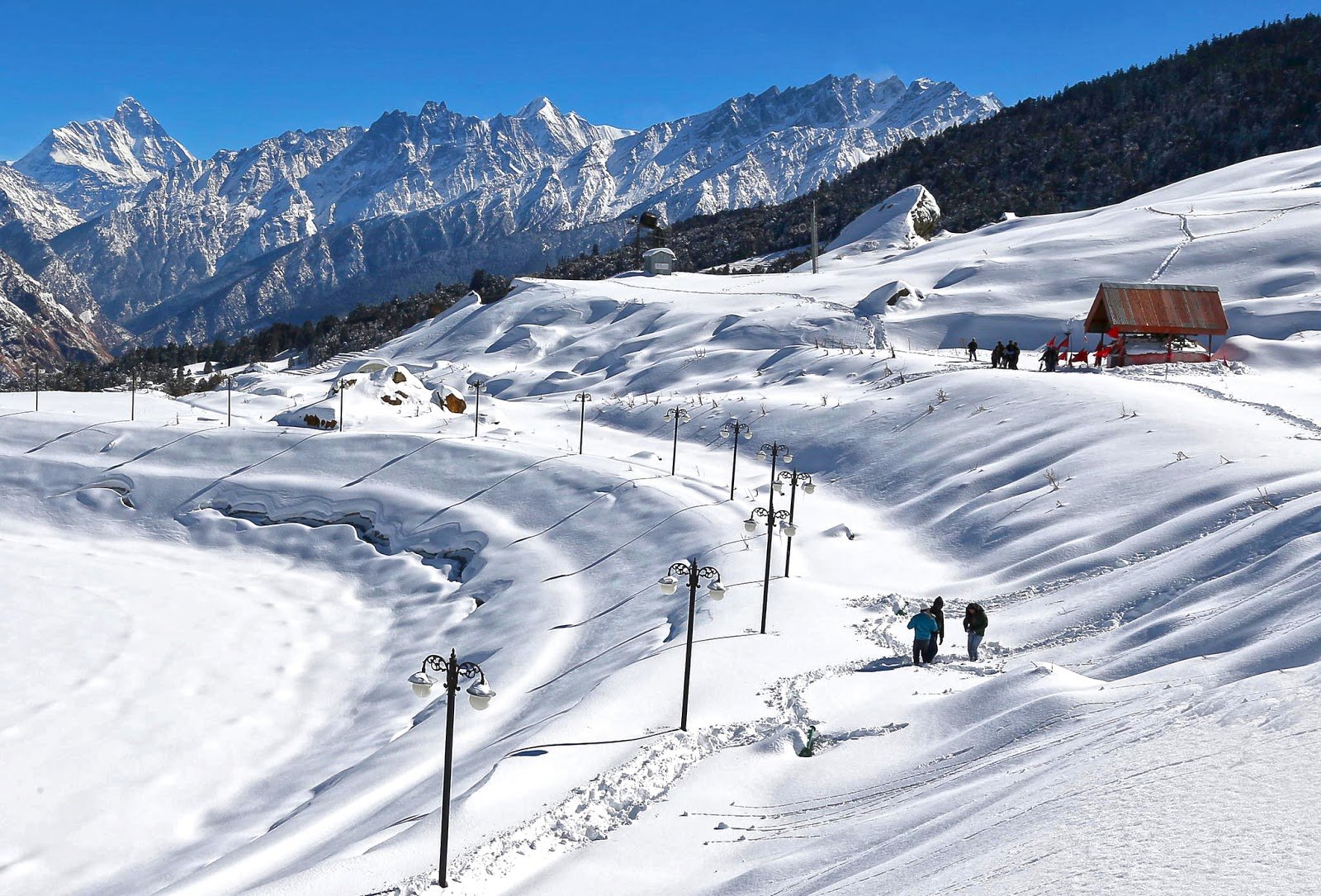
Kedarkantha is not just a trek; it is a journey into a winter wonderland that captivates the soul. Located in the Uttarkashi district of Uttarakhand, this stunning peak is one of India’s most popular and accessible winter treks, offering a perfect blend of adventure, spirituality, and natural beauty.
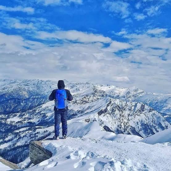
At an elevation of 3,810 metres (12,500 feet), Kedarkantha is nestled within the Govind Wildlife Sanctuary and National Park. The trek takes you through dense deodar, oak, and rhododendron forests, across frozen lakes, and finally to a breathtaking summit that offers panoramic views of some of the highest peaks in the Garhwal Himalayas.
What makes Kedarkantha truly special is its year-round appeal. While it is famous as a winter trek with guaranteed snow from December to April, it is equally rewarding in spring, summer, and autumn, when the meadows burst into colour, and the skies are crystal clear.
Whether you are a first-time trekker seeking an easy-to-moderate challenge, or an experienced adventurer looking for a quick weekend getaway from Delhi, Kedarkantha promises an experience that stays with you forever.
Key Information at a Glance
| Aspect | Details |
|---|---|
| Location | Uttarkashi district, Garhwal Himalayas, Uttarakhand |
| Altitude | 3,810 m (12,500 ft) |
| Trek Distance | 20–23 km (round trip) |
| Trek Duration | 4–6 Days |
| Difficulty | Easy to Moderate |
| Base Camp | Sankri Village (1,950 m / 6,400 ft) |
| Best Time to Visit | December–April (Snow); April–June & September–November (Clear Views) |
| Nearest Airport | Jolly Grant Airport, Dehradun (~200 km) |
| Nearest Railway Station | Dehradun Railway Station (~200 km) |
| Temperature | Day: 8°C to 15°C; Night: -5°C to -10°C |
| Entry Fee | ~₹600 (Forest permit) |
| Famous For | Snow-covered landscapes, sunrise views, 360° Himalayan panorama |
History and Mythology of Kedarkantha
The Legend of Bhasmasura
The mythological story of Kedarkantha goes back many years. According to legend, there was a demon named Bhasmasura who wanted to rule the world. Through severe penance, he pleased Lord Shiva and received a boon that anyone whose head he touched would turn to ashes. Drunk with power, Bhasmasura decided to test his boon on Shiva himself.
Lord Shiva fled and took refuge in the Garhwal Himalayas. As the demon chased him, Shiva transformed himself and hid in the mountains. The temple was created up to the neck of Lord Shiva; hence, this peak is known as Kedarkantha. The name “Kedar” is associated with Shiva, making this peak a lesser-known but significant Shiva shrine.
The Pandava Connection and Swargarohini
The mythology also goes back to the time of the Mahabharata. The Swargarohini massif, visible from the Kedarkantha summit, derives its name from the legend that it forms the path to heaven that was followed by the Pandavas. According to the epic, only one Pandava, Yudhishthira, and a dog reached heaven.
The peak is dedicated to Sadashiv, the invisible form of Shiva, who is said to have fled from the Pandavas and taken refuge here in the form of a buffalo.
A Sacred Summit
At the top of Kedarkantha, there is a small shrine dedicated to Lord Shiva, framed by snow-covered mountains. A small temple at the peak houses a statue of Lord Ganesha in summer. Locals visit the summit regularly to pay their respects at this sacred sanctum, making the trek as spiritually significant as it is adventurous.
Geography of Kedarkantha
Location and Topography
Kedarkantha is located within the Govind Wildlife Sanctuary and National Park in the Uttarkashi district of Uttarakhand. The base camp is Sankri Village, a picturesque settlement at an elevation of 1,950 metres (6,400 feet).
| Feature | Details |
|---|---|
| Coordinates | Approx. 31.0°N, 78.3°E |
| Max Altitude | 3,810 m (12,500 ft) |
| Base Camp Altitude | 1,950 m (6,400 ft) |
| Govind Wildlife Sanctuary | Part of the trek route |
The Trail and Terrain
The Kedarkantha trek is approximately 20 kilometres round trip. The trail takes you through:
- Dense Forests: Deodar, oak, pine, and rhododendron forests
- Alpine Meadows: Picturesque grasslands that burst into colour in spring
- High-Altitude Lakes: Juda Ka Talab (frozen in winter) is a stunning campsite
- Glacial Terrain: The final ascent to the summit
Key Campsites:
| Campsite | Altitude | Highlights |
|---|---|---|
| Sankri | 1,950 m (6,400 ft) | Base camp, scenic village |
| Juda Ka Talab | ~2,773 m (9,100 ft) | Frozen lake, picturesque campsite |
| Kedarkantha Base Camp | ~3,413 m (11,200 ft) | Final camp before the summit |
| Hargaon | ~2,700 m (8,850 ft) | Alternative descent route |
The Summit Panorama
From the summit, trekkers are rewarded with a 360-degree panoramic view of some of the most iconic Himalayan peaks:
| Peak | Details |
|---|---|
| Swargarohini | The legendary path to heaven |
| Bandarpoonch (Banderpooch) | Prominent Garhwal peak |
| Black Peak (Kalanag) | A striking Himalayan peak |
| Ranglana | Visible from the summit |
| Gangotri Group | Source of the Ganges |
| Yamunotri Group | Source of the Yamuna |
Flora and Fauna of Kedarkantha
Flora — A Botanical Paradise
Kedarkantha lies within the Govind Wildlife Sanctuary, making it a treasure trove of Himalayan biodiversity.
Lower Altitude Forests (Sankri to Juda Ka Talab – 6,400 to 9,000 ft):
- Chir Pine — common in the lower reaches
- Oak — dense forests providing shade and beauty
Mid-Altitude Forests (Juda Ka Talab to Kedarkantha Base – 9,000 to 11,000 ft):
- Deodar — towering Himalayan cedars
- Rhododendron — vibrant red blooms in spring
- Fir and Spruce — adding to the biodiversity
Alpine Meadows:
- The meadows are filled with a variety of wildflowers in spring and summer
- The rhododendron trees burst into colour, creating a stunning landscape
Fauna — Wildlife in the Sanctuary
The Govind Wildlife Sanctuary is home to a variety of Himalayan wildlife:
Mammals:
- Snow Leopard — the elusive apex predator
- Himalayan Black Bear — occasionally spotted in the forests
- Musk Deer — rare and shy
- Bharal (Blue Sheep) — found in higher altitudes
- Himalayan Tahr — a mountain goat-antelope
Birds:
- Himalayan Monal — the colourful state bird of Uttarakhand
- Golden Eagle — soaring above the peaks
- Black Eagle — majestic birds of prey
Religious Beliefs and Sacred Sites
The Shiva Shrine at the Summit
At the summit of Kedarkantha, there is a small shrine dedicated to Lord Shiva. Locals visit the top regularly to pay their respects at this sanctum. During the summer months, a small temple at the peak houses a statue of Lord Ganesha.
The Kedarkantha Temple
The peak is named Kedarkantha, which translates to the “Throat of Shiva” or the “Lord of the Peak”. The shrine is dedicated to Sadashiv, the invisible form of Shiva.
The Swargarohini Connection
The Swargarohini massif visible from the summit holds immense mythological significance as the path to heaven followed by the Pandavas. This adds a profound spiritual dimension to the trek.
How to Reach Kedarkantha
Step 1: Reach Sankri (The Base Camp)
The base camp for the Kedarkantha trek is Sankri Village, approximately 200 kilometres from Dehradun.
By Air — Nearest Airports
| Airport | Distance | Details |
|---|---|---|
| Jolly Grant Airport, Dehradun | ~200 km to Sankri | Nearest airport; connected to Delhi |
| Indira Gandhi International Airport, Delhi | ~430 km to Sankri | Major international hub |
From Dehradun Airport:
- Hire a taxi or take a shared cab to Sankri (approx. 8–10 hours)
By Train — Nearest Railway Stations
| Station | Distance | Details |
|---|---|---|
| Dehradun Railway Station | ~200 km to Sankri | Well-connected to Delhi and other cities |
| Rishikesh Railway Station | ~220 km to Sankri | Alternative station |
From Dehradun/Rishikesh:
- Hire a taxi or take a bus to Sankri
- Regular transportation is available from Dehradun to Purola, a village located approximately 54 kilometres from Sankri
By Road (Most Popular)
| Route | Distance | Travel Time |
|---|---|---|
| Delhi → Sankri | ~430–452 km | 10–12 hours |
| Dehradun → Sankri | ~200–220 km | 8–10 hours |
| Rishikesh → Sankri | ~220 km | 8–10 hours |
Route from Delhi:
Delhi → Haridwar → Rishikesh → Dehradun → Mussoorie → Nowgaon → Purola → Mori → Netwar → Sankri
Transport Options:
- Private Taxi: Most convenient and flexible
- Shared Jeep: Available from Dehradun to Sankri
- State Transport Buses: Buses available from Dehradun and Rishikesh
En Route Highlights:
- Scenic drive through Mussoorie, Purola, and Mori
- Views of Bandarpoonch, Swargarohini, Kala Nag, and Ranglana peaks
- Picturesque villages like Damta and Netwar
Distance from Major Cities
| City | Distance to Sankri | Travel Time |
|---|---|---|
| Delhi | ~430–452 km | 10–12 hours |
| Dehradun | ~200–220 km | 8–10 hours |
| Rishikesh | ~220 km | 8–10 hours |
| Haridwar | ~240 km | 9–10 hours |
| Chandigarh | ~350 km | 10–12 hours |
Weather and Best Time to Visit
Climate Overview
Kedarkantha experiences a high-altitude alpine climate with extreme temperature variations. The trek is accessible throughout the year, with each season offering a unique experience.
Seasonal Breakdown
| Season | Months | Temperature | Conditions | Suitability |
|---|---|---|---|---|
| Winter (Peak) | December–April | Day: 8–12°C; Night: -5°C to -10°C | Heavy snowfall, frozen landscapes | ⭐ Best (Snow Lovers) |
| Spring | April–June | Day: 10–17°C; Night: 0–6°C | Snow melting, rhododendron blooms | ⭐ Best (Wildflowers) |
| Monsoon | July–August | Variable | Heavy rainfall, leeches | ❌ Avoid |
| Autumn | September–November | Day: 10–16°C; Night: 0–5°C | Clear skies, stable weather | ⭐ Best (Beginners) |
Best Time to Visit by Season
| Season | Months | Suitability | Highlights |
|---|---|---|---|
| Winter | December–February | ⭐ Best | Guaranteed snow, magical landscapes |
| Late Winter | March–April | ⭐ Best | Snow with sunshine, spring awakening |
| Spring/Summer | April–June | ⭐ Best | Mild weather, rhododendron blooms, clear trails |
| Autumn | September–November | ⭐ Best | Crystal clear skies, no extreme cold |
| Monsoon | July–August | ❌ Avoid | Rain, leeches, restricted views |
Why Visit in Winter (December–April)
- Guaranteed snow from December to April
- The landscape turns into a pure white wonderland
- Magical experience of camping on snow
- The frozen Juda Ka Talab lake is a spectacular sight
Why Visit in Spring/Summer (April–June)
- Snow melts partially, revealing beautiful meadows
- Rhododendron trees bloom, painting the hillsides red
- Pleasant weather with temperatures ranging from 6°C to 17°C
- Dry trails and comfortable trekking
Why Visit in Autumn (September–November)
- Crystal clear skies with no extreme cold
- Perfect for beginners
- Excellent visibility of the Himalayan peaks
- Stable weather conditions
Why Avoid the Monsoon (July–August)
- Heavy rainfall makes trails slippery
- Leeches are common during this season
- Restricted views due to cloud cover
Packing Guide
| Category | Items |
|---|---|
| Clothing | Thermal wear, fleece, insulated jacket, waterproof shell, comfortable trekking pants |
| Footwear | Sturdy waterproof trekking shoes, warm socks |
| Accessories | Gloves, woollen cap, scarf, sunglasses, sunscreen |
| Gear | Backpack (50–60L), sleeping bag (-5°C rating), trekking poles, headlamp |
| Essentials | Water bottle, water purifier, snacks (energy bars, dry fruits), personal medication |
| Documents | Valid ID proof |
The Kedarkantha Trek: A Step-by-Step Guide
Trek Overview
| Detail | Information |
|---|---|
| Total Distance | 20–23 km round trip |
| Duration | 4–6 days |
| Difficulty | Easy to Moderate |
| Walking Hours | 4–6 hours per day (Summit day: 8–9 hours) |
Day-by-Day Itinerary (5 Days / 4 Nights)
Day 1: Delhi/Dehradun to Sankri
- Distance: 200–220 km drive
- Travel Time: 8–10 hours
- Highlights: Scenic drive through Mussoorie, Purola, and Mori
- Overnight: Homestay or hotel in Sankri
Day 2: Sankri to Juda Ka Talab (4–5 km)
- Trek Time: 3–4 hours
- Altitude: 6,400 ft to 9,100 ft
- Highlights: Dense deodar forests, first glimpses of the Himalayas
- Overnight: Camp at Juda Ka Talab
Day 3: Juda Ka Talab to Kedarkantha Base Camp (3 km)
- Trek Time: 3–4 hours
- Altitude: 9,100 ft to 11,200 ft
- Highlights: Alpine meadows, views of Swargarohini and Bandarpoonch
- Overnight: Camp at Kedarkantha Base Camp
Day 4: Base Camp to Kedarkantha Summit & Descend to Hargaon
- Trek Time: 7–9 hours
- Altitude Gain: 11,200 ft to 12,500 ft
- Highlights: Sunrise at the summit, 360° panoramic views
- Descent: To Hargaon (2,700 m / 8,850 ft)
- Overnight: Camp at Hargaon
Day 5: Hargaon to Sankri & Drive to Dehradun
- Trek Time: 3–4 hours
- Drive Time: 8–10 hours
- Highlights: Descend through beautiful forests
- End of Trek: Return to Dehradun/Delhi
Summit Day: The Climb to the Top
The summit climb is the highlight of the trek. Trekkers typically start early in the morning (around 2–3 AM) to catch the sunrise from the top. The final ascent is steep but rewarding, and the view from the summit is unparalleled.
What You See from the Top:
- Swargarohini — the legendary path to heaven
- Bandarpoonch — a majestic Garhwal peak
- Black Peak (Kalanag) — striking and prominent
- Ranglana — visible from the summit
- Gangotri and Yamunotri ranges — the sources of the Ganges and Yamuna
Nearby Places to Visit
| Destination | Distance from Sankri | Highlights |
|---|---|---|
| Juda Ka Talab | On the trek | High-altitude frozen lake, stunning campsite |
| Khujey | Near Sankri | Scenic spot |
| Kotgaon | Near the trail | Tiny hamlet in the hills |
| Har Ki Dun | ~30 km | Valley of Gods, ancient Pandava trail |
| Govind Pashu Vihar National Park | Within the region | Snow leopards, musk deer, pristine forests |
| Mussoorie | ~100 km | Queen of Hills, Mall Road, Kempty Falls |
| Netwar | Near Sankri | Entry gate to Govind National Park |
| Mori | ~40 km | Scenic town on the Tons River |
Accommodation Options
| Type | Location | Features | Price Range |
|---|---|---|---|
| Homestays | Sankri | Basic amenities, local hospitality | ₹500–₹1,500 |
| Camps | On the trail | Tents with basic facilities | Included in trek package |
| Hotels | Sankri | Comfortable stays | ₹1,500–₹3,000 |
| Forest Rest Houses | Govind Sanctuary | Basic accommodation | ₹500–₹1,500 |
Travel Tip: Most trek packages include accommodation in tents, while homestays are available in Sankri for the first and last nights.
Local Cuisine — A Taste of Garhwal
The food on the Kedarkantha trek is simple, nutritious, and mostly vegetarian.
What to Expect
| Meal | Description |
|---|---|
| Breakfast | Porridge, eggs, bread, tea/coffee |
| Lunch | Packed lunch (sandwiches, fruits, snacks) |
| Dinner | Dal, rice, roti, sabzi, soup |
| Snacks | Maggi, biscuits, energy bars |
Where to Eat:
- Trek Packages: Most packages include all meals during the trek
- Sankri: Simple meals at homestays and local eateries
- Local Favourites: Try authentic Garhwali dishes like Kafuli and Phanu
Frequently Asked Questions (FAQs)
General Questions
Q1: Where is Kedarkantha located?
Kedarkantha is located in the Uttarkashi district of Uttarakhand, within the Govind Wildlife Sanctuary and National Park.
Q2: What is the altitude of Kedarkantha?
Kedarkantha sits at an elevation of 3,810 metres (12,500 feet) above sea level.
Q3: What is the best time to visit Kedarkantha?
The best time depends on your preference:
- For snow: December to April
- For clear views and mild weather: April to June and September to November
- Avoid: July to August (monsoon)
Q4: Is Kedarkantha a difficult trek?
Kedarkantha is rated easy to moderate. It is suitable for first-time trekkers and families, though a basic level of fitness is recommended.
Q5: How long is the Kedarkantha trek?
The total trek distance is approximately 20–23 kilometres round trip. The trek typically takes 4 to 6 days to complete.
Q6: What is the temperature on the Kedarkantha trek?
Temperatures vary by season:
- Day: 8°C to 15°C
- Night: -5°C to -10°C
- In winter, temperatures can drop to -10°C
Q7: Is Kedarkantha open all year?
Yes, the trek is open throughout the year. However, the monsoon season (July–August) is not recommended due to heavy rain and leeches.
Q8: What peaks can I see from the Kedarkantha summit?
From the summit, you can see a 360-degree panorama of peaks including Swargarohini, Bandarpoonch, Black Peak (Kalanag), Ranglana, and the Gangotri and Yamunotri ranges.
Q9: Do I need a permit for the Kedarkantha trek?
Yes, since the trek passes through the Govind Wildlife Sanctuary, a forest entry permit is required. The fee is approximately ₹600. Most trek operators arrange this on your behalf.
Q10: Is there mobile connectivity on the trek?
Mobile connectivity is limited on the trek. BSNL tends to have the best coverage in the region, but it is not reliable.
Q11: Are there ATMs near the trek?
ATMs are available in Dehradun and Sankri. It is advisable to carry sufficient cash for the entire trip.
Q12: What is the local language spoken in the region?
The official language is Hindi. The regional language is Garhwali. English is understood in tourist areas.
Travel Logistics
Q13: How can I reach Kedarkantha from Delhi?
You can reach Kedarkantha by:
- Road: Drive from Delhi to Sankri (~430–452 km, 10–12 hours)
- Train: Take a train to Dehradun (~200 km from Sankri), then a taxi/bus
- Air: Fly to Jolly Grant Airport, Dehradun (~200 km from Sankri), then a taxi/bus
Q14: What is the distance between Delhi and Kedarkantha?
The distance from Delhi to Sankri (the base camp) is approximately 430–452 km.
Q15: What is the nearest railway station to Kedarkantha?
The nearest railway station is Dehradun Railway Station, approximately 200 km from Sankri.
Q16: What is the nearest airport to Kedarkantha?
The nearest airport is Jolly Grant Airport, Dehradun, approximately 200 km from Sankri.
Q17: How can I book a Kedarkantha trek?
Trek packages can be booked through:
- Local tour operators in Rishikesh, Dehradun, and Sankri
- Trekking agencies specialising in Himalayan treks
- Discover Uttarakhand for customised trekking packages
Practical Information
Q18: What should I pack for the Kedarkantha trek?
Pack thermal wear, a fleece jacket, an insulated jacket, waterproof trekking shoes, warm socks, gloves, a woollen cap, sunscreen, sunglasses, a headlamp, a sleeping bag, and personal medication.
Q19: What is the food like on the trek?
The food is simple, vegetarian, and nutritious, including dal, rice, roti, sabzi, soup, and snacks. Most trek packages include all meals.
Q20: Is camping allowed on the trek?
Yes, camping is allowed at designated campsites like Juda Ka Talab and Kedarkantha Base Camp. Most trek packages include tented accommodation.
Q21: Can I do the Kedarkantha trek solo?
While it is possible to trek solo, it is recommended to join a group or hire a local guide for safety, as the terrain is remote and weather can change rapidly.
Q22: What is the water availability on the trek?
Water sources are available along the trail, but it is advisable to carry a water bottle and a water purifier. In winter, streams may be frozen.
Plan Your Kedarkantha Trek with Discover Uttarakhand
At Discover Uttarakhand, we’ve been organising unforgettable Himalayan journeys since 1997. As a trusted local operator with deep knowledge of the Garhwal region and its stunning treks, we offer:
✅ Customised Kedarkantha trek packages (4 to 6 days)
✅ Combined itineraries with Har Ki Dun, Kedarkantha, and other Garhwal treks
✅ Experienced local guides and porters
✅ Comfortable transport with experienced hill drivers
✅ All necessary permits and arrangements
✅ Quality camping equipment and nutritious meals
✅ 24/7 customer support throughout your journey
Recommended Kedarkantha Packages
| Package | Duration | Starting Point | Highlights |
|---|---|---|---|
| Kedarkantha Winter Trek | 4 Nights / 5 Days | Dehradun | Snow landscapes, frozen Juda Ka Talab, summit sunrise |
| Kedarkantha & Har Ki Dun | 6 Nights / 7 Days | Dehradun | Two iconic Garhwal treks, Valley of Gods |
| Garhwal Himalayan Circuit | 8 Nights / 9 Days | Delhi | Kedarkantha, Har Ki Dun, Kedarkantha Base Camp |
📞 Call / WhatsApp: +91-9997187178, 9760222178, 8171977178
📍 Visit Our Office: Himalayan Colony, opposite DSVV, Haripur Kalan, Haridwar, Motichur Range, Uttarakhand 249411
🌐 Website: www.discover-uttarakhand.com
📧 Email: info@discover-uttarakhand.com
Discover Uttarakhand – Your Local Partner for Unforgettable Himalayan Journeys Since 1997 🏔️