Overview
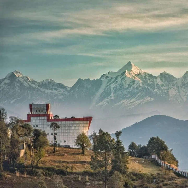
The Lord Curzon Trail, popularly known as the Kuari Pass Trek, is one of the most iconic trekking routes in the Indian Himalayas. Often referred to as the “Trekking Paradise of Garhwal,” this legendary trail in the Chamoli district of Uttarakhand offers a breathtaking 180-degree view of some of the world’s highest peaks, including Nanda Devi, Kamet, Dronagiri, Trishul, and Chaukhamba.
The trail gets its name from Lord Curzon, the then Viceroy of India, who trekked this route in 1905 to explore the upper limits of the Indian Himalayas. Since then, the route has been known as the Curzon Trail or Lord Curzon Trek.
The pass itself is called Kuari Pass, with “Kuari” meaning “virgin” in Hindi — a name bestowed by Lord Curzon himself when he discovered that the locals had no name for this pristine, unexplored area.
Situated at an altitude of approximately 3,800–4,264 metres (12,500–14,000 feet), the Kuari Pass lies on the shoulder of a high ridge overlooking the confluence of the Alaknanda and Dhauli Ganga Rivers. The trek begins from Joshimath or the nearby village of Dhak and passes through dense forests, charming villages, and emerald bugyals (alpine meadows).
Unlike many treks where views appear only at the summit, the Kuari Pass trek keeps the Himalayan skyline in sight for most days, making it a favourite among beginners and seasoned trekkers alike. Whether you are drawn by its rich history, its unparalleled mountain views, or the simple desire to walk in the footsteps of a viceroy, the Lord Curzon Trail promises an experience that stays with you forever.
Key Information at a Glance
History of the Lord Curzon Trail
The Legendary 1905 Expedition
In 1905, Lord Curzon, the then Viceroy of India, decided to explore the upper limits of the Indian Himalayas. Accompanied by a party of explorers, porters, and guides, he ventured deep into the Garhwal Himalayas to explore and map uncharted territories.
During his expedition, Curzon came across an area that captured his imagination. When he asked the local villagers what the area was called, they replied, “We don’t know what it’s called, Sahab. No one goes there!”. Lord Curzon, intrigued by the unexplored nature of the region, asked for the Hindi word for “virgin.” When told it was “Kuari,” he named the pass Kuari Pass.
The trail was improved especially for Lord Curzon’s trekking expedition, and since then, the route has been famous as the Lord Curzon Trail or Curzon’s Trail.
The Golden Age of Himalayan Exploration
The Kuari Pass finds mention in some of the most well-known accounts of mountain exploration of the 20th century. Legendary mountaineers like Eric Shipton (Nanda Devi), Bill Tilman (The Ascent of Nanda Devi), and Frank Smythe (The Valley of Flowers) all used this route in their pioneering explorations of the region.
Before the motorable road from Rishikesh to Joshimath was completed in the 1960s, the shortest way to access the Alaknanda Valley and Badrinath was via the Kuari Pass trail. This made the Kuari Pass a vital route for pilgrims, traders, and explorers for centuries.
The Ancient Trade and Pilgrimage Route
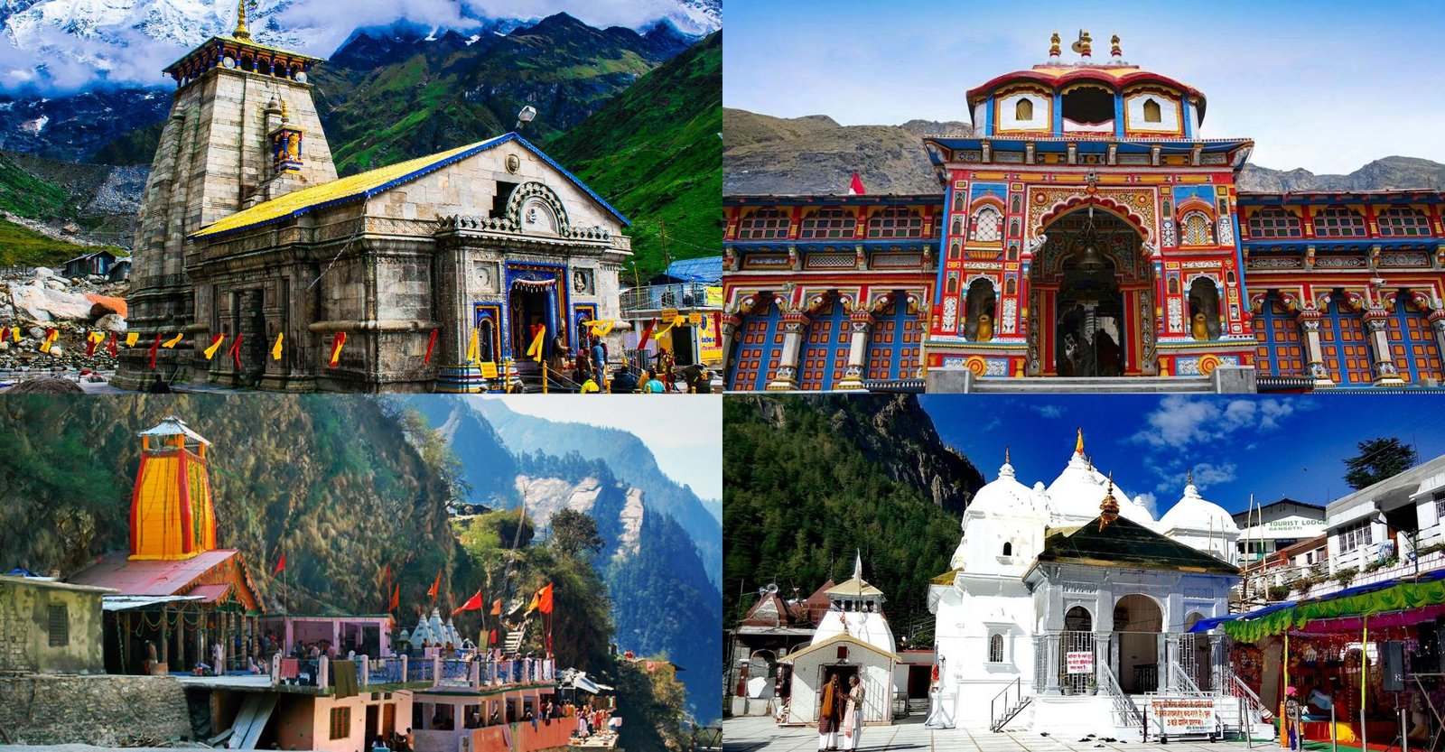
The Kuari Pass has been a route for the Kedarnath Yatra, regarded as an auspicious religious journey, and a corridor for trans-Himalayan trade. The region is characterized by a multitude of ancient temples that bear the signs of a harmonious blend of Hindu and Tibetan Buddhist traditions.
Geography of the Lord Curzon Trail
Location and Topography
The Lord Curzon Trail is located in the Chamoli district of Uttarakhand, in the heart of the Garhwal Himalayas. The Kuari Pass is situated on the shoulder of a high ridge overlooking the confluence of the Alaknanda and Dhauli Ganga Rivers.
The Route
The trek begins from Joshimath (6,150 ft), which serves as the base camp, and passes through nearby villages such as Dhak, Tugasi, Guling, and Khullara. The traditional route, once travelled by Lord Curzon, passes through the gentle meadows of Auli at 2,450 metres before ascending to Khullara, situated at 3,225 metres.
Notable Campsites and Landmarks:
Flora and Fauna of the Trail
Flora — A Botanical Paradise
The Lord Curzon Trail passes through pristine Rhododendron, Oak, and Deodar forests. The changing seasons paint the landscape in a spectrum of colours.
Dominant Tree Species:
- Rhododendron — fiery red flowers in spring
- Oak (Quercus) — dense forests along the trail
- Deodar (Cedrus deodara) — the Himalayan cedar
- Pine — found in the lower reaches
- Maple — golden hues in autumn
- Walnut — found near campsites like Akhrotghetta
Alpine Meadows (Bugyals):
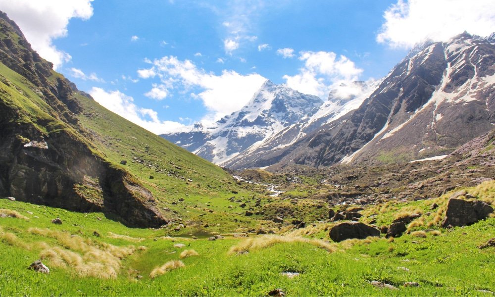
The trail is famous for its bugyals — lush Himalayan meadows that locals call by this name. Gorson Bugyal is one of the most spectacular, transforming from flower blossoms in summer to a snowy winter cover. Tali Lake adds to the scenic beauty, with its clear waters mirroring the peaks.
Fauna — Wildlife in the Wilderness
The Kuari Pass lies near the Nanda Devi Biosphere Reserve and the Nanda Devi National Park, making it rich in wildlife.
Mammals:
- Snow Leopard — the elusive apex predator
- Himalayan Black Bear — occasionally spotted
- Musk Deer — rare and shy
- Bharal (Blue Sheep) — found in higher altitudes
- Leopard — pugmarks can be seen on the trail
Birds:
- Himalayan Monal — the colourful state bird of Uttarakhand
- Golden Eagle — soaring above the peaks
- Various pheasant species
Religious Beliefs and Sacred Sites
The Mythological Connection
According to local legend, the Kuari Pass is associated with the epic Mahabharata, where it is believed to be the path taken by the Pandavas on their final journey to heaven. This sacred connection adds a profound spiritual dimension to the trek.
The Garhwali villages along the route perform the “Pandava Nritya” — a sacred dance-drama narrating tales from the Mahabharata — during winter festivals, portraying the Pandavas’ divine journeys and battles through song, music, and symbolic gestures.
The Significance of the Peaks
Each peak visible from the Kuari Pass holds symbolic significance in the Hindu religion. Dronagiri Peak is known for its closeness to the nation’s most revered epic — the Ramayana. According to legend, Lord Hanuman carried a part of Mount Dronagiri while searching for the Sanjeevani booti to revive Lakshmana.
Ancient Temples and Shrines
The region is characterized by a multitude of ancient temples that bear the signs of a harmonious blend of Hindu and Tibetan Buddhist traditions. Every village along the trail contains small shrines under peepal or deodar trees, where locals pray before starting their day.
Key Sacred Sites:
- Joshimath — home to the ancient Narasimha Temple
- Badrinath Temple — one of the Char Dham pilgrimage sites
- Kedarnath Temple — accessible via the Kuari Pass route
How to Reach the Lord Curzon Trail
By Air — Nearest Airports
| Detail | Information |
|---|---|
| Nearest Airport | Jolly Grant Airport, Dehradun |
| Distance to Joshimath | ~270 km |
| Travel Time | 9–10 hours by road |
| Connectivity | Connected to Delhi and other major cities |
From Dehradun Airport to Joshimath:
By Train — Nearest Railway Stations
| Detail | Information |
|---|---|
| Nearest Station | Rishikesh Railway Station |
| Distance to Joshimath | ~255 km |
| Travel Time | 8–10 hours by road |
| Alternative Stations | Haridwar, Dehradun |
From Rishikesh to Joshimath:
By Road (Most Popular)
| Route | Distance | Travel Time |
|---|---|---|
| Delhi to Joshimath | ~500 km | 12–14 hours |
| Rishikesh to Joshimath | ~255 km | 8–10 hours |
| Joshimath to Dhak | ~12 km | 30 minutes |
Route from Delhi:
Delhi → Haridwar → Rishikesh → Devprayag → Rudraprayag → Karnaprayag → Chamoli → Joshimath
Transport Options:
- Private Taxi: The most convenient and flexible option. The drive from Rishikesh to Joshimath takes approximately 8–10 hours.
- State Transport Buses: Regular buses are available from Rishikesh and Haridwar to Joshimath.
- Shared Taxis: Available from Rishikesh to Joshimath.
Note: The last 12 km from Joshimath to Dhak village (the start point of the trek) can be covered by a short drive.
Distance from Major Cities
| City | Approx. Distance to Joshimath | Approx. Travel Time |
|---|---|---|
| Delhi | ~500 km | 12–14 hours |
| Dehradun | ~270 km | 9–10 hours |
| Rishikesh | ~255 km | 8–10 hours |
| Haridwar | ~280 km | 9–10 hours |
| Chandigarh | ~450 km | 11–12 hours |
Note: The total distance from Delhi to the Kuari Pass base, including the drive to Dhak, is approximately 480–500 km.
Weather and Best Time to Visit
The Kuari Pass trek is one of those rare Himalayan trails that stays open for almost nine months of the year. Except during the monsoon season (July, August, and early September), you can plan this trek in any other season.
Seasonal Breakdown
Best Time to Visit by Season
Why Visit in Summer (May–June)
- Pleasant temperatures ranging from 15°C to 25°C during the day
- Lush green meadows and vibrant wildflowers
- Clear skies offering the best views of Nanda Devi and other peaks
- Ideal for first-time trekkers
Why Visit in Autumn (September–November)
- Crystal clear skies with excellent visibility
- Golden and red forests create a magical landscape
- Comfortable trekking conditions with warm days and cool nights
- Perfect for photography enthusiasts
Why Visit in Winter (December–March)
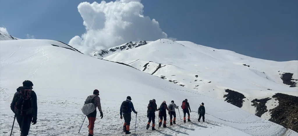
- The trail gets a generous layer of snow, turning into a winter wonderland
- One of the best treks for winter photography
- Unique experience of trekking on snow-covered trails
Trek Itinerary (6 Days / 5 Nights)
This is a classic 6-day itinerary for the Lord Curzon Trail (Kuari Pass Trek).
Day 1: Rishikesh to Joshimath
- Distance: ~255 km
- Travel Time: 8–10 hours
- Route: Rishikesh → Devprayag → Rudraprayag → Karnaprayag → Chamoli → Joshimath
- Altitude: 1,875 m (6,150 ft)
- Overnight: Hotel or guesthouse in Joshimath
Day 2: Joshimath to Dhak (Drive) & Trek to Gulling Top
- Drive (Joshimath to Dhak): 12 km / ~30 minutes
- Trek (Dhak to Gulling Top): 5–6 km / 5–6 hours
- Altitude: 6,900 ft (2,103 m) to 9,396 ft (2,864 m)
- Highlights: Dense forests of oak, pine, and rhododendron
- Overnight: Camp at Gulling Top
Day 3: Gulling Top to Khullara
- Trek Distance: 6–7 km / 3–4 hours
- Altitude: 9,396 ft (2,864 m) to 11,125 ft (3,391 m)
- Highlights: Mixed forests, gradual ascent, stunning views of Dronagiri
- Overnight: Camp at Khullara
Day 4: Khullara to Kuari Pass to Tali/Chitrakantha
- Trek Distance: 8–9 km / 7–8 hours
- Altitude: 11,100 ft (3,352 m) to 12,516 ft (3,815 m) via Kuari Pass
- Highlights: Summit of Kuari Pass, 180° views of Nanda Devi, Kamet, Dronagiri, Trishul
- Overnight: Camp at Tali or Chitrakantha
Day 5: Tali/Chitrakantha to Auli
- Trek Distance: 5–6 km / 4–5 hours
- Altitude: 11,503 ft (3,506 m) to 8,790 ft (2,679 m)
- Highlights: Gradual descent, views of the Alaknanda Valley
- Overnight: Guesthouse or hotel in Auli
Day 6: Auli to Rishikesh
- Distance: ~260 km
- Travel Time: 8–9 hours
- Departure: Drive from Auli to Rishikesh, reaching by evening
Nearby Places to Visit
Things to Do on the Lord Curzon Trail
1. Summit Kuari Pass
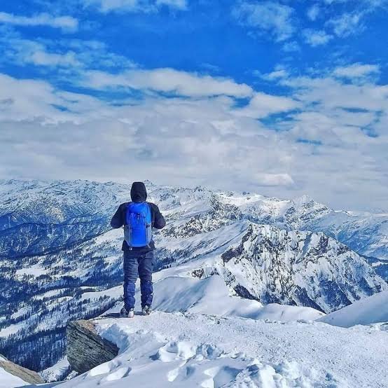
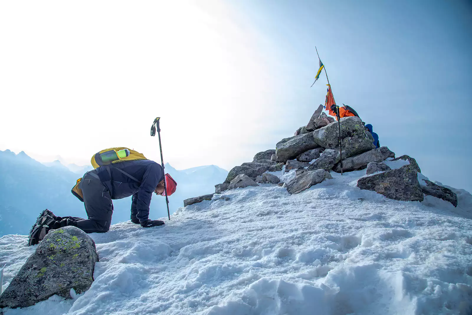
The highlight of the trek is reaching the Kuari Pass summit and being rewarded with a 180-degree view of the Garhwal Himalayas — from Kedarnath and Kedar Dome in the northwest to Nanda Devi and Trisul in the east.
2. Camp Under the Stars
Camp at scenic locations like Gulling, Khullara, or Tali, and fall asleep under starry Himalayan skies.
3. Explore the Bugyals
Walk through the lush Himalayan meadows called bugyals. Gorson Bugyal is one of the most spectacular, offering breathtaking views of the surrounding peaks.
4. Spot Wildlife
Keep an eye out for Himalayan Monal, leopards, black bears, and musk deer along the trail.
5. Visit Auli
Explore India’s premier skiing destination. Take the longest cable car in Asia for breathtaking views of Nanda Devi and other peaks.
6. Experience Local Culture
Visit traditional Garhwali villages like Dhak, Tugasi, and Guling. Interact with the locals and learn about their age-old customs and traditions.
7. Photography
From the golden autumn forests to the snow-covered winter landscapes, the trail offers postcard-perfect moments at every step.
Accommodation Options
Travel With Monk Recommendation: For a hassle-free experience, it is best to book a comprehensive trek package that includes all accommodation, meals, and a guide. The best campsites are at Gulling Top, Khullara, and Tali, offering stunning views of the surrounding peaks.
Local Cuisine
The food on the trek is simple, nutritious, and mostly vegetarian. You’ll get a taste of authentic Garhwali cuisine, especially if you stay in homestays or village guesthouses.
| Dish | Description |
|---|---|
| Kafuli | A traditional dish made from spinach and fenugreek leaves |
| Phanu | A lentil-based dish, a Garhwali speciality |
| Gahat ka Shorba | A nutritious soup made from horse gram |
| Chainsoo | Black gram curry, a Garhwali speciality |
| Jhangora Kheer | Sweet pudding made from barnyard millet |
| Roti-Sabzi | The staple meal of dal, rice, and vegetables |
Where to Eat:
- Trek Packages: Most packages include all meals during the trek.
- Local Dhabas: Simple meals are available in Joshimath, Auli, and other villages.
- Homestays: Enjoy authentic home-cooked Garhwali meals.
Frequently Asked Questions (FAQs)
General Questions
Q1: Why is it called the Lord Curzon Trail?
The trail is named after Lord Curzon, the then Viceroy of India, who trekked this route in 1905 to explore the upper limits of the Indian Himalayas. Since then, the route has been famous as the Curzon Trail or Lord Curzon Trek.
Q2: What is the meaning of “Kuari”?
“Kuari” means “virgin” in Hindi. Lord Curzon named the pass “Kuari Pass” when he discovered that the locals had no name for this pristine, unexplored area.
Q3: What is the altitude of Kuari Pass?
The Kuari Pass is situated at an altitude of approximately 3,800–4,264 metres (12,500–14,000 feet) above sea level.
Q4: What is the difficulty level of the trek?
The Kuari Pass trek is rated easy to moderate. It is suitable for first-time trekkers as well as experienced adventurers.
Q5: What is the best time to visit?
The best time to visit is from April to June (summer) and September to November (autumn). During these periods, the weather is stable, and the views are spectacular.
Q6: How long is the trek?
The total trek distance is approximately 22–35 kilometres, typically completed in 5 to 7 days.
Q7: What peaks can I see from the Kuari Pass?
From the Kuari Pass, you can see a 180° panorama of the Garhwal Himalayas, including Nanda Devi, Kamet, Dronagiri, Trishul, Chaukhamba, Neelkanth, Hathi Parbat, and Ghori Parbat.
Travel Logistics
Q8: How can I reach the base camp?
The base camp is Joshimath. You can reach it by:
- Road: Drive from Rishikesh (~255 km, 8–10 hours)
- Train: Take a train to Rishikesh, then a taxi/bus to Joshimath
- Air: Fly to Jolly Grant Airport, Dehradun, then a taxi/bus to Joshimath
Q9: What is the distance from Delhi to the base camp?
The distance from Delhi to Joshimath is approximately 500 km, taking about 12–14 hours by road.
Q10: Do I need a permit for the trek?
Yes. Since the trek passes through the Nanda Devi Biosphere Reserve, an entry permit is required. Most trek operators arrange this on your behalf.
Q11: Is mobile connectivity available on the trek?
Mobile connectivity is limited on the trek. BSNL tends to have the best coverage in the region. It is advisable to inform your family of your itinerary before starting the trek.
Q12: Are there ATMs near the trek?
ATMs are available in Joshimath and Auli. It is advisable to carry sufficient cash for the entire trip, as ATMs may not be available at higher altitudes.
Practical Information
Q13: What should I pack for the trek?
Pack sturdy waterproof trekking shoes, warm layers (fleece, down jacket), thermal wear, a raincoat, a sun hat, sunscreen, sunglasses, a headlamp, a sleeping bag, and personal medication.
Q14: What is the local language spoken in the region?
The official language is Hindi. The regional language is Garhwali. English is understood in tourist areas.
Q15: Is the trek safe for solo trekkers?
It is recommended to join a group or hire a local guide for safety, as the trail is remote and weather can change rapidly. Trekking with a reputable operator is the safest option.
Q16: What is the weather like during the trek?
The weather varies by season. In summer (May–June), daytime temperatures range from 15°C to 25°C, dropping to 3°C to 8°C at night. In winter (December–March), temperatures can drop to -10°C to -20°C at higher camps.
Q17: Can I extend my adventure after the Kuari Pass trek?
Yes! You can extend your adventure with nearby treks like the Pangarchulla Peak Trek, the Roopkund Trek, or the Valley of Flowers Trek, all easily accessible from the same region.
Q18: What is the significance of Lata Village?
Lata Village is where the Chipko movement started in India. It is also the entry point of the Nanda Devi National Park.
Plan Your Lord Curzon Trail Adventure with Travel With Monk
At Travel With Monk, we believe in curating journeys that go beyond conventional sightseeing. Our Kuari Pass expeditions are designed to foster self-discovery and a deep connection with the Himalayas through:
✅ Customised Kuari Pass trek packages (5 to 8 days)
✅ Combined itineraries with Auli, Valley of Flowers, and Pangarchulla
✅ Experienced local guides and porters
✅ Comfortable transport with experienced hill drivers
✅ All necessary permits and forest entry arrangements
✅ Quality camping equipment and nutritious meals
✅ 24/7 customer support throughout your journey
Recommended Kuari Pass Packages
| Package | Duration | Starting Point | Highlights |
|---|---|---|---|
| Lord Curzon Trail Trek | 5 Nights / 6 Days | Rishikesh | Kuari Pass, Gorson Bugyal, Tali Lake, Nanda Devi views |
| Kuari Pass & Auli Explorer | 6 Nights / 7 Days | Rishikesh | Kuari Pass, Auli skiing, cable car ride |
| Garhwal Himalayan Circuit | 8 Nights / 9 Days | Rishikesh | Kuari Pass, Valley of Flowers, Hemkund Sahib |
| Kuari Pass Winter Trek | 6 Nights / 7 Days | Rishikesh | Snow-covered Kuari Pass, winter photography |
📞 Call / WhatsApp: +91-9997187178, 9760222178, 8171977178
📍 Visit Our Office: Himalayan Colony, opposite DSVV, Haripur Kalan, Haridwar, Motichur Range, Uttarakhand 249411
🌐 Website: www.discover-uttarakhand.com
📧 Email: info@discover-uttarakhand.com
Travel With Monk – Your Gateway to Transformative Himalayan Journeys 🏔️