Introduction: The Sacred Lake of the Young Sage
Nestled in the pristine Garhwal Himalayas of Uttarakhand’s Uttarkashi district, Nachiketa Tal is a sacred high-altitude lake that holds a unique place in ancient Vedic mythology and spiritual traditions. According to the Katha Upanishad, this is where the young sage Nachiketa journeyed to the abode of Yama (the God of Death) and received the divine knowledge of the Self (Atman). The lake stands as a testament to the timeless pursuit of truth and spiritual wisdom.
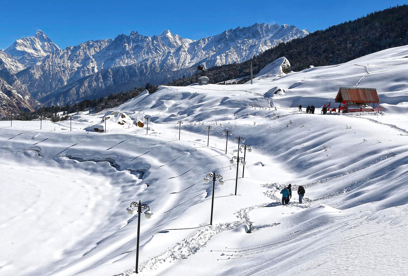
The lake sits at an altitude of approximately 2,453 metres (8,048 feet) and is surrounded by dense oak, pine, and rhododendron forests, offering breathtaking views of the Himalayan peaks, including Bandarpunch, Srikanth, and Gangotri. The name “Nachiketa Tal” connects this sacred site to the legendary child sage whose story is immortalised in one of the most profound Upanishads.
What makes Nachiketa Tal truly special is its combination of mythological significance and natural beauty. The journey to the lake passes through scenic forests, and the tranquil atmosphere makes it an ideal destination for meditation, introspection, and spiritual exploration. The nearby Yam Dawar (Gate of Yama) is believed to be the portal through which Nachiketa descended to meet the God of Death.
Quick Facts – Nachiketa Tal
| Aspect | Details |
|---|---|
| Location | Uttarkashi district, Uttarakhand |
| Altitude | 2,453 m (8,048 ft) |
| Region | Garhwal Himalayas |
| Famous For | Legend of Sage Nachiketa from Katha Upanishad, Yam Dawar |
| Lake Size | ~200 m long, 30 m wide, 7 m deep |
| Peaks Visible | Bandarpunch, Srikanth, Gangotri |
| Nearest Village | Chaurangi Khal (trek starting point) |
| Best Season | April–June & September–November |
| Trek Distance | 3 km from Chaurangi Khal |
| Trek Difficulty | Easy to moderate |
| Nearest Airport | Jolly Grant Airport, Dehradun (~180 km) |
| Nearest Railway Station | Rishikesh (~167 km) |
| Distance from Delhi | ~420 km |
| Permit Required | Available from the Forest Department at Chaurangi Khal |
History and Mythology: The Legend of the Young Sage
The Story from the Katha Upanishad
The story of Nachiketa Tal originates from the Katha Upanishad (also known as Kathakopanishad) of the Krishna Yajurveda. According to this ancient Vedic text, there lived a Vedic sage named Vajashravasa (also referred to as Uddalak or Udalak). He was performing a Yagya (sacrificial ritual) to gain divine blessings and was donating his belongings as part of the ritual.
Young Nachiketa, his son, noticed that his father was only giving away old, barren, and lame cows—animals that held no real value. Concerned about the insincerity of the offerings, Nachiketa questioned his father repeatedly: “To whom will you offer me?”
Annoyed by the persistent questioning, Uddalak lost his temper and declared, “I offer you to Yama” (the God of Death).
The Journey to Yama’s Abode
Taking his father’s words literally, Nachiketa dutifully decided to journey to the abode of Yama. It is believed that a small den-like structure ahead of Nachiketa Tal, known as Yam Dawar (the Gate of Yama), is where he descended into the netherworld to find the God of Death. Nachiketa waited at Yama’s door for three days without food or water.
Upon his return, Yama—pleased with the boy’s patience, determination, and unwavering resolve—granted him three boons as compensation for the lack of hospitality.
The Three Boons
| Boon | Description | Significance |
|---|---|---|
| First Boon | Nachiketa asked for his father’s anger to subside and for peace to be restored between them | Yama granted this wish, demonstrating the importance of family harmony |
| Second Boon | He asked to learn the sacred fire sacrifice (Yagya Vidhi) that leads to heaven | Yama taught him the ritual, which came to be known as the Nachiketa Yagya Vidhi |
| Third Boon | He asked for the ultimate truth—what happens after death | Yama initially hesitated, offering wealth, long life, and worldly pleasures instead. Nachiketa remained steadfast, declaring that material things were ephemeral. Impressed by his disciple’s unwavering pursuit of truth, Yama bestowed upon him Atma Vidya—the divine knowledge of the Self (Atman) and the ultimate reality (Brahman) |
The Sage’s Return
Having attained enlightenment from Yama himself, Nachiketa returned as a Jivanmukta (one liberated while still alive). He established an ashram near the pit of Yama, beside a beautiful lake, which was later named Nachiketa Tal in his honour.
Religious Beliefs Today
- Nag Devta Temple: A small temple dedicated to Nag Devta (the Serpent God) is located on the lake’s shore. Local tradition holds that the lake is now inhabited by a Naga, underscoring the site’s layered sanctity.
- Nag Panchami Festival: Villagers visit the lake during Nag Panchami to offer prayers and take a holy dip.
- Spiritual Retreat: The lake’s tranquil atmosphere makes it a popular spot for meditation and introspection.
- Yam Dawar: A narrow, vertical pit in a field near the lake is believed to be the portal through which Nachiketa descended to Yama’s realm.
- Local Beliefs: It is believed that no one should take a dip in the lake until Nag Panchami, as per local traditions. Even today, the descendants of Nachiketa’s guru perform a special fire ritual (Havan) at the lake every year.
Geography and Location
Location and Setting
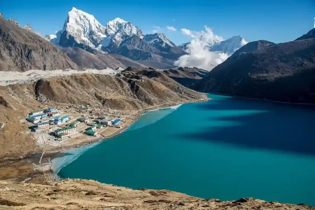
Nachiketa Tal is situated in the Mukhem range of the Uttarkashi district, Uttarakhand, in the Garhwal Himalayas. The lake is located at the base of towering mountain peaks, creating a natural amphitheatre of breathtaking beauty.
| Geographic Feature | Description |
|---|---|
| Altitude | 2,453 m (8,048 ft) above sea level |
| Length | ~200 metres |
| Width | ~30 metres |
| Depth | 7 metres |
| Shape | Elliptical |
| Coordinates | Approximately 30°27′N latitude, 78°28′E longitude |
Unique Hydrological Feature
The lake has no discernible inlet or outlet, making it a unique hydrological feature in the region. During the monsoon season, the size of the lake increases significantly, fed by rainfall and snowmelt.
Peaks Visible from Nachiketa Tal
| Peak Name | Description |
|---|---|
| Bandarpunch | A prominent Himalayan peak visible from the lake |
| Srikanth | Another majestic peak in the Garhwal range |
| Gangotri | The source of the Ganges, visible on clear days |
Nearby Villages
| Village | Distance | Significance |
|---|---|---|
| Chaurangi Khal | Base village (0 km) | Temple of Guru Chaurangi Nath, trek starting point |
| Uttarkashi | 26–30 km | District headquarters, Vishwanath Temple |
| Manpur | ~20 km | On the way to Chaurangi Khal |
| Sankurna Dhar | ~22 km | En route to Chaurangi Khal |
Flora and Fauna
Forests and Vegetation
The Nachiketa Tal region is blessed with rich Himalayan vegetation typical of the Garhwal Himalayas:
| Forest Type | Dominant Species | Characteristics |
|---|---|---|
| Oak Forests | Quercus species | Dense canopies, autumn colours |
| Pine Forests | Pinus species | Tall evergreen trees, fragrant resin |
| Rhododendron | Rhododendron arboreum | Spring blooms (March–April), vibrant red/pink flowers |
| Deodar | Cedrus deodara | Fragrant, tall evergreen trees |
Medicinal Plants and Flowers
The region is rich in medicinal herbs and colourful flowers:
| Species | Description | Blooming Season |
|---|---|---|
| Medicinal Herbs | Various species used in traditional medicine | Summer months |
| Rhododendrons | Vibrant red and pink flowers | March–April |
| Colourful Flowers | Various alpine species | August–September |
Wildlife
The region is home to a variety of Himalayan fauna:
| Animal | Type | Description |
|---|---|---|
| Kakad | Barking deer | Common in the region |
| Himalayan Bear | Mammal | Occasionally spotted |
| Leopard | Mammal | Present in the forests |
| Fox | Mammal | Seen in the area |
| Porcupine | Mammal | Found in the region |
| Himalayan Langur | Primate | Often seen in groups |
Birdlife
The dense deodar forests and alpine meadows provide ideal habitats for a variety of Himalayan bird species:
| Bird Species | Description |
|---|---|
| Himalayan Monal | State bird of Uttarakhand, with its iridescent plumage |
| Various Bird Species | Numerous Himalayan birds for birdwatching |
Lake Aquatic Life
The lake itself houses a large population of freshwater fish, easily visible in its clear waters.
Historical Vegetation Studies
Scientific studies, including pollen analysis of the lake’s sediment, have revealed the area’s vegetational history dating back thousands of years. The region has witnessed shifts between mixed conifer forests (dominated by Pine, Cedar, and Fir) and broad-leaved forests (dominated by Oak, Alder, and Birch) in response to climatic changes over the mid-Holocene period.
How to Reach Nachiketa Tal
By Air
| Details | Information |
|---|---|
| Nearest Airport | Jolly Grant Airport, Dehradun |
| Distance | ~180 km to Uttarkashi |
| Travel Time | 6–7 hours by taxi |
| Airlines | Regular flights from Delhi to Dehradun (approx. 1 hour) |
| Onward Travel | Taxis available from the airport to Uttarkashi |
By Train
| Details | Information |
|---|---|
| Nearest Station | Rishikesh and Dehradun |
| Distance | Rishikesh: ~167 km, Dehradun: ~160 km |
| Travel Time | 5–6 hours by taxi |
| Connectivity | Well-connected from Delhi |
Popular Trains from Delhi to Haridwar/Rishikesh:
| Train Name | From Delhi | Departure | Arrival | Destination |
|---|---|---|---|---|
| Shatabdi Express | Delhi | 6:00 AM | 11:40 AM | Haridwar |
| Jan Shatabdi | Delhi | 3:20 PM | 9:00 PM | Haridwar |
| Mussoorie Express | Delhi | 10:05 PM | 5:30 AM | Haridwar |
By Road
Route to Uttarkashi (Base for Nachiketa Tal):
| Starting Point | Distance | Travel Time | Route |
|---|---|---|---|
| Delhi | ~420 km | 10–12 hours | Delhi → Haridwar → Rishikesh → Chamba → Uttarkashi |
| Dehradun | ~180 km | 5–6 hours | Dehradun → Mussoorie → Chamba → Uttarkashi |
| Haridwar | ~180 km | 5–6 hours | Haridwar → Rishikesh → Chamba → Uttarkashi |
Road Conditions: The route is scenic but winding, following the Bhagirathi River through the Garhwal Himalayas. The drive from Uttarkashi to Chaurangi Khal is on steep mountain roads with sharp bends.
From Uttarkashi to Chaurangi Khal
| Details | Information |
|---|---|
| Distance | 26–30 km |
| Travel Time | Approximately 1 hour |
| Transport | Regular buses and taxis available from Uttarkashi |
| Route | Uttarkashi → Manpur → Sankurna Dhar → Chaurangi Khal |
Important: The last petrol pump before Chaurangi Khal is at Uttarkashi. Fill your tank to full capacity.
From Chaurangi Khal to Nachiketa Tal (The Trek)
| Details | Information |
|---|---|
| Distance | 3 km |
| Trek Duration | 1 to 1.5 hours (one way) |
| Difficulty | Easy to moderate, suitable for beginners and families |
| Trail | Well-marked, winding through rhododendron, oak, and pine forests |
| Highlights | First glimpse of the emerald-green lake is truly mesmerising |
The Trekking Route:
The trail is well-marked and winds through beautiful rhododendron, oak, and pine forests. The first glimpse of the emerald-green lake is truly mesmerising. The trek is suitable for bird watching and photography.
Local Guide: A local guide is recommended for first-time trekkers to ensure safety and enhance the experience.
Weather and Best Time to Visit
Climate Overview
Nachiketa Tal experiences a high-altitude climate. The lake is at 2,453 metres, and the region receives moderate snowfall in winter.
Month-by-Month Guide
| Month | Season | Conditions | Suitability |
|---|---|---|---|
| April–June | Summer | Pleasant (15°C–25°C), clear skies, rhododendrons in bloom | ⭐ Best |
| July–August | Monsoon | Heavy rain, slippery trails, leeches, and landslides | ❌ Avoid |
| September–November | Autumn | Moderate (10°C–20°C), refreshed greenery, clear skies | ⭐ Best |
| December–March | Winter | Harsh, lake freezes, below freezing, heavy snow | ❌ Closed |
Best Time to Visit by Season
| Season | Months | Suitability | Conditions | Best For |
|---|---|---|---|---|
| Summer | April–June | ⭐ Best | 15°C–25°C days, clear skies | Trekking, photography, comfortable weather, rhododendron blooms |
| Post-Monsoon | September–November | ⭐ Best | 10°C–20°C, crystal-clear views | Trekking, clear mountain views, vibrant foliage |
| Monsoon | July–August | ❌ Avoid | 15°C–20°C, rain, slippery trails | Not recommended—landslide risk |
| Winter | December–March | ❌ Closed | Below freezing, heavy snow | Not accessible without expert guidance |
Why Visit in Summer (April–June)
- Pleasant weather with daytime temperatures ranging from 15°C to 25°C
- Clear skies offering spectacular views of the Himalayan peaks
- Ideal conditions for trekking and photography
- Rhododendrons bloom in vibrant red and pink
- Best for first-time visitors
Why Visit in Post-Monsoon (September–November)
- Post-monsoon freshness brings out the lush greenery
- Crisp, invigorating air with clear, cloudless skies
- Perfect for photography
- Fewer crowds compared to the summer peak season
- Vibrant autumn colours in the forests
Why Avoid Monsoon (July–August)
- Heavy rainfall makes trails slippery and dangerous
- High risk of landslides and road blockages
- Cloud cover obscuring mountain views
- Leeches are present on the trail
Winter Closure (December–March)
- The region is covered in heavy snow
- The lake freezes over completely
- Roads are blocked and inaccessible
- Do not attempt the trek during winter without expert guidance
Special Events
| Event | Time | Significance |
|---|---|---|
| Nag Panchami | July–August | Locals celebrate a fair, villagers visit the lake to worship and take a holy dip |
| Annual Havan | Every year | Descendants of Nachiketa’s guru perform a special fire ritual at the lake |
Nearby Places to Visit
| Destination | Distance | Highlights |
|---|---|---|
| Chaurangi Khal | Base village (0 km) | Temple of Guru Chaurangi Nath, trek starting point |
| Harunta Bugyal | Near Chaurangi | Scenic meadow, excellent for outdoor activities, learning grounds |
| Naagni Devi Temple | Short hike from Chaurangi | Popular local temple |
| Uttarkashi | 26–30 km | Vishwanath Temple, Shakti Temple, gateway to Gangotri & Yamunotri |
| Gangotri Temple | ~100 km | Char Dham temple, source of the Ganges |
| Yamunotri Temple | ~150 km | Char Dham shrine, source of the Yamuna |
| Gangnani Hot Springs | ~55 km | Natural hot water springs |
Detailed Descriptions
Chaurangi Khal: The base village from where the trek begins. It has a temple dedicated to Guru Chaurangi Nath, a significant spiritual figure in the region.
Harunta Bugyal: A scenic meadow near Chaurangi Khal, offering excellent views and learning grounds for outdoor activities. Ideal for camping and nature walks.
Naagni Devi Temple: Another popular short hike from Chaurangi Khal. The temple is dedicated to the serpent goddess and offers panoramic views of the surrounding valleys.
Uttarkashi: The district headquarters and a major pilgrimage town. Home to the famous Vishwanath Temple, dedicated to Lord Shiva, and the Shakti Temple. It serves as a gateway to the Gangotri and Yamunotri shrines.
Gangotri Temple: One of the four Char Dham pilgrimage sites, located at the source of the Ganges. The temple is dedicated to Goddess Ganga.
Yamunotri Temple: Another Char Dham shrine, located at the source of the Yamuna River. It is dedicated to the Goddess Yamuna.
Gangnani Hot Springs: Natural hot water springs located on the way to Gangotri. A popular stop for pilgrims to take a holy dip.
Distance from Major Cities
| City | Distance | Travel Time | Route |
|---|---|---|---|
| Delhi | ~420 km | 10–12 hours | Delhi → Haridwar → Rishikesh → Chamba → Uttarkashi |
| Dehradun | ~180 km | 5–6 hours | Dehradun → Mussoorie → Chamba → Uttarkashi |
| Haridwar | ~180 km | 5–6 hours | Haridwar → Rishikesh → Chamba → Uttarkashi |
| Rishikesh | ~167 km | 4–5 hours | Rishikesh → Chamba → Uttarkashi |
| Uttarkashi | 26–30 km | 1 hour | Uttarkashi → Manpur → Sankurna Dhar → Chaurangi Khal |
Travel Tips and Important Information
Before You Go
- Check Weather: Avoid monsoon (July–August) due to heavy rainfall and landslide risk.
- Carry Cash: No ATMs or digital payment facilities near the lake. Bring sufficient cash from Uttarkashi.
- Fill Fuel: The last petrol pump before Chaurangi Khal is at Uttarkashi. Fill your tank to full capacity.
- Mobile Network: BSNL works in some pockets; inform family of your travel plans.
- Advance Booking: Essential for accommodations during the summer season.
- Hire a Local Guide: The trek to Nachiketa Tal is well-marked, but a guide is recommended for first-timers.
- Permit: A permit can be obtained from the Forest Department checkpoint at Chaurangi Khal.
During Your Visit
- Dress in Layers: Even in summer, evenings are cool; winter requires heavy woollens.
- Stay Hydrated: Carry water for treks and day trips.
- Respect Local Customs: The area is considered sacred by locals; maintain silence at the lake.
- Start Early: Begin sightseeing early to avoid afternoon weather changes.
- Avoid Whistling: According to local belief, whistling at night disturbs spirits in the mountains.
- No Swimming: Swimming is not recommended—the lake is deep, the water is cold, and it’s considered sacred by locals.
Safety Tips
- Road Safety: Mountain roads require patience; avoid night driving.
- Monsoon Travel: Avoid July–August due to landslide risk.
- Altitude Awareness: At 2,453 m, altitude sickness is possible; stay hydrated and take it easy.
- Wildlife: Do not feed animals; maintain a safe distance.
- Trail Safety: Wear sturdy shoes; the trail can be slippery.
Packing Checklist
| Season | Essentials |
|---|---|
| All Year | Comfortable walking shoes, sunscreen, sunglasses, hat, reusable water bottle, power bank, camera, cash, ID proof |
| Summer (Apr–Jun) | Light woolens for evenings, cotton clothes for daytime, sun protection |
| Monsoon (Jul–Aug) | Raincoat, waterproof footwear (avoid travel if possible) |
| Winter (Sep–Mar) | Heavy woollens, thermals, down jacket, gloves, muffler, woollen cap, waterproof boots |
Photography Tips
- Best Spots: Nachiketa Tal, surrounding peaks, deodar forests, Yam Dawar
- Best Time: Early morning for clear mountain views; golden hour (4:00–5:30 PM) for landscapes
- Camera Gear: Carry extra batteries—cold drains them quickly
- Suggested Equipment: Wide-angle lens for landscapes, telephoto lens for peaks and wildlife
Accommodation Options
- No Accommodations: There are no accommodations right at Nachiketa Tal.
- Camping: Camping is possible near the lake, but arrangements must be made in advance.
- Stay in Uttarkashi: Best to stay in Uttarkashi guesthouses or hotels and do a day trip to the lake.
| Accommodation | Location | Type | Contact |
|---|---|---|---|
| Guesthouses | Uttarkashi | Budget/Standard | Book in advance |
| Hotels | Uttarkashi | Standard/Deluxe | Book in advance |
| GMVN | Uttarkashi | Government | Online booking available |
Frequently Asked Questions (FAQs)
Q1: What is Nachiketa Tal famous for?
A: Nachiketa Tal is famous for its mythological association with the young sage Nachiketa from the Katha Upanishad and its serene natural beauty. It is believed to be the place where Nachiketa journeyed to the abode of Yama (the God of Death).
Q2: What is the best time to visit Nachiketa Tal?
A: The best time to visit is April to June (summer) and September to November (post-monsoon). These months offer clear skies and comfortable weather.
Q3: How far is Nachiketa Tal from Delhi?
A: The distance from Delhi is approximately 420 km, with a travel time of 10–12 hours by road.
Q4: How do I reach Nachiketa Tal?
A: By road to Uttarkashi (via Delhi/Dehradun), then drive to Chaurangi Khal (26–30 km), followed by a 3 km trek. The nearest airport is Jolly Grant Airport, Dehradun (~180 km), and the nearest railway station is Rishikesh (~167 km).
Q5: What is the altitude of Nachiketa Tal?
A: Nachiketa Tal is situated at an altitude of approximately 2,453 metres (8,048 feet) above sea level.
Q6: What is the Yam Dawar (Gate of Yama)?
A: Yam Dawar is a small den-like structure near Nachiketa Tal. According to legend, it is the portal through which Nachiketa descended to the abode of Yama (the God of Death).
Q7: What is the story behind Nachiketa Tal?
A: According to the Katha Upanishad, young Nachiketa was offered to Yama (God of Death) by his father. He journeyed to Yama’s abode, waited for three days, and received three boons—the third being the divine knowledge of the Self (Atman). The lake was named in his honour.
Q8: What are the three boons of Nachiketa?
A: (1) Peace between Nachiketa and his father, (2) Knowledge of the sacred fire sacrifice (Nachiketa Yagya Vidhi), and (3) The divine knowledge of the Self (Atma Vidya) and the ultimate reality (Brahman).
Q9: Is the Nachiketa Tal trek difficult?
A: The 3 km trek from Chaurangi Khal is considered easy to moderate. It takes approximately 1 to 1.5 hours and is suitable for beginners and families.
Q10: What is the Nag Devta Temple at Nachiketa Tal?
A: It is a small temple dedicated to Nag Devta (the Serpent God) located on the lake’s shore. Local tradition holds that the lake is now inhabited by a Naga.
Q11: Can I swim in Nachiketa Tal?
A: Swimming is not recommended—the lake is deep, the water is cold, and it’s considered sacred by locals.
Q12: What should I carry for the trek to Nachiketa Tal?
A: Sturdy trekking shoes, water, snacks, a light jacket, a first aid kit, rain protection gear, and sufficient cash. No ATMs are available near the lake.
Q13: Are there accommodation options at Nachiketa Tal?
A: No, there are no accommodations right at the lake. Camping is possible, but it’s best to stay in Uttarkashi and do a day trip.
Q14: Is there a mobile network at Nachiketa Tal?
A: Mobile connectivity is very limited. BSNL works in some pockets. Inform family of your travel plans in advance.
Q15: Do I need a permit to visit Nachiketa Tal?
A: A permit can be obtained from the Forest Department checkpoint at Chaurangi Khal.
Q16: What peaks are visible from Nachiketa Tal?
A: Bandarpunch, Srikanth, and Gangotri peaks are visible from Nachiketa Tal on clear days.
Q17: What is the Nag Panchami festival at Nachiketa Tal?
A: Nag Panchami is a festival celebrated in July–August when villagers visit the lake to worship and take a holy dip. It is believed that no one should take a dip in the lake until Nag Panchami.
Q18: What is the best time to see rhododendrons at Nachiketa Tal?
A: Rhododendrons bloom in vibrant red and pink during March–April, making this an ideal time to visit.
Q19: Is Nachiketa Tal accessible during winter?
A: Winter (December–March) is not recommended due to heavy snowfall, extreme cold, and road closures. The lake freezes over completely.
Q20: What is the Kedar Khand Purana connection?
A: It is mentioned in the Kedar Khand Purana that an angel from Devlok (the celestial realm) comes to bathe in the sacred pond. This adds to the lake’s spiritual significance.
Q21: What is the annual Havan at Nachiketa Tal?
A: Every year, the descendants of Nachiketa’s guru perform a special fire ritual (Havan) at the lake, continuing the spiritual tradition.
Q22: What bird species can I see at Nachiketa Tal?
A: Bird species include the Himalayan Monal (state bird of Uttarakhand) and various other Himalayan birds.
Q23: Can I visit Nachiketa Tal with children?
A: Yes, the 3 km trek is easy to moderate and is suitable for families with children, provided they are comfortable with walking.
Q24: How long does the complete journey from Delhi take?
A: From Delhi, it takes approximately 10–12 hours to reach Uttarkashi, plus 1 hour to Chaurangi Khal, plus 1–1.5 hours of trekking—making it a 2-day journey minimum.
Q25: Is there a guide service available at Chaurangi Khal?
A: Yes, local guides are available at Chaurangi Khal and can be hired for the trek to Nachiketa Tal.
Plan Your Nachiketa Tal Journey with Discover Uttarakhand
At Discover Uttarakhand, we’ve been organising unforgettable journeys across Devbhoomi since 1997. As a trusted local operator with deep knowledge of the Garhwal Himalayas, we offer:
✅ Customised Nachiketa Tal tour packages (2 to 5 days)
✅ Combined itineraries covering Nachiketa Tal, Uttarkashi, Gangotri, and Yamunotri
✅ Comfortable transport with experienced hill drivers
✅ Verified accommodations in Uttarkashi
✅ Local guides for the trek
✅ 24/7 customer support throughout your journey
Recommended Nachiketa Tal Packages
| Package | Duration | Starting Point | Highlights |
|---|---|---|---|
| Nachiketa Tal Trek | 2 Nights / 3 Days | Dehradun | Uttarkashi, Chaurangi Khal, Nachiketa Tal, Yam Dawar |
| Nachiketa Tal & Gangotri | 3 Nights / 4 Days | Dehradun | Uttarkashi, Nachiketa Tal, Gangotri Temple |
| Nachiketa Tal & Harunta Bugyal | 3 Nights / 4 Days | Dehradun | Uttarkashi, Nachiketa Tal, Harunta Bugyal |
| Garhwal Spiritual Circuit | 5 Nights / 6 Days | Dehradun | Nachiketa Tal, Gangotri, Yamunotri, Uttarkashi |
Book Your Nachiketa Tal Journey Today
Discover one of Uttarakhand’s most sacred and pristine Himalayan lakes—where mythology meets nature, and the pursuit of truth echoes through the ages.
📞 Call / WhatsApp: +91-9997187178, 9760222178, 8171977178
📍 Visit Our Office: Himalayan Colony, opposite DSVV, Haripur Kalan, Haridwar, Motichur Range, Uttarakhand 249411
🌐 Website: www.discover-uttarakhand.com
📧 Email: info@discover-uttarakhand.com
Discover Uttarakhand – Your Local Partner for Unforgettable Himalayan Journeys Since 1997 🏔️🙏