Introduction: The Hidden Gem of the Kumaon Himalayas
Nestled deep in the Kumaon Himalayas of Uttarakhand’s Bageshwar district, Pindar Valley—also known as Danpur Valley—is one of the most breathtaking and accessible trekking destinations in the Indian Himalayas. Named after the Pindar River that flows through it, this pristine valley originates from the majestic Pindari Glacier and offers a perfect blend of natural beauty, adventure, and cultural richness.
What makes Pindar Valley truly special is its accessibility combined with raw wilderness. Unlike many high-altitude Himalayan destinations, the valley is renowned for being beginner-friendly while still offering spectacular views of peaks like Nanda Kot, Maiktoli, and Panwali Dwar. The journey takes you through charming Kumaoni villages like Khati (the last inhabited village on the route), dense oak and rhododendron forests, alpine meadows, and finally to the iconic Pindari Glacier—one of the most accessible glaciers in India.
The valley is also an ecological treasure. The Upper Pindar Catchment has been designated as an Important Bird Area (IBA) by BirdLife International, harbouring large populations of five pheasant species, including the Himalayan Monal, Satyr Tragopan, and Koklass Pheasant. It is also one of the few places in India with the largest herds of Himalayan Tahr and is contiguous with the Nanda Devi Biosphere Reserve, a UNESCO World Heritage Site.
Whether you are a beginner trekker seeking your first Himalayan adventure, a birdwatcher hoping to spot rare pheasants, a nature lover drawn to dense forests and alpine meadows, or a cultural explorer wanting to experience authentic Kumaoni village life, Pindar Valley promises an unforgettable Himalayan journey.
Key Information at a Glance:
History and Mythology: Ancient Trade Routes to Tibet
The Ancient Trans-Himalayan Connection
Pindar Valley’s history is deeply intertwined with the ancient trans-Himalayan trade routes that once connected the Kumaon region to Tibet. According to local lore, ancient trade routes once connected Pindari Valley to Tibet, adding a rich cultural depth to the region. Before the 1962 Sino-Indian War, these routes were used by merchants and shepherds travelling between the two regions, carrying goods across high mountain passes.
The Legend of the Pindar River
The Pindar River, which gives the valley its name, originates from the Pindari Glacier. The glacier itself is named after the “pind” (lump of ice) formations that characterize its terminus. The river flows southward through the valley, eventually merging with the Alaknanda River at Karnaprayag—one of the Panch Prayags (five sacred confluences) of Uttarakhand. This confluence marks the river’s entry into the Ganges river system, adding a spiritual dimension to the valley.
Khati Village – The Last Inhabited Settlement
Khati village, perched at an altitude of approximately 2,210 meters, is the last inhabited settlement on the Pindari Glacier trek route. This traditional Kumaoni village serves as the cultural heart of the Pindar Valley and the final point where trekkers can experience authentic mountain life before entering the wilderness.
What makes Khati special:
- Traditional Kumaoni wooden houses with slate roofs
- Terraced fields cultivating buckwheat, kidney beans, amaranth, Jhangora, and barley
- Warm hospitality from locals who have been hosting trekkers for generations
- The last point for basic amenities before the glacier
The Remote Villages of Upper Pindar
Further up the valley, beyond Khati, lie some of the most remote hamlets in the Himalayan region, including Teekh, Daula, Kilapara, and Jhhali Kunwari. These villages lead toward the Garhwal region, with Samdar village marking the end of road connectivity. The Niwanis (local inhabitants) cultivate coarse grains in their fields, preserving traditional farming methods that have sustained life in this harsh terrain for centuries.
The Pindari Glacier Trek – A Trekker’s Legacy
The Pindari Glacier trek has been popular for decades, often called the “trekker’s glacier” because it is one of the few glaciers in India that is relatively accessible to beginners. Unlike many high-altitude Himalayan treks that require technical mountaineering skills, the Pindari trek offers a manageable route with spectacular rewards—close-up views of Nanda Devi (India’s second-highest peak) and Nanda Kot.
Geography and Location
Geographic Setting
The Pindar Valley is situated in the Bageshwar district of Uttarakhand, in the Kumaon region of the Himalayas. The valley lies within the Upper Pindar Catchment, which has been recognised as an Important Bird Area (IBA) covering approximately 20,000 hectares.
The valley is defined by the Pindar River, which originates from the Pindari Glacier at approximately 3,660 meters (12,008 feet) and flows southward for about 3.2 kilometres through the glacier snout. The river eventually merges with the Alaknanda River at Karnaprayag, forming part of the Ganges River system.
Surrounding Peaks
The Pindar Valley is framed by some of the most iconic peaks in the Kumaon Himalayas:
The Pindari Glacier
The Pindari Glacier is the crown jewel of the valley, located at coordinates approximately 30.335°N, 80.017°E. Key facts:
| Aspect | Details |
|---|---|
| Altitude | 3,660 m (12,008 ft) |
| Length | 3.2 km |
| Location | Southern slope of Nanda Devi sanctuary |
| Access | Trek-only from Loharkhet |
| Viewpoint | Zero Point (final viewpoint of the glacier) |
The glacier lies at the head of the Pindar Valley, a narrow valley carved over millennia by the movement of ice and rock. The surrounding landscape is characterised by:
- Towering Himalayan peaks
- Alpine meadows and rhododendron forests
- Pristine rivers and waterfalls
- Remote mountain villages
Tributaries and Side Valleys
The Pindar Valley is fed by two main upper-level tributaries:
- Sunderdhunga Gad – Meaning “Valley of Beautiful Stones,” this side valley is known for its boulders, hanging glaciers, and remote alpine environment
- Kaphni Gad – Leads to the less-commercial Kaphni Glacier, an offbeat alternative to Pindari
Flora and Fauna: A Biodiversity Hotspot
Important Bird Area (IBA) Status
The Upper Pindar Catchment has been recognised as an Important Bird Area (IBA) by BirdLife International, covering approximately 20,000 hectares. This designation reflects the valley’s exceptional avian diversity, particularly its populations of high-altitude pheasants.
Pheasant Species – A Global Rarity
The area has large and viable populations of five pheasant species :
In the Western Himalayas Endemic Bird Area (EBA), very few IBAs have five species of pheasant, making the Pindar Valley truly exceptional .
Other Bird Species
A total of 185 bird species have been recorded from the Almora district, which includes the Pindar Valley. Of these:
In detailed surveys of two oak forests in the IBA, researchers recorded 120 bird species, including:
- 28 species of Sino-Himalayan Temperate Forest (Biome-7)
- 9 species of Sino-Himalayan Subtropical Forest (Biome-8)
- 4 species of Eurasian High Montane (Biome-5)
The Himalayan Snowcock (Tetraogallus himalayensis) is also found here, adding to the valley’s high-altitude avian diversity.
Mammals
The Pindar Valley is renowned for its mammalian diversity, particularly its populations of Himalayan ungulates:
Forests and Vegetation
The valley features a variety of temperate to alpine vegetation communities :
| Elevation Zone | Vegetation Type | Characteristics |
|---|---|---|
| Lower Forests (1,500–2,500 m) | Oak, Pine, Deodar | Dense forests, rich birdlife |
| Mid-Altitude (2,500–3,200 m) | Rhododendron, Birch | Spring blooms (March–April) |
| High-Altitude (3,200–4,000 m) | Alpine meadows | Grasses, wildflowers, medicinal herbs |
The Reserved Forests of Dhakuri block and Sunderdhunga block (3,087 hectares) constitute the forested part of the IBA. The forests of Khati Van Panchayat (village council) provide ecological continuity and form important buffers.
Medicinal Herbs
The valley’s forests are rich in medicinal herbs, drawing tourists interested in natural remedies. Notable herbs include:
- Yarsagumba (Caterpillar Fungus) – Highly prized in traditional medicine
- Jula
- Ghingharu
- Hisalu
- Kilmora
These natural treasures have been used in traditional medicine for centuries, adding another layer of allure to this magical valley.
How to Reach Pindar Valley
By Air
Nearest Airport: Pantnagar Airport (approximately 250 km from the trek base)
| Details | Information |
|---|---|
| Distance | ~250 km |
| Travel Time | 8–10 hours by taxi to Bageshwar |
| Airlines | Regular flights from Delhi to Pantnagar (approx. 1 hour) |
| Onward Travel | Taxis available from the airport to Bageshwar via Haldwani |
By Train
Nearest Railway Station: Kathgodam (approximately 160–200 km from the valley)
| Station | Distance | Travel Time | Connectivity |
|---|---|---|---|
| Kathgodam | 160–200 km | 6–8 hours by road | Most preferred, well-connected from Delhi |
Popular Train from Delhi to Kathgodam:
| Train Name | From Delhi | Departure | Arrival (Kathgodam) | Duration |
|---|---|---|---|---|
| Ranikhet Express | Delhi | 10:05 PM | 5:05 AM | 7 hours |
From Kathgodam station, taxis and buses are available for Bageshwar.
By Road to Bageshwar (Base Town)
Bageshwar is the district headquarters and the last major town before the trek begins.
| Starting Point | Distance | Travel Time | Route |
|---|---|---|---|
| Delhi | 450–500 km | 12–14 hours | Delhi → Hapur → Moradabad → Rampur → Haldwani → Kathgodam → Almora → Bageshwar |
| Kathgodam | 160 km | 6–7 hours | Kathgodam → Bhimtal → Almora → Bageshwar |
| Almora | 100 km | 4–5 hours | Almora → Bageshwar |
Step-by-Step Route to the Trek Starting Point
Step 1: Kathgodam to Bageshwar
- Distance: ~160 km
- Travel Time: 6–7 hours by taxi/bus
- Bageshwar is the last town with ATMs, markets, and reliable mobile connectivity
Step 2: Bageshwar to Loharkhet (Trek Start)
| Segment | Distance | Travel Time |
|---|---|---|
| Bageshwar → Song | ~45 km | 2 hours |
| Song → Loharkhet | ~45 km | 2–3 hours |
Step 3: Loharkhet to Pindari Glacier (Trek)
The trek from Loharkhet to Pindari Glacier and back takes approximately 6–8 days.
Distances from Major Cities
| City | Distance (km) |
|---|---|
| Delhi | 450–500 |
| Kathgodam | 160–200 |
| Almora | 100 |
| Bageshwar | 0 (base town) |
| Loharkhet | 45 km from Bageshwar |
| Khati | ~20 km (trek from Loharkhet) |
| Pindari Glacier | ~45 km (trek from Loharkhet) |
Pindari Glacier Trek: Complete Guide
Trek Overview
The Pindari Glacier trek is one of the most popular and accessible glacier treks in India, often called the “trekker’s glacier”.
Day-by-Day Trek Itinerary
Day 1: Kathgodam to Bageshwar (Drive)
| Aspect | Details |
|---|---|
| Distance | 160 km |
| Duration | 6–7 hours |
| Overnight | Bageshwar |
Highlights:
- Scenic drive through the Kumaon hills
- Visit Bagnath Temple at the confluence of the Saryu and Gomti rivers
- Last chance for supplies and cash withdrawal
Day 2: Bageshwar to Loharkhet (Drive) to Dhakuri (Trek)
| Aspect | Details |
|---|---|
| Drive | Bageshwar → Loharkhet (45 km, 2–3 hours) |
| Trek Distance | 8–10 km |
| Trek Duration | 4–5 hours |
| Altitude Gain | 1,760 m → 2,680 m |
| Overnight | Dhakuri (camp/guesthouse) |
Highlights:
- Loharkhet is the actual trailhead
- Trek through dense oak and rhododendron forests
- Dhakuri Pass at ~3,000 m offers first views of Nanda Kot
Day 3: Dhakuri to Khati Village
| Aspect | Details |
|---|---|
| Trek Distance | 8–10 km |
| Trek Duration | 4–5 hours |
| Altitude | 2,680 m → 2,210 m (descent) |
| Overnight | Khati (homestay/camp) |
Highlights:
- Khati is the last inhabited village on the route
- Experience traditional Kumaoni village life
- Terraced fields and wooden houses
- Warm hospitality from local families
Day 4: Khati to Dwali
| Aspect | Details |
|---|---|
| Trek Distance | 10–12 km |
| Trek Duration | 5–6 hours |
| Altitude | 2,210 m → 2,570 m |
| Overnight | Dwali (camp) |
Highlights:
- Trek through dense forests
- Dwali is the confluence of the Pindar and Kaphni rivers
- Forest huts and camping are available
- This is the fork: Pindari Glacier to the right, Kaphni Glacier to the left
Day 5: Dwali to Phurkia
| Aspect | Details |
|---|---|
| Trek Distance | 8–10 km |
| Trek Duration | 4–5 hours |
| Altitude | 2,570 m → 3,200 m |
| Overnight | Phurkia (camp) |
Highlights:
- Gradual ascent into alpine terrain
- Views of Nanda Kot and Maiktoli peaks
- The landscape becomes more dramatic
Day 6: Phurkia to Pindari Glacier (Zero Point) and Return to Phurkia
| Aspect | Details |
|---|---|
| Trek Distance | 6–8 km round trip |
| Trek Duration | 4–5 hours |
| Altitude | 3,200 m → 3,660 m |
| Overnight | Phurkia (camp) |
Highlights:
- The highlight of the entire trek
- Arrive at Zero Point—the viewpoint of Pindari Glacier
- Spectacular views of Nanda Devi (7,816 m) and Nanda Kot (6,861 m)
- The glacier is 3.2 km long, surrounded by towering peaks
- Many trekkers leave prayer flags or stones at Zero Point to mark their journey
Day 7: Phurkia to Khati (Return Trek)
| Aspect | Details |
|---|---|
| Trek Distance | 18–20 km |
| Trek Duration | 6–7 hours |
| Overnight | Khati (homestay) |
Day 8: Khati to Loharkhet to Bageshwar
| Aspect | Details |
|---|---|
| Trek Distance | 8–10 km (trek) |
| Drive | Loharkhet → Bageshwar (45 km, 2–3 hours) |
| Overnight | Bageshwar |
Alternative: Kaphni Glacier Trek
For those seeking a less crowded experience, the Kaphni Glacier trek is an offbeat alternative to the main Pindari route.
| Aspect | Details |
|---|---|
| Starting Point | Dwali (fork from Pindari route) |
| Distance from Dwali | ~12 km one way |
| Altitude | ~3,800 m |
| Highlights | Less commercial, more raw, serene alpine environment |
Village Stops Along the Trek
Bageshwar – The Spiritual Base Town
Highlights:
- Bagnath Temple at the confluence of the Saryu and Gomti rivers
- Traditional Kumaoni market
- Last major town with permits, cash, and local insights
Loharkhet – The Actual Trailhead
Highlights:
Khati – The Last Inhabited Village
Highlights:
- The last inhabited settlement on the route
- Traditional Kumaoni wooden houses
- Terraced fields cultivating buckwheat, kidney beans, amaranth, Jhangora, and barley
- Warm hospitality and basic homestays
Dwali – The River Confluence Camp
Highlights:
- Confluence of the Pindar and the Kaphni rivers
- Dense forest surroundings and vibrant birdlife
- Camping and forest huts available
- Central fork: Pindari Glacier (right), Kaphni Glacier (left)
Sunderdhunga Valley – The Valley of Beautiful Stones
| Aspect | Details |
|---|---|
| Altitude | Varies (max ~4,100 m at Maiktoli Base) |
| Access | From Khati via Jatoli |
Highlights:
- A remote alpine valley filled with boulders and hanging glaciers
- Leads to Maiktoli, Tharkot, and Sukhram glaciers
- Known for epic night skies and glacier views
Weather and Best Time to Visit
Climate Overview
The Pindar Valley experiences a temperate climate with mild summers and chilly winters. The valley’s beauty transcends seasons, making it an ideal destination year-round.
Month-by-Month Guide
| Month | Season | Day Temp (°C) | Night Temp (°C) | Conditions | Trek Suitability |
|---|---|---|---|---|---|
| March | Spring | 8–15 | -2–5 | Rhododendrons begin blooming | ⭐ Good |
| April | Spring | 10–18 | 0–6 | Pleasant, wildflowers begin | ⭐ Best |
| May | Summer | 12–20 | 2–8 | Lush green, clear skies | ⭐ Best |
| June | Summer | 15–22 | 5–10 | Warm, ideal for families | ⭐ Best |
| July–August | Monsoon | 12–18 | 8–12 | Heavy rain, landslides, leeches | ❌ Avoid |
| September | Autumn | 10–16 | 2–8 | Post-monsoon freshness | ⭐ Best |
| October | Autumn | 8–14 | -2–5 | Golden meadows, crystal-clear | ⭐ Best |
| November | Autumn | 4–10 | -5–0 | Cold, trails closing | ⭐ Good |
| December–February | Winter | -2–8 | -10–-2 | Heavy snow, trails closed | ❌ Closed |
Seasonal Breakdown
Summer (April–June) – Best Time
This is the most popular season for trekking in Pindar Valley. Perfect conditions, lush greenery, wildflowers, and clear mountain views. Days are pleasant (12°C–22°C), while nights remain chilly (2°C–10°C). Clear skies give the best chances for uninterrupted mountain views.
Best for: Families, first-time trekkers, photography, and clear mountain views.
Autumn (September–October) – Excellent
Autumn is known for golden views. Meadows turn yellow, skies remain crystal clear, and distant peaks look striking. The valley is less crowded compared to summer. Daytime temperatures remain around 8°C–16°C, while nights drop below zero in October.
Best for: Photography, clear mountain views, peaceful trails.
Monsoon (July–August) – Avoid
Trekking is not advised during the monsoon because the trails become slippery, rivers overflow, and landslides are common. While the valley is at its greenest, the risks outweigh the rewards.
Winter (December–February) – Closed
Winter transforms the valley into a snow-covered landscape, but the trek is generally not accessible. Daytime temperatures may not rise above 5°C to 10°C, while nights can drop to -10°C or even lower. This season is suitable only for experienced trekkers with proper winter gear.
Best Time for Specific Activities
Cultural Richness and Local Traditions
The People of Pindar Valley
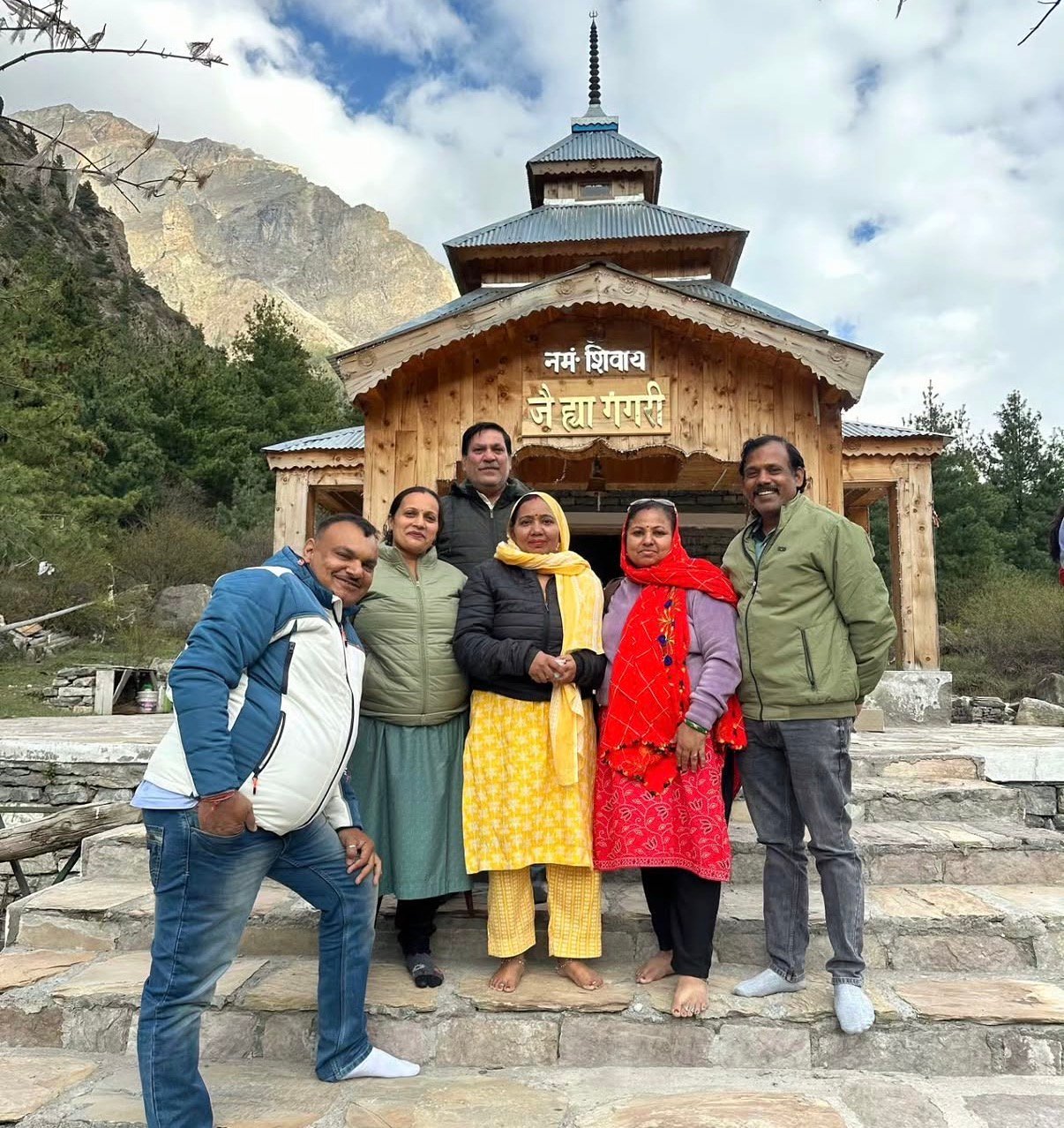
The inhabitants of Pindar Valley hold deep reverence for their local deities, celebrating festivals like Dev Paksha with great enthusiasm and devotion. This cultural richness is palpable as you witness traditional rituals and festivities, offering a glimpse into the spiritual fabric of the valley.
Traditional Occupations
The primary occupations in Pindar Valley include:
| Occupation | Description |
|---|---|
| Animal Husbandry | Yak, sheep, goat rearing |
| Agriculture | Traditional farming methods |
| Herb Cultivation | Medicinal herb collection and trade |
Local Crops
The Niwanis (local inhabitants) cultivate coarse grains in their fields:
These traditional farming practices not only sustain the local economy but also attract visitors interested in experiencing authentic rural life.
Festivals and Celebrations
Traditional Crafts
The Shauka and Kumaoni communities of the region are known for:
- Woollen shawls and blankets
- Wooden handicrafts
- Traditional jewelry
Local Cuisine: What to Eat
Must-Try Kumaoni Dishes
| Dish | Description |
|---|---|
| Bhatt ki Churkani | Black soybean curry, a regional specialty |
| Aloo Ke Gutke | Black soybean curry, a regional speciality |
| Chainsoo | Protein-rich black gram curry |
| Gahat Ki Dal | Horse gram lentil soup, warming and nutritious |
| Mandua Roti | Finger millet flatbread, healthy and filling |
| Jhangora Kheer | Barnyard millet sweet pudding |
| Singauri | Spiced fried potatoes with local Kumaoni flavours |
Where to Eat
| Location | Dining Options |
|---|---|
| Bageshwar | Local restaurants, Kumaoni thalis |
| Khati Village | Homestay meals (traditional Kumaoni food) |
| Dhakuri/Dwali | Trekker meals (simple dal-chawal, vegetables) |
| On the Trek | Meals provided by trek operators |
Dining Tips
- Most homestays offer meal packages
- Pure vegetarian options are widely available
- Carry packaged snacks for treks
- Try the local chai (tea) at small stalls
Accommodation Options
In Bageshwar (Base Town)
| Category | Price Range (per night) | Features |
|---|---|---|
| Hotels | ₹1,500 – ₹3,500 | Comfortable rooms, modern amenities |
| Budget Guesthouses | ₹500 – ₹1,500 | Basic amenities |
On the Trek
Booking Tips
- Book through registered trek operators for organised treks
- Homestays in Khati can be arranged through local contacts or tour operators
- Carry cash—no card facilities on the trek
- For peak seasons (April–June, September–October), book well in advance
Essential Packing List
Clothing (Layering System)
| Layer | Items | Quantity |
|---|---|---|
| Base Layer | Thermal innerwear (top & bottom) | 2 sets |
| Mid Layer | Fleece jacket, woolen sweater | 1–2 each |
| Outer Layer | Down jacket, waterproof windcheater | 1 each |
| Bottoms | Trekking pants (quick-dry) | 2 pairs |
| Head | Woolen cap, sun hat | 1 each |
| Hands | Waterproof gloves | 2 pairs |
| Feet | Woolen socks | 4–5 pairs |
Footwear
- Trekking shoes: Sturdy, waterproof, high ankle support, broken-in
- Camp shoes: Sandals or floaters for evening
Gear and Accessories
| Category | Items |
|---|---|
| Backpack | 20–30 litres (if offloading main bag) |
| Daypack | 2-litre capacity |
| Trekking Poles | Highly recommended for steep sections |
| Headlamp/Torch | With extra batteries |
| Water Bottles | 2 liters capacity |
| Water Purification | Tablets or filter |
| Sunglasses | UV protection |
| Rain Protection | Poncho or raincoat |
Health and Hygiene
| Category | Items |
|---|---|
| First Aid | Wet wipes, hand sanitiser, toilet paper |
| Medications | Personal prescription medicines, Diamox (consult doctor) |
| Hygiene | Wet wipes, hand sanitizer, toilet paper |
| Sun Protection | Sunscreen (SPF 50+), lip balm |
Documents and Other Essentials
- Valid ID proof (Aadhaar/Passport)
- Trek permits (arranged by operator)
- Travel insurance
- Cash (no ATMs on the trek)
- Power bank
- Camera with extra batteries
Sample Itineraries
8-Day Pindari Glacier Trek (From Kathgodam)
| Day | Segment | Distance | Time | Overnight |
|---|---|---|---|---|
| 1 | Kathgodam → Bageshwar (drive) | 160 km | 6–7 hours | Bageshwar |
| 2 | Bageshwar → Loharkhet → Dhakuri (trek) | 45 km drive + 8–10 km trek | 6–7 hours | Dhakuri |
| 3 | Dhakuri → Khati | 8–10 km | 4–5 hours | Khati |
| 4 | Khati → Dwali | 10–12 km | 5–6 hours | Dwali |
| 5 | Dwali → Phurkia | 8–10 km | 4–5 hours | Phurkia |
| 6 | Phurkia → Pindari Glacier → Phurkia | 6–8 km | 4–5 hours | Phurkia |
| 7 | Phurkia → Khati | 18–20 km | 6–7 hours | Khati |
| 8 | Khati → Loharkhet → Bageshwar → Kathgodam | 8–10 km trek + 45 km drive + 160 km drive | – | – |
5-Day Cultural Pindar Valley Tour (Non-Trekkers)
| Day | Segment | Highlights |
|---|---|---|
| 1 | Kathgodam → Bageshwar | Bagnath Temple, Saryu River ghats |
| 2 | Bageshwar → Khati (drive + short walk) | Visit the last inhabited village |
| 3 | Khati exploration | Village walks, interaction with locals, views of Nanda Kot |
| 4 | Khati → Bageshwar | Return drive |
| 5 | Bageshwar → Kathgodam → Delhi | Departure |
Travel Tips and Important Information
Before You Go
- Physical Fitness: The trek is moderate, covering ~90 km over 6–8 days. Prepare with regular walking and stair climbing 4–6 weeks before .
- Medical Check-up: Consult your doctor before undertaking high-altitude trekking.
- Carry Cash: No ATMs on the trek; bring sufficient cash from Bageshwar.
- Check Weather: Avoid monsoon (July–August); the trek is closed in winter.
- Book Through Registered Operators: The trek requires permits and local knowledge. Book through registered tour operators.
During Your Visit
- Acclimatise Properly: Spend a night in Bageshwar (~1,000 m) before starting the trek.
- Stay Hydrated: Drink plenty of water to prevent altitude sickness.
- Dress in Layers: Temperatures can change rapidly.
- Start Early: Begin treks early to complete sections before afternoon weather changes.
- Hire Local Guides: Local guides are essential for navigation, safety, and cultural insights.
Safety Tips
- Altitude Awareness: Above 3,000 m, altitude sickness is possible. Stay hydrated, walk slowly, and descend if symptoms worsen.
- Road Safety: Mountain roads require patience; avoid night driving.
- Monsoon Travel: Avoid July–August due to landslide risk.
- Wildlife: The area is a wildlife sanctuary; do not feed animals.
- Garbage: Carry back all non-biodegradable waste.
Photography Tips
- Best Spots: Zero Point (Pindari Glacier viewpoint), Dhakuri Pass (first view of Nanda Kot), Khati Village (traditional architecture)
- Best Time: Early morning for golden light on the peaks; autumn for clearest views
- Camera Gear: Carry extra batteries—cold drains them quickly; telephoto lens for wildlife
Packing Checklist
| Category | Items |
|---|---|
| Clothing | Thermal inners, fleece jacket, down jacket, waterproof outer shell, trekking pants, woolen gloves, muffler, woollen cap, woollen socks, sturdy trekking shoes |
| Gear | Trekking poles, headlamp/torch, power bank, reusable water bottle, water purification tablets |
| Health | Personal medications, first-aid kit, Diamox (consult doctor), ORS packets |
| Documents | ID proof, travel insurance, permit copies |
| Other | Thermal inners, fleece jacket, down jacket, waterproof outer shell, trekking pants, woolen gloves, muffler, woollen cap, woolen socks, sturdy trekking shoes |
Responsible Tourism
- Leave No Trace: The Pindari area is ecologically sensitive. Carry back all waste.
- Support Local Economy: Hire local guides, stay in homestays, buy local products.
- Protect Wildlife: Do not disturb animals or collect medicinal herbs without permission.
- Respect Local Culture: The villagers have unique traditions; be respectful and ask permission before photographing people.
Nearby Places to Visit
Frequently Asked Questions (FAQs)
Q1: What is Pindar Valley famous for?
A: Pindar Valley (also called Danpur Valley) is famous for the Pindari Glacier trek, one of the most accessible glacier treks in India. It is also recognised as an Important Bird Area (IBA) with five species of pheasants, including the Himalayan Monal and Satyr Tragopan.
Q2: What is the best time to visit Pindar Valley?
A: The best time to visit is April to June (summer) and September to October (autumn). The valley remains inaccessible during winter due to heavy snowfall.
Q3: How far is Pindar Valley from Delhi?
A: The distance from Delhi to Bageshwar is approximately 450–500 km, with a travel time of 12–14 hours by road.
Q4: How do I reach the Pindari Glacier trek starting point?
A: By road to Bageshwar (via Kathgodam), then to Loharkhet (45 km), followed by a 6–8 day trek. The nearest railway station is Kathgodam (~160–200 km), and the nearest airport is Pantnagar (~250 km).
Q5: What is the altitude of Pindari Glacier?
A: The Pindari Glacier is located at approximately 3,660 meters (12,008 feet) above sea level.
Q6: Is the Pindari Glacier trek difficult?
A: The trek is considered moderate in difficulty, suitable for beginners with good fitness. The total trek distance is approximately 90 km round trip over 6–8 days.
Q7: What is Khati village?
A: Khati is the last inhabited village on the Pindari Glacier trek route, located at approximately 2,210 meters. It offers homestays and a glimpse into traditional Kumaoni village life.
Q8: What is the Upper Pindar Catchment IBA?
A: The Upper Pindar Catchment is an Important Bird Area (IBA) designated by BirdLife International. It is known for having large populations of five pheasant species and the largest herds of Himalayan Tahr in India.
Q9: Can I see snow leopards in Pindar Valley?
A: Snow leopards are probably present in the upper reaches of the valley, but sightings are extremely rare. The area is contiguous with the Nanda Devi Biosphere Reserve, which is known as a snow leopard habitat.
Q10: What is the Kaphni Glacier trek?
A: The Kaphni Glacier trek is an offbeat alternative to the Pindari Glacier trek, starting from Dwali (the confluence of Pindar and Kaphni rivers). It is less crowded and offers a more raw, serene alpine experience.
Q11: What wildlife can I see in Pindar Valley?
A: The valley is home to Himalayan Monal, Koklass Pheasant, Satyr Tragopan, Cheer Pheasant, Himalayan Tahr, Musk Deer, Serow, Goral, Himalayan Black Bear, and Leopard.
Q12: Is there mobile network in Pindar Valley?
A: Mobile connectivity is available in Bageshwar but becomes very poor or non-existent on the trek. BSNL works in some pockets. Inform family of your travel plans in advance.
Q13: Are there ATMs in Pindar Valley?
A: ATMs are available in Bageshwar but not on the trek. Carry sufficient cash before starting .
Q14: What is the Sunderdhunga Valley?
A: Sunderdhunga means “Valley of Beautiful Stones.” It is a remote alpine valley accessible from Khati via Jatoli, known for boulders, hanging glaciers, and epic night skies .
Q15: How many days are enough for Pindar Valley?
A: 6–8 days are sufficient for the Pindari Glacier trek. For a shorter cultural tour focusing on villages like Khati, allow 4–5 days.
Plan Your Pindar Valley Journey with Discover Uttarakhand
At Discover Uttarakhand, we’ve been organizing unforgettable Himalayan journeys across Devbhoomi since 1997. As a trusted local operator with deep knowledge of the Kumaon Himalayas, we offer:
- ✅ Pindari Glacier Trek packages (8 to 10 days)
- ✅ Kaphni Glacier Trek (offbeat alternative)
- ✅ Customised Pindar Valley tour packages (4 to 7 days)
- ✅ Comfortable transport from Kathgodam to Bageshwar
- ✅ Experienced local guides familiar with the region
- ✅ Homestay arrangements in Khati village
- ✅ Camping equipment (tents, sleeping bags, meals)
- ✅ Permit assistance for the Upper Pindar Catchment
- ✅ 24/7 customer support throughout your journey
Recommended Pindar Valley Packages
| Package | Duration | Starting Point | Highlights |
|---|---|---|---|
| Pindari Glacier Trek | 7 Nights / 8 Days | Kathgodam | Khati, Dwali, Phurkia, Zero Point |
| Kaphni Glacier Trek | 7 Nights / 8 Days | Kathgodam | Offbeat, less crowded, serene |
| Pindar Valley Village Explorer | 4 Nights / 5 Days | Kathgodam | Bageshwar, Khati, cultural immersion |
Book your Pindar Valley journey today and discover one of Uttarakhand’s most pristine and wildlife-rich Himalayan valleys.
📞 Call / WhatsApp: +91-9997187178, 9760222178, 8171977178
📍 Visit Our Office: Himalayan Colony, opposite DSVV, Haripur Kalan, Haridwar, Motichur Range, Uttarakhand 249411
🌐 Website: www.discover-uttarakhand.com
📧 Email: info@discover-uttarakhand.com
Discover Uttarakhand – Your Local Partner for Unforgettable Himalayan Journeys Since 1997 🏔️