Introduction: Where the Pandavas’ Five Hearths Touch the Sky
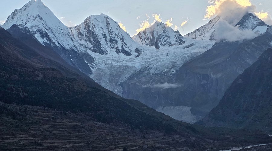
Nestled in the eastern Kumaon Himalayas of Uttarakhand’s Pithoragarh district, the Panchachuli Glacier is one of the most breathtaking and spiritually significant glacial landscapes in the Indian Himalayas. Located at the base of the majestic Panchachuli peaks—five snow-capped summits that rise like a fortress wall along the Indo-Tibetan border—this glacier is a hidden gem for trekkers, nature lovers, and pilgrims alike.
The name “Panchachuli” combines two Sanskrit words: “Panch” meaning “five” and “Chuli” meaning “hearths” or “cooking stoves”. According to Hindu mythology, this is the sacred place where the five Pandava brothers—Yudhishthira, Bhima, Arjuna, Nakula, and Sahadeva—cooked their last meal before ascending to heaven (Swargarohini). The five distinct peaks, ranging from over 20,700 feet to 22,650 feet above sea level, are believed to represent the five hearths used by the Pandavas.
The Panchachuli peaks form a spectacular east-west ridge, with the highest peak reaching 6,904 metres (22,651 feet). The glacier lies at the base of these peaks, at an elevation of approximately 3,800 metres (12,467 feet). The trek to the glacier passes through remote Shauka (Bhotiya) villages, dense deodar and rhododendron forests, and offers stunning panoramic views of some of the most iconic Himalayan peaks, including Rajrambha, Kalabaland, and the Nanda Devi range.
Whether you are a trekker seeking a moderate high-altitude adventure, a devotee wanting to connect with the Pandava legend, a birdwatcher hoping to spot the Himalayan Monal, or a photographer chasing the perfect shot of the five peaks at sunrise, Panchachuli Glacier promises an unforgettable Himalayan experience.
Key Information at a Glance:
| Aspect | Details |
|---|---|
| Location | Pithoragarh district, Uttarakhand (near Munsiyari) |
| Altitude | 3,800 m (12,467 ft) |
| Trek Distance | ~16 km round trip from base |
| Trek Duration | 7 Days / 6 Nights (Dharchula to Dharchula) |
| Difficulty | Easy to Moderate |
| Best Season | May–June & September–October |
| Highest Peak | 6,904 m (22,651 ft) |
| Starting Point | Dharchula / Munsiyari |
| Nearest Airport | Pantnagar (~250-300 km) |
| Nearest Railway Station | Kathgodam (~280 km) |
| Distance from Delhi | ~600 km |
| Famous For | Pandava legend, five sacred peaks, Shauka culture |
History and Mythology: The Legend of the Five Hearth Peaks
The Pandavas’ Last Meal
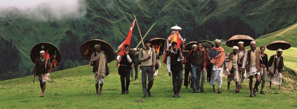
The most profound legend associated with Panchachuli Glacier is that of the five Pandava brothers from the Mahabharata. According to Hindu mythology, after the bloody Kurukshetra war, the Pandavas—burdened by guilt—renounced their kingdom and began their final journey toward heaven (Swargarohini).
As the story goes, the Pandavas cooked their last meal at the base of these five peaks before ascending to their heavenly abode. The five distinct summits are believed to represent the five hearths (chulis) used by the brothers—one for each Pandava. This is how the peaks and the glacier got their name: Panchachuli—”Five Hearth Peaks”.
Some scholars suggest an alternative interpretation: the term “chuli” may have been derived from the Nepalese language, where it literally means “peaks”. Regardless of the origin of the name, there is no arguing that these majestic peaks are absolutely awe-inspiring.
The Easternmost Sentinels of Kumaon
The Panchachuli peaks belong to the eastern Kumaon region of Uttarakhand and are probably the last of the prominent Himalayan peaks before entering Nepalese territory. Their strategic location on the Indo-Tibetan border has made this region significant both spiritually and geopolitically.
Cultural Significance for the Shauka Community
The Panchachuli Glacier and its surrounding peaks hold deep cultural significance for the local Shauka (Bhotiya) community. According to local tradition, the peaks are revered as sacred, and rituals and festivals are held to honour the natural landscape. The glacier and the peaks are considered integral to the community’s identity and spiritual heritage.
The Mythology of Panchachuli in the Mahabharata
The peaks are mentioned in the context of the Swargarohini Parvata—the “Ascent to Heaven” mountain. According to the Mahabharata, the Pandavas climbed this mountain, and one by one, they fell, unable to complete the journey, until only Yudhishthira remained. The Panchachuli peaks are visible from the Swargarohini area, and the five peaks are often associated with the five Pandavas themselves.
The Geological Story
The Panchachuli peaks are composed of ancient crystalline rocks, primarily granites and gneisses, formed over millions of years through tectonic activity. The glacier itself has formed over thousands of years through the accumulation and compaction of snow. The region was once part of the Tethys Sea, and marine fossils can occasionally be found in the sedimentary rocks of the lower valleys, evidence that this land was once underwater.
Geography and Location
Geographic Setting
The Panchachuli Glacier is situated in the Pithoragarh district of Uttarakhand, in the eastern Kumaon region of the Himalayas. The glacier lies at the base of the Panchachuli peaks, a spectacular east-west ridge running for approximately 25 kilometres along the Indo-Tibetan border.
| Aspect | Details |
|---|---|
| Coordinates | Approximately 30°20′N, 80°25′E |
| Glacier Altitude | 3,800 m (12,467 ft) |
| Peak Altitudes | 6,312 m – 6,904 m |
| Trek Distance | ~16 km round trip |
| Region | Kumaon Himalayas |
| Nearest Town | Munsiyari (~60 km) |
The Panchachuli Peaks
The Panchachuli massif consists of five distinct peaks, arranged from east to west:
| Peak | Height | Notes |
|---|---|---|
| Panchachuli I | 6,904 m (22,651 ft) | Highest peak; easternmost |
| Panchachuli II | 6,690 m (21,949 ft) | Second highest |
| Panchachuli III | 6,312 m (20,709 ft) | Third peak |
| Panchachuli IV | 6,334 m (20,781 ft) | Fourth peak |
| Panchachuli V | 6,410 m (21,030 ft) | Westernmost |
The peaks are characterised by their distinct pyramidal shapes, which resemble chimneys or hearths—hence the name “chuli” meaning hearth. From Munsiyari town, the five peaks appear as a single massive wall, but from closer vantage points, the individual summits become clearly distinguishable.
The Kumaon Landscape
The area surrounding Panchachuli Glacier is characterised by:
| Terrain Feature | Description |
|---|---|
| Glacial Valleys | U-shaped valleys carved by glacial action |
| Alpine Meadows | Grassy pastures are used for grazing during the summer |
| Rhododendron Forests | Dense forests of rhododendron, oak, and deodar |
| Glacial Rivers | Tributaries of the Gori Ganga and Kali rivers |
| Remote Villages | Traditional Shauka settlements like Sela, Nagling, and Baaling |
The Glacier Structure
The Panchachuli Glacier is a valley glacier situated at the base of the peaks. It is flanked by the Panchachuli peaks, known for their distinct shapes resembling chimneys. The glacier’s structure is composed of ice and snow, and it dynamically changes shape and size depending on the seasons and climatic conditions. The glacier is a significant source of the Kali River (also known as the Sharda River), which flows southward through the Kumaon region.
Flora and Fauna
Forests and Vegetation
The Panchachuli Glacier trek passes through a variety of ecological zones, each with unique vegetation:
| Elevation Zone | Vegetation Type | Characteristics |
|---|---|---|
| Lower Forests | Pine, Deodar, Oak | Dense forests, rich birdlife |
| Mid-Altitude | Rhododendron, Birch | Spring blooms (March-April), vibrant colours |
| Sub-alpine | Juniper, Dwarf Rhododendron | Hardy shrubs adapted to harsh conditions |
| Alpine Meadows | Grasses, wildflowers, medicinal herbs | Summer grazing grounds |
The trail from Sobla to the glacier passes through thick forests of deodar and bhojpatra (birch) and conifer. The rhododendron forests are especially spectacular in spring when the hillsides burst into vibrant red and pink blooms.
Wildlife
The region is rich in Himalayan wildlife. According to wildlife experts, herds of Himalayan goats, musk deer, and rare Himalayan birds can be seen in the lower valleys at a height of 3,500 metres during certain times of the year.
| Species | Scientific Name | Status | Habitat |
|---|---|---|---|
| Himalayan Monal | Lophophorus impejanus | State bird of Uttarakhand | Forested slopes |
| Musk Deer | Moschus chrysogaster | Endangered | Alpine meadows |
| Himalayan Tahr | Hemitragus jemlahicus | Near Threatened | Rocky slopes |
| Bharal (Blue Sheep) | Pseudois nayaur | Schedule I | Alpine meadows |
| Snow Leopard | Uncia uncia | Endangered | High alpine zones (rare) |
| Himalayan Black Bear | Ursus thibetanus | Vulnerable | Forested areas |
Important Conservation Note: The Panchachuli slopes are known to be targeted by poachers who set fire to forests to hunt wild animals, especially the musk deer, which is poached for its prized musk pod valued at up to US$50,000 per kg. The forest department maintains anti-poaching teams in the region, and visitors are encouraged to report any suspicious activity.
Birds
The area is home to a variety of Himalayan bird species:
- Himalayan Monal – State bird of Uttarakhand; iridescent plumage
- Tragopan Pheasant – Globally threatened
- Cheer Pheasant – Globally threatened
- Himalayan Griffon Vulture – High-altitude scavenger
- Golden Eagle – Apex predator of the skies
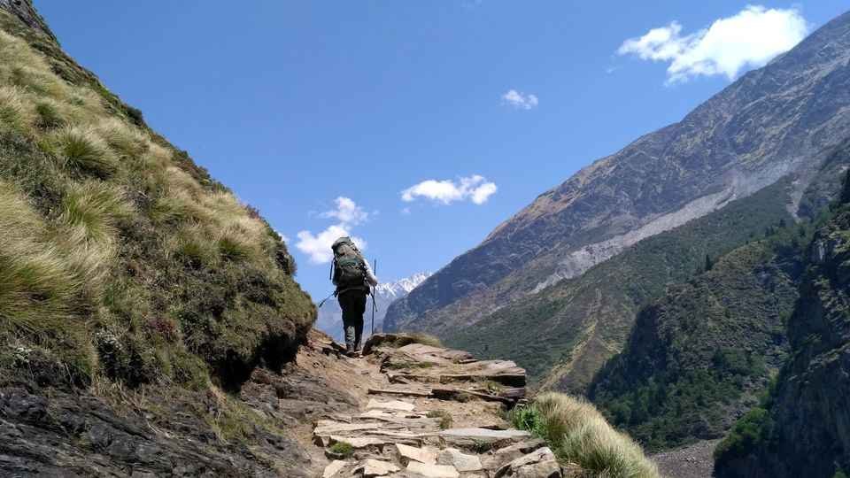
Panchachuli Glacier Trek: Complete Guide
Trek Overview
The Panchachuli Glacier trek is considered easy to moderate in difficulty, making it suitable for beginners with good fitness and for experienced trekkers seeking a less demanding Himalayan adventure.
| Aspect | Details |
|---|---|
| Total Duration | 7 Days / 6 Nights (Dharchula to Dharchula) |
| Trek Distance | ~16 km round trip |
| Maximum Altitude | 3,800 m (12,467 ft) |
| Difficulty | Easy to Moderate |
| Best Time | May–June & September–October |
| Starting Point | Dharchula / Munsiyari |
Day-by-Day Trek Itinerary
Day 1: Arrival at Kathgodam – Drive to Dharchula
| Aspect | Details |
|---|---|
| Distance | ~350 km |
| Travel Time | 10–12 hours |
| Overnight | Dharchula (hotel/guesthouse) |
Start your journey by arriving at Kathgodam Railway Station, the gateway to the Kumaon Himalayas. From Kathgodam, embark on a scenic drive to Dharchula, a town on the Indo-Nepal border known for its rich culture and picturesque landscapes. Dharchula serves as the base camp for the Panchachuli Glacier trek.
Highlights:
- Scenic drive through Almora and the Kumaon countryside
- Views of snow-covered Himalayan peaks
- Overnight in Dharchula, preparing for the trek ahead
Day 2: Dharchula to Sela (Trek)
| Aspect | Details |
|---|---|
| Trek Distance | Variable |
| Trek Duration | 4–5 hours |
| Overnight | Sela (camp) |
After breakfast in Dharchula, start your trek towards Sela. The trail winds through remote villages and lush landscapes, introducing you to the serene beauty of the region. Set up camp in Sela, a small village nestled in the mountains.
Day 3: Sela to Nagling (Trek)
| Aspect | Details |
|---|---|
| Trek Distance | Variable |
| Trek Duration | 5–6 hours |
| Overnight | Nagling (camp) |
Continue your trek from Sela to Nagling, experiencing more of the region’s stunning natural beauty. The path becomes steeper, offering breathtaking views of the surrounding peaks. Arrive at Nagling and set up camp for the night. This village provides a serene setting for rest and acclimatisation.
Day 4: Nagling to Panchachuli Base Camp (Trek)
| Aspect | Details |
|---|---|
| Trek Distance | Variable |
| Trek Duration | 5–6 hours |
| Altitude Gain | ~3,800 m |
| Overnight | Panchachuli Base Camp (camp) |
This is the highlight of the entire trek. Trek from Nagling to the Panchachuli Base Camp, the final destination of this journey. The trail offers panoramic views of the Panchachuli peaks, which are among the most iconic sights in the Kumaon Himalayas. Spend the afternoon exploring the base camp area, soaking in the majestic views of the five peaks. Set up camp for an unforgettable night under the stars.
Day 5: Explore Panchachuli Glacier – Return to Nagling
| Aspect | Details |
|---|---|
| Exploration | Half day at the glacier |
| Return Trek | Nagling |
| Overnight | Nagling (camp) |
Dedicate the day to exploring the Panchachuli Glacier. The glacier, situated at the base of the Panchachuli peaks, offers a profound sense of the Himalayan grandeur and tranquillity. After spending time at the glacier, begin your trek back to Nagling. The return journey gives you another chance to enjoy the magnificent landscapes of the region.
Day 6: Nagling to Sela (Return Trek)
| Aspect | Details |
|---|---|
| Trek Distance | Variable |
| Trek Duration | 5–6 hours |
| Overnight | Sela (camp) |
Trek back from Nagling to Sela, retracing your steps through the beautiful landscapes.
Day 7: Sela to Dharchula (Trek) – Drive to Kathgodam
| Aspect | Details |
|---|---|
| Trek | Sela to road head |
| Drive | Dharchula to Kathgodam |
| Overnight | Train/Onward journey |
Complete the final trek from Sela to the road head, then drive back to Dharchula. From Dharchula, begin the return drive to Kathgodam, marking the end of your Panchachuli Glacier adventure.
Alternative Route via Sobla
An alternative approach to the Panchachuli Glacier starts from Sobla, a 40 km drive from Dharchula. From Sobla, the trekking route passes through:
| Segment | Distance | Notes |
|---|---|---|
| Sobla → Dar | Variable | Through villages |
| Dar → Urthing | Variable | Forest trails |
| Urthing → Nagling | Variable | Scenic landscapes |
| Nagling → Baaling | Variable | Remote villages |
| Baaling → Panchachuli Glacier | Variable | Final approach |
This route passes through the Darma Valley, which offers splendid views of the Panchachuli peaks. The trail from Duktu to Panchachuli Glacier is harder to follow, but determination and strategy can help overcome these difficulties.
Trek Difficulty and Preparation
| Aspect | Recommendation |
|---|---|
| Fitness Level | Moderate; prepare with regular walking/jogging 3–4 weeks before |
| Acclimatization | Important at altitudes above 3,000 m |
| Best for | Beginners with good fitness; experienced trekkers |
| Prior Experience | Not mandatory but helpful |
Pre-trek Preparation:
- Start running/walking at least 3–4 km every day
- Break in new trekking shoes before the trek to avoid blisters
- Consult your doctor about altitude sickness medication (Diamox)
How to Reach Panchachuli Glacier
By Air
Nearest Airport: Pantnagar Airport
| Details | Information |
|---|---|
| Distance | ~250-300 km to Dharchula |
| Travel Time | 10–12 hours by taxi |
| Airlines | Limited flights from Delhi to Pantnagar |
| Onward Travel | Taxis available to Dharchula |
Alternative: Fly to Delhi IGI Airport, then take a train or taxi to Kathgodam.
By Train
Nearest Railway Station: Kathgodam Railway Station
| Details | Information |
|---|---|
| Distance | ~350 km to Dharchula |
| Travel Time | 10–12 hours by taxi |
| Connectivity | Well-connected from Delhi, Lucknow, Dehradun |
Popular Trains from Delhi to Kathgodam:
| Train Name | From Delhi | Departure | Arrival (Kathgodam) | Duration |
|---|---|---|---|---|
| Ranikhet Express | Delhi | 10:05 PM | 5:05 AM | 7 hours |
| Sampark Kranti Express | Delhi | 4:45 PM | 10:35 PM | ~6 hours |
From Kathgodam station, taxis are available for Dharchula.
By Road
Route from Delhi to Dharchula:
Delhi → Ghaziabad → Hapur → Moradabad → Rampur → Haldwani → Kathgodam → Almora → Bageshwar → Pithoragarh → Dharchula
| Starting Point | Distance | Travel Time | Route |
|---|---|---|---|
| Delhi | ~600 km | 14–16 hours | Via NH9 and NH87 |
| Kathgodam | ~350 km | 10–12 hours | Via Almora and Bageshwar |
| Pithoragarh | ~100 km | 3–4 hours | Via Dharchula road |
Road Conditions: The roads are scenic but winding, passing through pine and deodar forests. The final stretch from Pithoragarh to Dharchula follows the Kali River along the India-Nepal border.
The Trek Starting Point
The trek to Panchachuli Glacier begins from Dharchula or Munsiyari. From Dharchula, you can drive to Sobla (40 km) and begin the trek from there.
Distances from Major Cities
| City | Distance (km) |
|---|---|
| Delhi | ~600 |
| Dehradun | ~450 |
| Rishikesh | ~400 |
| Haridwar | ~420 |
| Kathgodam | ~350 |
| Pithoragarh | ~100 |
| Dharchula | 0 (base) |
| Munsiyari | ~60 |
Weather and Best Time to Visit
Climate Overview
Panchachuli Glacier experiences a high-altitude alpine climate. The region is accessible only during specific months due to heavy snowfall in winter.
Month-by-Month Guide
| Month | Season | Day Temp (°C) | Night Temp (°C) | Conditions | Suitability |
|---|---|---|---|---|---|
| April | Spring | 7–15 | 0–5 | Snow melting, trails opening | ⭐ Good |
| May | Summer | 10–18 | 2–8 | Pleasant, clear skies | ⭐ Best |
| June | Summer | 12–20 | 5–10 | Pleasant, ideal | ⭐ Best |
| July | Monsoon | 10–18 | 8–12 | Heavy rain, landslides | ❌ Avoid |
| August | Monsoon | 10–18 | 8–12 | Heavy rain, slippery trails | ❌ Avoid |
| September | Autumn | 8–15 | 2–8 | Post-monsoon, clear | ⭐ Best |
| October | Autumn | 5–12 | -5–0 | Crisp, clear, valley closing | ⭐ Good |
| November–March | Winter | -5–10 | -15–-5 | Heavy snow, valley closed | ❌ Closed |
Best Time to Visit by Season
| Season | Months | Suitability | Conditions | Best For |
|---|---|---|---|---|
| Summer | May–June | ⭐ Best | 10°C–20°C, clear skies, pleasant | Trekking, glacier views, photography |
| Autumn | September–October | ⭐ Excellent | 5°C–15°C, crisp air, clear views | Clear mountain views, photography |
| Monsoon | July–August | ❌ Avoid | 10°C–18°C, heavy rainfall, landslides | Not recommended |
| Winter | November–April | ❌ Closed | Below freezing, heavy snow | Valley inaccessible |
Why Visit in Summer (May–June)
This is the most popular time to visit Panchachuli Glacier:
- Pleasant weather with temperatures ranging from 10°C to 20°C
- Clear skies offering spectacular views of the five peaks
- Ideal conditions for the trek
- The rhododendron forests are in bloom (April–May)
- Best time for wildlife spotting
Why Visit in Autumn (September–October)
Autumn is another excellent time to visit:
- Post-monsoon freshness brings out the lush greenery
- Crisp, invigorating air with clear, cloudless skies
- Crystal-clear views of the Panchachuli peaks
- Perfect for photography
Why Avoid Monsoon (July–August)
The monsoon months are not recommended for visiting due to:
- Heavy rainfall is making trails slippery and dangerous
- High risk of landslides on mountain roads
- Cloud cover obscuring mountain views
- The route gets slippery, and trekkers find it very difficult to make their way through
Winter Closure (November–April)
The valley remains closed during winter due to heavy snowfall, and the temperature falls significantly, making it impossible to trek.
Best Time of Day for Glacier Views
| Time | Experience | Tips |
|---|---|---|
| Sunrise (5:30–6:30 AM) | Golden light on the peaks | Best for photography |
| Morning (7:00–10:00 AM) | Clear glacier views | Best for exploration |
| Afternoon (12:00–3:00 PM) | Good light but can be hazy | Plan accordingly |
| Evening (4:00–5:30 PM) | Sunset colours on peaks | Beautiful end to the day |
Essential Packing List
Clothing (Layering System)
| Layer | Items | Quantity |
|---|---|---|
| Base Layer | Thermal innerwear (top & bottom) | 2 sets |
| Mid Layer | Fleece jacket, woollen sweater | 1–2 each |
| Outer Layer | Down jacket, waterproof windcheater | 1 each |
| Bottoms | Trekking pants (quick-dry) | 2 pairs |
| Head | Woollen cap, sun hat | 1 each |
| Hands | Waterproof gloves | 2 pairs |
| Feet | Woollen socks | 4–5 pairs |
Footwear
- Trekking shoes: Sturdy, waterproof, high ankle support, broken-in
- Camp shoes: Sandals or floaters for evening
Gear and Accessories
| Category | Items |
|---|---|
| Backpack | 20–30 litres |
| Daypack | 2-litre capacity |
| Trekking Poles | Highly recommended |
| Headlamp/Torch | With extra batteries |
| Water Bottles | 2 liters capacity |
| Water Purification | Tablets or filter |
| Sunglasses | UV protection |
| Rain Protection | Poncho or raincoat |
Health and Hygiene
| Category | Items |
|---|---|
| First Aid | Wet wipes, hand sanitiser, toilet paper |
| Medications | Personal prescription medicines, Diamox (consult doctor) |
| Hygiene | Wet wipes, hand sanitizer, toilet paper |
| Sun Protection | Sunscreen (SPF 50+), lip balm |
Documents and Other Essentials
- Valid ID proof (Aadhaar/Passport)
- Trek permits (arranged by operator)
- Medical certificate (if applicable)
- Travel insurance
- Cash (no ATMs on the trek)
- Power bank
- Camera with extra batteries
- Energy bars, dry fruits, ORS packets
Travel Tips and Important Information
Before You Go
- Physical Fitness: The trek is easy to moderate, but good fitness is recommended. Prepare with regular walking and stair climbing 3–4 weeks before.
- Medical Check-up: Consult your doctor before undertaking high-altitude trekking, especially if you have heart or respiratory conditions.
- Carry Cash: ATMs are limited in Dharchula and non-existent on the trek; bring sufficient cash from Kathgodam.
- Check Weather: Avoid monsoon (July–August); the trek is closed in winter (November–April).
- Book Through Registered Operators: The trek requires permits and local knowledge. Book through registered tour operators.
- Permits: Inner Line Permits may be required as the area is near the Indo-Tibetan border. These are typically arranged by trek operators.
During the Trek
- Acclimatise: Spend a night in Dharchula before starting the trek.
- Stay Hydrated: Drink plenty of water to prevent altitude sickness.
- Dress in Layers: Temperatures can change rapidly; layers allow adjustment.
- Start Early: Begin each day’s trek early to complete sections before afternoon weather changes.
- Hire a Local Guide: For safety and better navigation, consider hiring a local guide familiar with the terrain.
- Preserve the Environment: Maintain cleanliness and avoid littering to preserve the natural beauty of the area.
Safety Tips
- Altitude Awareness: Above 3,000 m, altitude sickness is possible. Stay hydrated, walk slowly, and descend if symptoms worsen.
- Road Safety: The mountain roads from Kathgodam to Dharchula are winding; avoid night driving.
- Monsoon Travel: Avoid July–August due to landslide risk.
- Wildlife: The area is rich in wildlife; do not feed animals.
- Poaching Alert: Report any suspicious activity to authorities.
Packing Tips
Photography Tips
- Best Spots: Panchachuli Base Camp (peaks), Nagling (valley views), along the trekking trail
- Best Time: Sunrise (5:30–6:30 AM) for golden light on the peaks
- Camera Gear: Wide-angle lens for landscapes; telephoto lens for wildlife
- Note: Carry extra batteries—cold drains them quickly
Nearby Places to Visit
| Destination | Distance | Highlights |
|---|---|---|
| Munsiyari | ~60 km | “Little Kashmir,” Panchachuli views, Tribal Museum |
| Dharchula | 0 (base) | Indo-Nepal border town, Kali River |
| Pithoragarh | ~100 km | Pithoragarh Fort, Kapileshwar Mahadev Temple |
| Milam Glacier | ~100 km | Source of the Gori Ganga, an ancient trade route |
| Ralam Valley | Trek route | Offbeat trekking, raw beauty |
| Chaukori | ~150 km | Tea gardens, sunrise over Panchachuli |
| Bageshwar | ~180 km | Confluence of rivers, Bagnath Temple |
| Almora | ~250 km | Cultural capital of Kumaon |
| Jageshwar Dham | ~300 km | 124 ancient Shiva temples, Jyotirlinga |
| Kasar Devi Temple | ~280 km | Ancient Shakti Peetha, Van Allen Belt |
Munsiyari – The Gateway to Johar Valley
Munsiyari acts as the base camp for treks to Milam Glacier, Nanda Devi Base Camp, Ralam Valley, and Panchachuli Glacier. It stands at an altitude of 2,135 metres above sea level, and the entire region is known as Johar Valley. The town offers stunning views of the Panchachuli peaks and serves as the starting point for many treks.
Dharchula – The Indo-Nepal Border Town
Dharchula is a town on the Indo-Nepal border known for its rich culture and picturesque landscapes. It serves as an important base for trekkers heading towards the Panchachuli Base Camp. The town offers a glimpse into life at the edge of two nations.
Pithoragarh – The District Headquarters
Pithoragarh is a beautiful town often called “Little Kashmir.” Key attractions include Pithoragarh Fort (built by Gorkhas in 1789), Kapileshwar Mahadev (cave temple), and stunning views of the Himalayan peaks.
Chaukori – The Tea Garden Paradise
Chaukori provides majestic views of snow-capped peaks, including Panchachuli, Nanda Devi, and Nanda Kot. The entire area is filled with tea gardens and orchards, making it a perfect place for relaxation after the trek.
Accommodation Options
In Dharchula (Base Camp)
| Category | Price Range | Features |
|---|---|---|
| Hotels | ₹1,000–2,500 | Comfortable rooms, hot water |
| Guesthouses | ₹500–1,500 | Basic amenities |
| Dharamshalas | ₹300–800 | Simple, spiritual atmosphere |
On the Trek
| Location | Accommodation Type | Features |
|---|---|---|
| Sela | Camp | Tented accommodation |
| Nagling | Camp | Tented accommodation |
| Panchachuli Base Camp | Camp | Tented accommodation, glacier views |
In Munsiyari
| Category | Price Range | Features |
|---|---|---|
| Mid-Range Hotels | ₹2,500–5,000 | Comfortable rooms, mountain views |
| Budget Hotels | ₹800–1,800 | Basic amenities |
| Homestays | ₹1,500–3,500 | Authentic Kumaoni experience |
Booking Tips
- Book well in advance for peak season (May–June, September–October)
- For treks, camping arrangements are typically made through trek operators
- Carry cash—card facilities are limited in Dharchula and non-existent on the trek
Local Cuisine: What to Eat
In Dharchula/Munsiyari
| Dish | Description |
|---|---|
| Aloo Ke Gutke | Spiced fried potatoes, a Kumaoni speciality |
| Bhatt ki Churkani | Black soybean curry |
| Chainsoo | Protein-rich black gram curry |
| Mandua Roti | Finger millet flatbread |
| Gahat Ki Dal | Horse gram lentil soup |
| Jhangora Kheer | Barnyard millet sweet pudding |
On the Trek
| Food | Description |
|---|---|
| Simple Vegetarian Meals | Dal, rice, chapati, sabzi |
| Packed Lunch | Parathas, fruits, energy bars |
| Evening Snacks | Pakoras, biscuits, tea |
Dining Tips
- Most trek operators include meals in their packages
- Pure vegetarian options are widely available
- Carry packaged snacks for the trek
- Stay hydrated—carry water for the trek
Frequently Asked Questions (FAQs)
Q1: What is Panchachuli Glacier famous for?
A: Panchachuli Glacier is famous for being at the base of the Panchachuli peaks—the five sacred peaks where the Pandavas are believed to have cooked their last meal before ascending to heaven. It is also known for its stunning natural beauty and moderate trekking难度.
Q2: What is the best time to visit Panchachuli Glacier?
A: The best time to visit is May to June (summer) and September to October (autumn). The weather is pleasant, and the skies are clear.
Q3: How far is Panchachuli Glacier from Delhi?
A: The distance from Delhi to Dharchula (base) is approximately 600 km, with a travel time of 14–16 hours by road.
Q4: How do I reach Panchachuli Glacier?
A: By road to Dharchula (via Kathgodam and Pithoragarh), then a multi-day trek through Sobla, Dar, Urthing, Nagling, and Baaling. The nearest railway station is Kathgodam (~350 km), and the nearest airport is Pantnagar (~250-300 km).
Q5: What is the altitude of Panchachuli Glacier?
A: The glacier is situated at an altitude of approximately 3,800 metres (12,467 feet) above sea level.
Q6: Is the Panchachuli Glacier trek difficult?
A: The trek is considered easy to moderate. It is suitable for beginners with good physical fitness and for experienced trekkers.
Q7: How long is the Panchachuli Glacier trek?
A: The trek from Dharchula takes approximately 7 days (6 nights) round-trip.
Q8: What is the trek distance?
A: The trek distance from the base to the glacier is approximately 16 km round trip.
Q9: Do I need a permit for the Panchachuli Glacier trek?
A: Yes, permits may be required as the area is near the Indo-Tibetan border. Most trek operators arrange these permits as part of their packages.
Q10: What is the mythological significance of Panchachuli?
A: According to Hindu mythology, the five Pandava brothers cooked their last meal on these five peaks before ascending to heaven. The peaks are named Panchachuli—”Five Hearth Peaks”—after this legend.
Q11: What wildlife can I see in the region?
A: The region is home to Himalayan monal, musk deer, Himalayan tahr, bharal (blue sheep), and occasionally snow leopards.
Q12: Is there a mobile network on the trek?
A: Mobile connectivity is very limited on the trek. BSNL works in some pockets. Inform family of your travel plans in advance.
Q13: Are there ATMs on the trek?
A: No, there are no ATMs on the trek. Carry sufficient cash from Kathgodam or Dharchula.
Q14: What is the height of the highest Panchachuli peak?
A: The highest peak, Panchachuli I, stands at 6,904 metres (22,651 feet) above sea level.
Q15: Can I visit Panchachuli Glacier during the monsoon?
A: Monsoon (July–August) is not recommended due to heavy rainfall, landslides, and slippery trails.
Plan Your Panchachuli Glacier Journey with Discover Uttarakhand
At Discover Uttarakhand, we’ve been organising unforgettable Himalayan journeys across Devbhoomi since 1997. As a trusted local operator with deep knowledge of the Kumaon region, we offer:
- ✅ Panchachuli Glacier Trek packages (7 to 10 days)
- ✅ Combined itineraries covering Munsiyari, Milam Glacier, and Panchachuli
- ✅ Complete permit assistance for restricted areas
- ✅ Comfortable transport from Kathgodam to Dharchula
- ✅ Verified accommodations in Dharchula and Munsiyari
- ✅ Camping equipment (tents, sleeping bags, meals)
- ✅ Experienced local guides familiar with the region
- ✅ 24/7 customer support throughout your journey
Recommended Panchachuli Glacier Packages
| Package | Duration | Starting Point | Highlights |
|---|---|---|---|
| Panchachuli Glacier Trek | 6 Nights / 7 Days | Kathgodam | Dharchula, Sela, Nagling, Panchachuli Base Camp |
| Panchachuli & Munsiyari Explorer | 5 Nights / 6 Days | Kathgodam | Munsiyari, Panchachuli views, Tribal Museum |
| Kumaon Glacier Trek Combo | 10 Nights / 11 Days | Kathgodam | Panchachuli Glacier, Milam Glacier, Nanda Devi views |
Book your Panchachuli Glacier journey today and walk in the footsteps of the Pandavas to the sacred Five Hearth Peaks.
📞 Call / WhatsApp: +91-9997187178, 9760222178, 8171977178
📍 Visit Our Office: Himalayan Colony, opposite DSVV, Haripur Kalan, Haridwar, Motichur Range, Uttarakhand 249411
🌐 Website: www.discover-uttarakhand.com
📧 Email: info@discover-uttarakhand.com
Discover Uttarakhand – Your Local Partner for Unforgettable Himalayan Journeys Since 1997 🏔️